Wind Cave National Park in Custer County, South Dakota — The American Midwest (Upper Plains)
Exposing the Past
Photographed by William Fischer, Jr., September 23, 2026
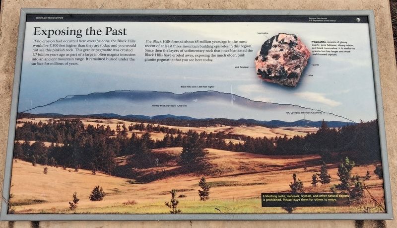
1. Exposing the Past Marker
If no erosion had occurred here over the eons, the Black Hills would be 7,500 feet higher than they are today, and you would not see this pinkish rock. This granite pegmatite was created 1.7 billion years ago as part of a large molten magma intrusion into an ancient mountain range. It remained buried under the surface for millions of years.
The Black Hills formed about 65 million years ago in the most recent of at least three mountain building episodes in this region. Since then the layers of sedimentary rock that once blanketed the Black Hills have eroded away, exposing the much older, pink granite pegmatite that you see here today.
[Inset photo of] Pegmatite
consists of glassy quartz, pink feldspar, silvery micas, and black tourmaline. It is similar to granite but has larger and more well-formed crystals.
Collecting rocks, minerals, crystals, and other natural objects is prohibited. Please leave them for others to enjoy.
Erected by National Park Service.
Topics. This historical marker is listed in these topic lists: Environment • Paleontology.
Location. 43° 35.72′ N,
this page online

Regionally, this marker is in West River and in Greater Rapid City. It is also in the American Black Hills, in the Lewis & Clark Corridor, on the prairies, and on the Northern Plains. Globally, it is in North America, the Western Hemisphere, the Western World, and the Anglosphere. Historically, it finds itself in what was once Rupert’s Land and also the Louisiana Purchase.
Other nearby markers. At least 8 other markers are within 3 miles of this marker, measured as the crow flies: Early Game Preserve (approx. 1.4 miles away); Life in a Prairie Dog Town (approx. 1½ miles away); Cold Springs School & Cemetery (approx. 2.1 miles away); Paha Sapa Limestone (approx. 2.7 miles away); Home on the Range (approx. 2.8 miles away); Stephen Tyng Mather (approx.
Photographed by William Fischer, Jr., September 23, 2026
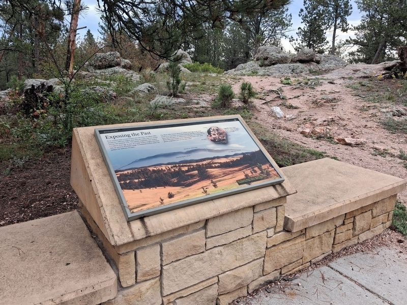
2. Exposing the Past Marker
Photographed by William Fischer, Jr., September 23, 2026
3. Looking south from the Exposing the Past Marker
Credits. This page was last revised on October 6, 2026. It was originally submitted on October 6, 2026, by William Fischer, Jr. of Reynoldsburg, Ohio. This page has been viewed 5 times since then. Photos: 1, 2, 3. submitted on October 6, 2026, by William Fischer, Jr. of Reynoldsburg, Ohio.
