Pine Bluff in Jefferson County, Arkansas — The American South (West South Central)
Quapaw Treaty of 1824
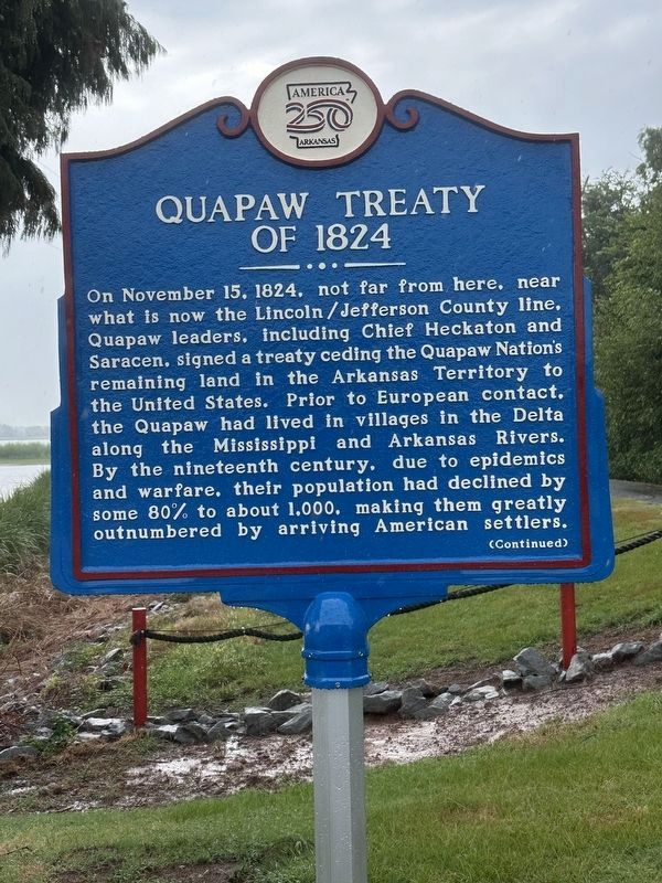
Photographed by April Goff, August 24, 2026
1. Quapaw Treaty of 1824 Marker, Side One
With the 1824 treaty, six years later, they ceded the remaining territory, ultimately establishing themselves in Indian Territory, or modern-day Oklahoma.
With the placement of this official marker, the Arkansas250 Commission, appointed by Governor Sarah Huckabee Sanders, recognizes this site, for the events that occurred here, as among the most significant in Arkansas
this page online
Erected 2026 by Arkansas250 Commission.
Topics and series. This historical marker is listed in these topic lists: Indigenous Peoples and Communities • Settlements & Settlers. In addition, it is included in the America 250 series list. A significant historical date for this entry is November 15, 1824.
Location. 34° 13.832′ N, 92° 0.037′ W. Marker is in Pine Bluff, Arkansas, in Jefferson County. It is on Lake Saracen Drive 0.1 miles west of Regional Park Drive, on the right when traveling west. Marker stands at entrance to Lake Saracen Walking Trail. Touch for map. Marker is at or near this postal address: 200 Lake Saracen Dr, Pine Bluff AR 71601, United States of America. Touch for directions.

Regionally, this marker is in the Arkansas Delta and in the Quapaw Homeland. It is also in the American South and specifically in the Upper South. Globally, it is in North America, the Western Hemisphere, the Western World, and the Anglosphere.
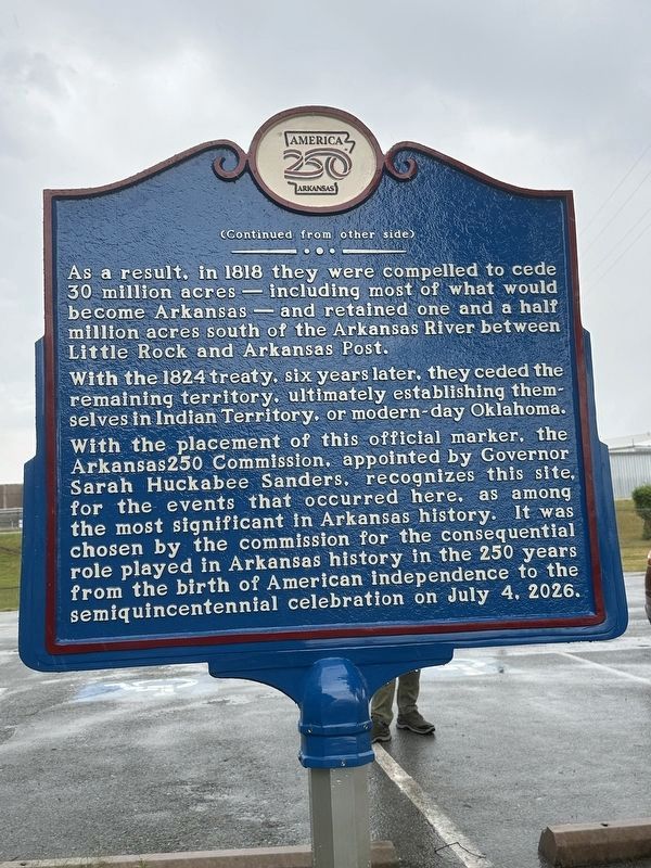
Photographed by April Goff, August 24, 2026
2. Quapaw Treaty of 1824 Marker, Side Two
Other nearby markers. At least 8 other markers are within walking distance of this marker: Jefferson County First Court House (about 800 feet away, measured in a direct line); A Memorial to the War that United the North and South (approx. 0.2 miles away); Battle of Pine Bluff (approx. 0.2 miles away); Auguste La noir de Serville (approx. 0.2 miles away); Barraque Street (approx. ¼ mile away); Saenger Theatre (approx. ¼ mile away); Joseph Bonne Cabin (approx. ¼ mile away); Saint Andrew's — A Black Episcopal Mission (approx. half a mile away). Touch for a list and map of all markers in Pine Bluff.
Other markers no longer nearby. Dedicated to Miss Willie K. Hocker (was approx. 0.2 miles away but has been confirmed missing); a different marker also named Dedicated to Miss Willie K. Hocker (was approx. 0.2 miles away but has been confirmed missing).
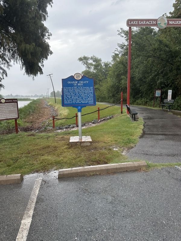
Photographed by April Goff, August 24, 2026
3. Quapaw Treaty of 1824 Marker at the entrance to Lake Saracen Walking Trail
Credits. This page was last revised on October 11, 2026. It was originally submitted on October 6, 2026, by Ashley Sides of Little Rock, Arkansas. This page has been viewed 8 times since then. Photos: 1, 2, 3. submitted on October 6, 2026, by Ashley Sides of Little Rock, Arkansas. • Andrew Ruppenstein was the editor who published this page.
