
Warrington, England, United Kingdom — Northwestern Europe (the British Isles)
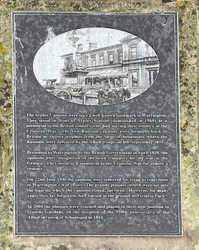
The Arpley Cannons
Photographed by Ray Gurganus, May 16, 2026
1. The Arpley Cannons Marker
Presented to Warrington by the British Government in April 1858, the cannons were recognition of the town's support for the war in the Crimea. They stood as a memorial to the Crimean War for almost a century.
On 22nd June 1940 the cannons were removed for scrap to contribute to Warrington's war effort. The granite plaques, which were set into the base on which the cannons rested, survived. However, for many years they lay forgotten, half-buried in the ground in Victoria Park.
In 2004 the plaques were rescued and placed in their new position in Queens Gardens, on the occasion of the 150th anniversary of the Allied invasion of Sebastopol in 1854.
Topics. This historical marker is listed in this topic list: Wars, Non-US. A significant historical month for this entry is April 1858.
Location. 53° 23.267′ N,
this page online

Regionally, it is on the Atlantic Ocean, in the North Atlantic Region, in Europe, in Atlantic Europe, on one of the British Isles, in the Western World, and in the Anglosphere. Historically, it finds itself in what was once the Roman Empire.
Other nearby markers. At least 2 other markers are within 16 kilometers of this marker, measured as the crow flies: Eyre's Press (approx. 0.3 kilometers away); Hartford's Listed Sites and its Conservation Area (approx. 16.2 kilometers away).
Credits. This page was last revised on October 11, 2026. It was originally submitted on October 6, 2026, by Ray Gurganus of Washington, District of Columbia. This page has been viewed 4 times since then. Photo 1. submitted on October 6, 2026, by Ray Gurganus of Washington, District of Columbia. • Andrew Ruppenstein was the editor who published this page.
Editor’s want-list for this marker. photo of the marker within its surroundings • Can you help?
