Fall River in Bristol County, Massachusetts — The American Northeast (New England)
Fast Facts
⭐ Learn some fast facts about Massachusetts!
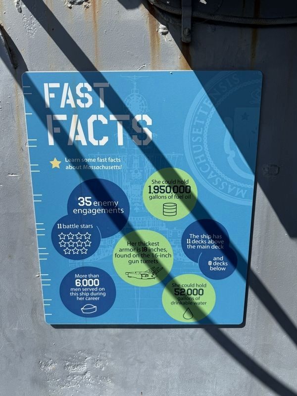
35 enemy engagements
11 battle stars ☆ ☆ ☆ ☆ ☆ ☆ ☆ ☆ ☆ ☆ ☆
She could hold 1,950,000 gallons of fuel oil 🛢️
The ship has 11 decks above the main deck and 8 decks below
More than 6,000 men served on this ship during her career
She could hold 52,000 gallons of drinkable water 💧
Topics. This historical marker is listed in these topic lists: Natural Resources • War, World II • Waterways & Vessels.
Location. 41° 42.417′ N, 71° 9.771′ W. Marker is in Fall River, Massachusetts, in Bristol County. It can be reached from Water Street west of Davol Street, on the right when traveling west. Touch for map. Marker is at or near this postal address: 46 Water St, Fall River MA 02720, United States of America. Touch for directions.

Regionally, this marker is in the South Coast. It is also in the American Northeast, in New England, and on the Eastern Seaboard. Globally, it is in the North Atlantic Region, North America, the Western Hemisphere, the Western World, and
this page online
Other nearby markers. At least 8 other markers are within walking distance of this marker: Searchlight (here, next to this marker); General Announcing System (here, next to this marker); Flag Bag (a few steps from this marker); 5-Inch Gun System (within shouting distance of this marker); Boats + Rescue Craft (within shouting distance of this marker); Gunner's Mate (within shouting distance of this marker); 5-Inch Gun (within shouting distance of this marker); Camouflage (within shouting distance of this marker). Touch for a list and map of all markers in Fall River.
Credits. This page was last revised on October 6, 2026. It was originally submitted on October 6, 2026, by Devry Becker Jones of Washington, District of Columbia. This page has been viewed 5 times since then. Photos: 1, 2. submitted on October 6, 2026, by Devry Becker Jones of Washington, District of Columbia.
