
Lichfield in Staffordshire, England, United Kingdom — Northwestern Europe (the British Isles)
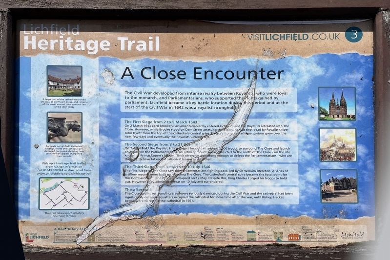
A Close Encounter
| — | Lichfield Heritage Trail | — |
Photographed by Ray Gurganus, May 11, 2026
1. A Close Encounter Marker
The First Siege from 2 to 5 March 1643
On 2 March 1643 Lord Brooke's Parliamentarian army entered Lichfield, and Royalists retreated into The Close. However, while Brooke stood on Dam Street assessing the action, he was shot dead by Royalist sniper John Dyott from the top of the cathedral's central spire. Pressure from the Parliamentarians grew over the next few days and eventually the Royalists surrendered.
The Second Siege from 8 to 21 April 1643
On 7 April 1643 the Royalist Prince Rupert brought in around 3,000 troops to surround The Close and launch an attack on the Parliamentarians. An artillery mount was constructed to the north of The Close - on the site known Prince Rupert's mount. Their offensive was strong enough to defeat the Parliamentarians who are thought to have taken cathedral treasures with them.
The Third Siege from 9 March to 10 July 1646
The
this page online
The aftermath
The Close its surrounding areas were seriously damaged during the Civil War and the cathedral had been significantly defaced. Squatters occupied the cathedral for some time after the war, until Bishop Hacket began work to restore the cathedral in 1661.
Erected by Lichfield District Council. (Marker Number 3.)
Topics. This historical marker is listed in these topic lists: Religion & Religious Structures • Wars, Non-US. A significant historical year for this entry is 1643.
Location. 52° 41.091′ N, 1° 49.718′ W. Marker is in Lichfield, England, in Staffordshire. It is on Dam Street, on the left when traveling west. Touch for map. Marker is at or near this postal address: 30 Dam Street, Lichfield, England WS13 6PY, United Kingdom. Touch for directions.

Regionally,
Photographed by Ray Gurganus, May 11, 2026
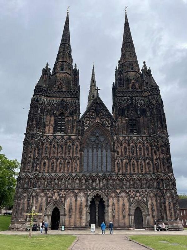
2. Lichfield Cathedral
Other nearby markers. At least 8 other markers are within walking distance of this marker: St Mary's Corner (within shouting distance of this marker); Edward Wightman Memorial (about 150 meters away, measured in a direct line); Welcome to the Garden of Remembrance (about 240 meters away); Promenades and Pleasure Gardens (about 240 meters away); Inns and Outs (approx. 0.2 kilometers away); George Farquhar (1677-1707) (approx. 0.2 kilometers away); 1910 London To Manchester Flight (approx. 0.3 kilometers away); Newton's Garden (approx. 0.3 kilometers away). Touch for a list and map of all markers in Lichfield.
Credits. This page was last revised on October 8, 2026. It was originally submitted on October 7, 2026, by Ray Gurganus of Washington, District of Columbia. This page has been viewed 16 times since then. Photos: 1, 2. submitted on October 7, 2026, by Ray Gurganus of Washington, District of Columbia. • Andrew Ruppenstein was the editor who published this page.
