Athens in Athens-Clarke County, Georgia — The American South (South Atlantic)
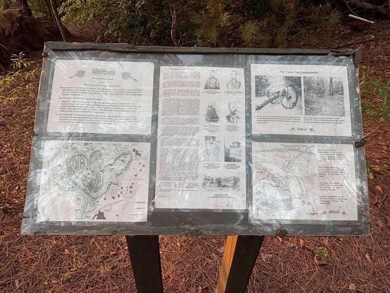
The Battle of Barber's Creek
Photographed by Darren Jefferson Clay, September 20, 2026
1. The Battle of Barber's Creek Marker
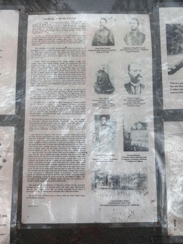
On July 30, 1864, General Stoneman, now 70 miles southwest of Athens, encountered Confederate Alfred Iverson in Clinton, Georgia. In the midst of heavy fighting, he believed the Confederate forces were larger than he first observed. He realized if his troops were captured, Sherman's orders couldn't be carried out. General Stoneman was not going to have a defeat doucmented on his military record.
After conferring with his staff, Stoneman made a decision to dispatch two of his brigades to carry out General Sherman's request. The two cavalry units totaled over 1000 troops. Union Lt. Colonel Silas Adams and Colonel Horace Capron commanded
this page online
Colonel Adams was advancing north through Madison, Georgia while Colonel Capron moved through Rutledge, Georgia. They joined forces late in the afternoon of August 1, and camped 12 miles south of the Oconee River near Athens. Early on the morning of August 2, they entered the city of Watkinsville. Here they planned their attack strategy on Athens. The Orders from General Sherman were to destroy and burn all government works in the city. This included the Cook & Brother Armory, the Athens Foundry, and all railroad lines leading in and out of the city. Union Colonel Silas Adams and 500 men would lead the assault on Athens. Meanwhile, Colonel Capron and his men would cover them to the south in case of enemy attack by the pursuing Confederate cavalry under the command of Brigadier General John Stuart Williams. The Union commanders expected little of no resistance from Athens, their last scouting report showed no active military force stationed there. However, they underestimated
Photographed by Darren Jefferson Clay, September 20, 2026
2. The Battle of Barber's Creek Marker
Confederate General Howell Cobb, who was from Athens and had been appointed commander of all the defense operations in Georgia, has the insight to know sooner or later Athens would be a target of attack. In early summer 1864, he put Confederate Colonel Andrew Young in charge of building defense fortifications in Athens. Home Guard Units had been going through drills and military tactics so they were prepared when called to man the fortifications.
The Athens Home Guard Units first line of defense was Lumpkin's Artillery and was commanded by Captain Edward P. Lumpkin. This location was between two creek crossings three miles south of Athens on a hill that overlooked the entire countryside. This position is just above what is now Edwards Chapel Baptist Church off of Timothy Road. Captain Lumpkin had his cannons placed in three tiers, one above the other. Information found revealed that the famous Double-Barreled Cannon was positioned on the bottom tier nearest Barber Creek and would be used for close range firing.
The second line of defense was Home Guard Infantry
Photographed by Darren Jefferson Clay, September 20, 2026
3. Historical Park Proposal for the Barber and McNutt's Creek Battlefield Site
Early afternoon of August 2, 1864, men from Lumpkin's Battery looked across the creek and they could plainly see a large Union Cavalry on the hill approaching them from Watkinsville. When Union Colonel Adams reached the creek bridge he found the planks had been removed. This momentarily stopped him and at that instant Lumpkin's Artillery opened fire. A shell came screaming across the stream and landed in their midst. A second, third and fourth shell-burst followed. While the Union Troops were scattering along the creek bank the Double-Barreled Cannon fired its barrels, along with the hidden infantrymen. The Federal cavalrymen recoiled behind the crest of a hill. Numerous men were wounded and one Lieutenant
Photographed by Darren Jefferson Clay, September 20, 2026
4. The Upper Gun Emplacement
Photographed by Darren Jefferson Clay, September 20, 2026
5. The Battle of Barber's Creek Marker
This ended the trail of destruction for Stoneman's Raiders, but they went down in history as one of the most victorious units in the Union Army. This encounter with the Athens Home Guard Units was directly responsible for the demise of Stoneman's Cavalry, by sending them in the path of the Confederate Soldiers.
This was the only fortifications site in Athens, which saw armed conflict during the War Between the States.
Don B. Parr, Jr.
(captions)
Union Major General
George Stoneman Cavalry Commander
Army of The Ohio
Confederate Brigadier General
Albert Holt Iverson Cavalry Commander
Army of Tennessce
Union Colonel
Horace Capron Cavatry Officer
Army of The Ohio
Commander of The 14h Illinois,
8 Michigan and McLaughlin's
Ohio Squadron
Union Lt. Colonel
Silas Adams Cavalry Officer
Army of The Ohio
Commander of The 1" and 11th
Kentucky Cavalry
Confederate Major General
Howell Cebb
Commander of Defease Operations
for Georgia and Fiorida
Georgia Railroad
Connected Athens with cities such
as Augusta, Greensboro, Madison,
Covington and Atlanta
Cook & Brother Armory
Ferdinand and Frances Cook
The Largest Independent armory in the Confederacy
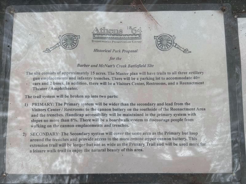
Historical Park Proposal for the Barber and McNutt's Creek Battlefield Site
The
Photographed by Darren Jefferson Clay, September 20, 2026
6. The Battle of Barber's Creek Marker
The trail system will be broken up into two parts:
1) Primary: The primary system will be wider than the secondary and lead from the Visitors Center / Restrooms to the cannon battery on the southside of the Reenactment Area and the trenches. Handicap accessibility will be maintained in the primary system with slopes no more than 8%. There will be a boardwalk system to discourage people from walking on the cannon emplacements and trenches.
2) Secondary: The secondary system will cover the same area as the primary but loop around the trenches and provide access to the more remote upper cannon battery. This extension trail will be longer but not as wide as the primary trail and will be used more for a leisure walk trail to enjoy the natural beauty of this area.
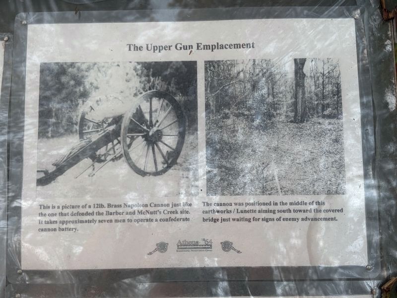
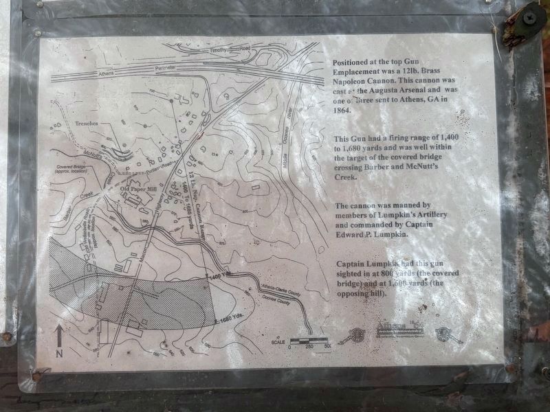
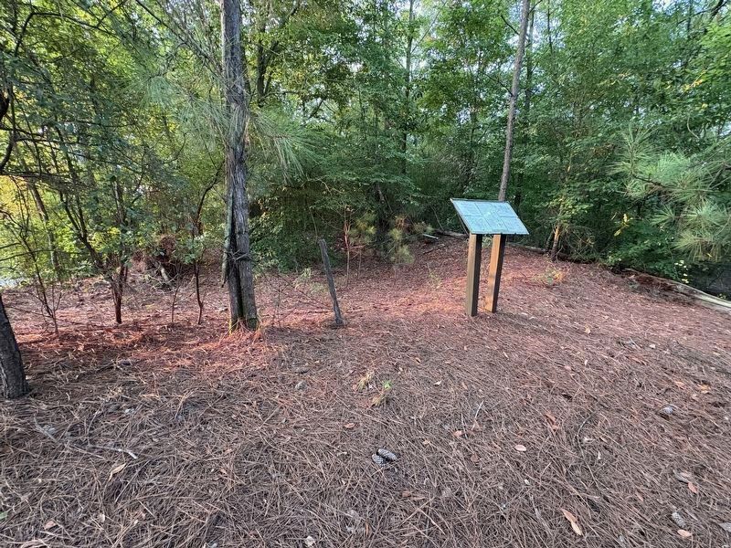
The Upper Gun Emplacement
This is a picture of a 12lb. Brass Napoleon Cannon just like the one that defended the Barber and McNutt's Creek site. It takes approximately seven men to operate a confederate cannon battery.
The cannon was positioned in the middle of this earthworks / Lunette aiming south toward the covered bridge just waiting for signs of enemy advancement.
Positioned at the top Gun Emplacement was a 12lb. Brass Napoleon Cannon. This cannon was cast at the Augusta Arsenal and was one of three sent to Athens, GA in 1864.
This Gun had a firing range of 1,400 to 1,680 yards and was well within the target of the covered bridge crossing Barber and McNutt's Creek.
The cannon was manned by members of Lumpkin's Artillery and commanded by Captain Edward P. Lumpkin.
Captain Lumpkin had this gun sighted in at 800 yards (the covered bridge) and at 1,600 yards (the opposing hill).
Topics. This historical marker is listed in this topic list: War, US Civil. A significant historical date for this entry is July 19, 1864.
Location. 33° 54.923′ N, 83° 23.967′ W. Marker is in Athens, Georgia, in Athens-Clarke County. It can be reached from Timothy Place west of Macon Highway, on the left when traveling north. Touch for map. Marker is at or near this postal address: 105 Timothy Pl, Athens GA 30606, United States of America. Touch for directions.

Regionally, this marker is in the Classic City Area and in the Piedmont. It is also in the American South and specifically in the Deep South. Globally, it is in North America, the Western Hemisphere, the Western World, and the Anglosphere. Historically, it finds itself in what was once the territory of the Mississippian Culture, one of the original Thirteen Colonies, one of the Confederate States of America, and the Antebellum South.
Other nearby markers. At least 8 other markers are within 2 miles of this marker, measured as the crow flies: Clarke County Confederate Monument (about 500 feet away, measured in a direct line); Athens Confederate Monument (about 500 feet away); Princeton Methodist Church (approx. 0.7 miles away); Former Site of Fairhaven Tuberculosis Sanitarium (approx. 1.2 miles away); Purple Heart Memorial (approx. 1.2 miles away); Gold Star Honor Roll Athens and Clarke County (approx. 1.2 miles away); William Bartram Trail (approx. 1.4 miles away); Hodgson-Dodd Park (approx. 2 miles away). Touch for a list and map of all markers in Athens.
Credits. This page was last revised on October 27, 2026. It was originally submitted on October 7, 2026, by Darren Jefferson Clay of Duluth, Georgia. This page has been viewed 22 times since then. Photos: 1. submitted on October 19, 2026, by Darren Jefferson Clay of Duluth, Georgia. 2, 3. submitted on October 9, 2026, by Darren Jefferson Clay of Duluth, Georgia. 4, 5. submitted on October 19, 2026, by Darren Jefferson Clay of Duluth, Georgia. 6. submitted on October 9, 2026, by Darren Jefferson Clay of Duluth, Georgia. • Bernard Fisher was the editor who published this page.
