Enkhuizen, North Holland, Netherlands — Northwestern Europe
Spaans Leger
Photographed by Andrew Ruppenstein, September 7, 2026
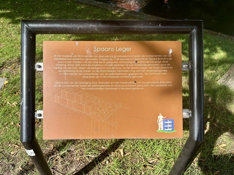
1. Spaans Leger Marker

Op initiatief van de vereniging Oud Enkhuizen en met medewerking van de gemeente Enkhuizen zijn de fundamenten tussen de Spijtbroekstoren en de brug zichtbaar gehouden. Een gedeelte van het oorspronkelijke metselwerk is bewaard gebleven.
In the spring of 2015, the foundations of the medieval city wall were discovered here during excavation work. According to the 17th-century chronicler Gerard Brandt, the wall was
this page online
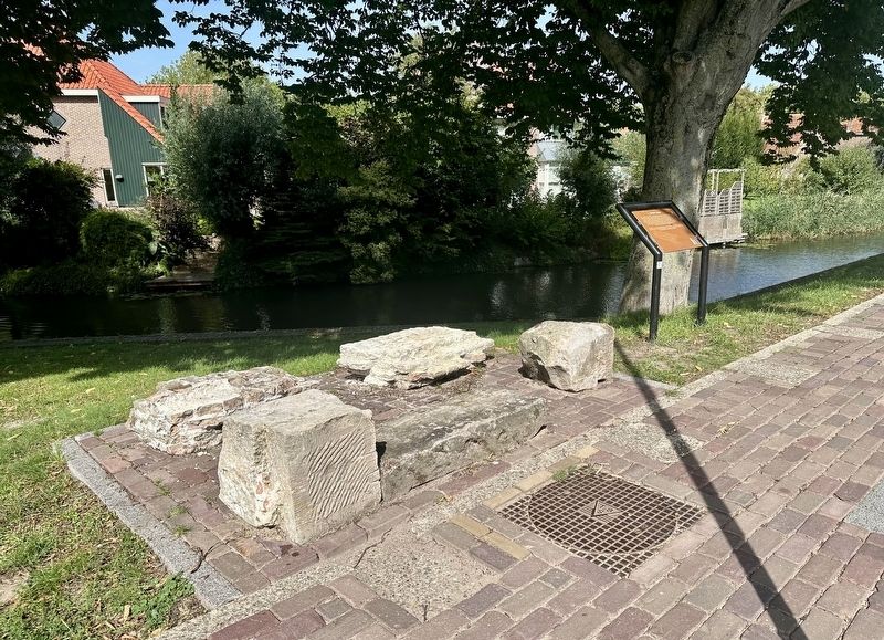
At the initiative of the Oud Enkhuizen association and with the cooperation of the Municipality of Enkhuizen, the foundations between the Spijtbroek Tower and the bridge have been left visible. A section of the original masonry has been preserved.
Erected by Gemeente Enkhuizen.
Topics. This historical marker is listed in these topic lists: Anthropology & Archaeology • Forts and Castles. A significant historical year for this entry is 2015.
Location. 52° 42.245′ N, 5° 17.065′ E. Marker is in Enkhuizen, Noord-Holland (North Holland). It is at the intersection of Paulus Potterstraat and Spaans
Photographed by Andrew Ruppenstein, September 7, 2026
2. Spaans Leger marker and excavated remains

Regionally, it is in Europe, the European Union, Atlantic Europe, the Benelux Low Countries, the Schengen Area, Western Europe, and the Western World. Historically, it finds itself in what was once the Holy Roman Empire.
Other nearby markers. At least 8 other markers are within walking distance of this marker: Westerstraat 158 (about 120 meters away, measured in a direct line); Soephuisje / Soup House (about 150 meters away); De Munt / The Mint (about 180 meters away); Oude Weeshuis / Old Orphanage (approx. 0.3 kilometers away); Vermaning (Doopsgezinde kerk) / Vermaning (Mennonite Church) (approx. 0.4 kilometers away); Genaamt: Het Huis van Gemak (approx. 0.4 kilometers away); Snouck van Loosenpark / Snouck van Loosen Park (approx. half a kilometer away); Sint Janstraat 9 (approx. half a kilometer away). Touch for a list and map of all markers in Enkhuizen.
Also see . . . Spaans Leger (Archeologie Westfriesland, in Dutch). Excerpt (in translation):
Until the end of the 16th century, the entire landward side of Enkhuizen was separated from the surrounding countryside by a high city wall, accompanied by a wide defensive moat. The city boundary at that time ran along Spaans Leger, Paulus Potterstraat, Prinsenstraat, Waaigat, and Paktuinen. The city wall was constructed in phases between 1531 and 1570. Three water gates in the wall allowed barges from the hinterland to enter the city. One of these water gates, the Voertboom, was located at the site of the current bridge at the corner of Spaans Leger and Driebanen. This water gate is visible on Wagenaar’s 1577 map of the city. Brick defensive towers dating from the late 15th and 16th centuries stood along the wall.(Submitted on October 8, 2026.)
Enkhuizen underwent a major urban expansion around 1600. This involved the construction of a modern defensive system around the city, consisting of earthen ramparts and bastions. During this period, the city wall and defensive towers lost their function and were demolished. Only the Drommedaris—a city gate that also served as a defensive tower, built in 1540—has survived to the present day.
The section of the city wall along the street named 'Spaans Leger' had subsided, and one of the buttresses had broken away. Consequently, the remains could not be preserved. During the construction work, the outline of the wall and its buttresses was marked out in the paving. Additionally, a reconstruction using natural stone blocks was created, and an information panel was installed.
Close to the site of this discovery—at the corner of Spaans Leger and Paulus Potterstraat—excavations in 1984 uncovered the foundations of the Spijtbroek Tower, a round defensive tower dating from the late 15th century. The outline of this tower was marked in the paving at that time
Credits. This page was last revised on October 8, 2026. It was originally submitted on October 8, 2026, by Andrew Ruppenstein of Lamorinda, California. This page has been viewed 8 times since then. Photos: 1, 2. submitted on October 8, 2026, by Andrew Ruppenstein of Lamorinda, California.
