Kyneton in Macedon Ranges Shire, Victoria, Australia — Oceania
Kyneton Museum
Photographed by Dean Barton-Ancliffe, August 31, 2026
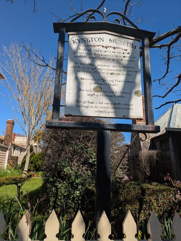
1. Kyneton Museum Marker
The furnishings, ornaments and the numerous exhibits are of local origin drawn from the gracious homes and old farms of a unique district.
The Intersection of Piper and Powlett streets is an historic locality.
Here in by-gone days was the business centre of Victorian Kyneton.
The old bank is but one of many colonial buildings in the vicinity inherited from a colourful past.
Topics. This historical marker is listed in these topic lists: Colonial Era • Education • Industry & Commerce. A significant historical year for this entry is 1969.
Location. 37° 14.652′ S, 144° 26.92′ E. Marker is in Kyneton, Victoria, in Macedon Ranges Shire. It is at the intersection of Piper Street (Victoria Route C793) and Powlett Street, on the left when traveling west on Piper Street. Touch for map. Marker is at or near this postal address: 67 Piper Street, Kyneton VIC 3444, Australia. Touch for directions.

Regionally, it is in Oceania, in Australasia, in the Pacific Ocean, in South Pacific,
this page online
Other nearby markers. At least 8 other markers are within walking distance of this marker: Kyneton Museum - National Trust (a few steps from this marker); Old Bank of New South Wales (a few steps from this marker); Old Butter Factory (about 210 meters away, measured in a direct line); Royal George Hotel (about 240 meters away); Congregational or Independent Church (approx. 0.3 kilometers away); Willis Steam Mill (approx. 0.3 kilometers away); G.W. Willis's Mill (approx. 0.3 kilometers away); Kyneton Gasworks Community Park (approx. 0.3 kilometers away). Touch for a list and map of all markers in Kyneton.
Also see . . . Former Bank Of New South Wales. Victorian Heritage Database Report
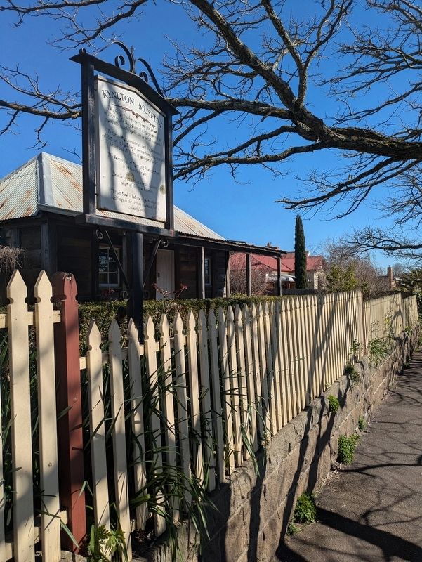
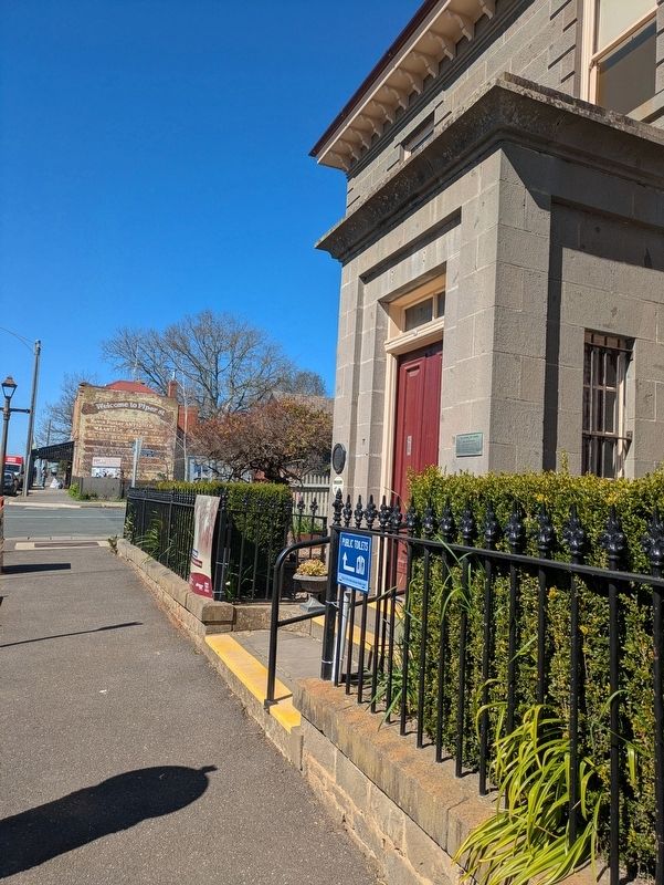
Former Bank of New South Wales is a bluestone structure erected in 1856 for the bank to the designs of architect Andrea Stombuco. The two storied structure is constructed in coursed bluestone masonry and has a hipped slate roof. It is symmetrically arranged about the centrally located, single storied porch,(Submitted on October 8, 2026, by Dean Barton-Ancliffe of Rowville, Victoria.)which is faced with bands and has a cornice. The chimneys, eaves, brackets, quoins, window and door surrounds and string course are features.Photographed by Dean Barton-Ancliffe, August 31, 20262. Kyneton Museum Marker along Piper Street
The Former Bank forms part of the notable townscape of Kyneton, an important nineteenth century highway town. This bank is a landmark in the town and is an essential part of its streetscape. The structure is particularly representative of the long business centre of the town, which contracted after the gold rushes, closing this bank.
The important, essentially Georgian design is distinguished by its Regency porch and Classical eaves brackets and chimneys.
The Former Bank closed in the 1880s and was a residence until recent years when the building became a Museum. Intactness is good and condition is excellent.
Photographed by Dean Barton-Ancliffe, August 31, 2026
3. Kyneton Museum frontage on Piper Street
Credits. This page was last revised on October 11, 2026. It was originally submitted on October 8, 2026, by Dean Barton-Ancliffe of Rowville, Victoria. This page has been viewed 5 times since then. Photos: 1, 2, 3. submitted on October 8, 2026, by Dean Barton-Ancliffe of Rowville, Victoria. • Andrew Ruppenstein was the editor who published this page.
