Dinkelsbühl in Ansbach, Bavaria, Germany — Central Europe
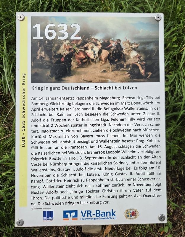
Krieg in ganz Deutschland – Schlacht bei Lützen
1630–1635 Schwedischer Krieg
⎯⎯⎯
War Throughout Germany – Battle of Lützen
Swedish War, 1630–1635
| — | 1632 | — |
Photographed by James Hulse, September 14, 2026
1. Krieg in ganz Deutschland – Schlacht bei Lützen / War Throughout Germany – Battle of Lützen Marker

Am 14. Januar entsetzt Pappenheim Magdeburg. Ebenso siegt Tilly bei Bamberg. Gleichzeitig belagern die Schweden im März Donauwörth. Im April erweitert Kaiser Ferdinand II. die Befugnisse Wallensteins. In der Schlacht bei Rain am Lech besiegen die Schweden unter Gustav II. Adolf die Truppen der Katholischen Liga. Feldherr Tilly wird verletzt und stirbt zwei Wochen später in Ingolstadt. Nachdem der Versuch scheitert, Ingolstadt einzunehmen, ziehen die Schweden nach München. Kurfürst Maximilian von Bayern muss fliehen.
Im Mai werden die Schweden bei Landshut besiegt und Wallenstein besetzt Prag. Koblenz fällt im Juni an die Franzosen. Am 16. August schlagen die Schweden die Kaiserlichen bei Wiesloch. Erzherzog Leopold Wilhelm verteidigt erfolgreich Reutte in Tirol. 3. September: In der Schlacht an der Alten Veste bei Nürnberg bringen die kaiserlichen Söldner, unter dem Befehl Wallensteins, Gustav II. Adolf die erste Niederlage bei.
Es folgt am 16. November die Schlacht bei Lützen. König Gustav II. Adolf fällt im Kampf. Gottfried Heinrich zu Pappenheim stirbt an einer
this page online
© Johannes Munique
War Throughout Germany – Battle of Lützen
On January 14, Pappenheim relieves Magdeburg. Tilly is also victorious near Bamberg. In March, the Swedes simultaneously besiege Donauwörth. In April, Emperor Ferdinand II expands Wallenstein’s authority. At the Battle of Rain am Lech, the Swedes under Gustav II Adolf defeat the forces of the Catholic League. Their commander, Tilly, is wounded and dies two weeks later in Ingolstadt. After their attempt to capture Ingolstadt fails, the Swedes march toward Munich, forcing Elector Maximilian of Bavaria to flee.
In May, the Swedes are defeated near Landshut and Wallenstein occupies Prague. Koblenz falls to the French in June. On August 16, the Swedes defeat the Imperial forces near Wiesloch. Archduke Leopold Wilhelm successfully defends Reutte in Tyrol. On September 3, at the Battle of the Alte Veste
Photographed by James Hulse
2. Krieg in ganz Deutschland – Schlacht bei Lützen / War Throughout Germany – Battle of Lützen Marker
The Battle of Lützen follows on November 16. King Gustav II Adolf is killed in combat, while Gottfried Heinrich zu Pappenheim dies from a gunshot wound. Wallenstein retreats to Bohemia. In November, Gustav Adolf’s six-year-old daughter Christina succeeds her father to the throne. Political and military leadership passes to Axel Oxenstierna, and the Swedes advance as far as Freiburg.
Erected by SHW Komplett, VR-Bank Feuchtwangen-Dinkelsbühl eG and Octavus Rex König Gustav Adolf 1632 e.V.
Topics. This historical marker is listed in this topic list: Wars, Non-US. A significant day of the year for for this entry is January 14.
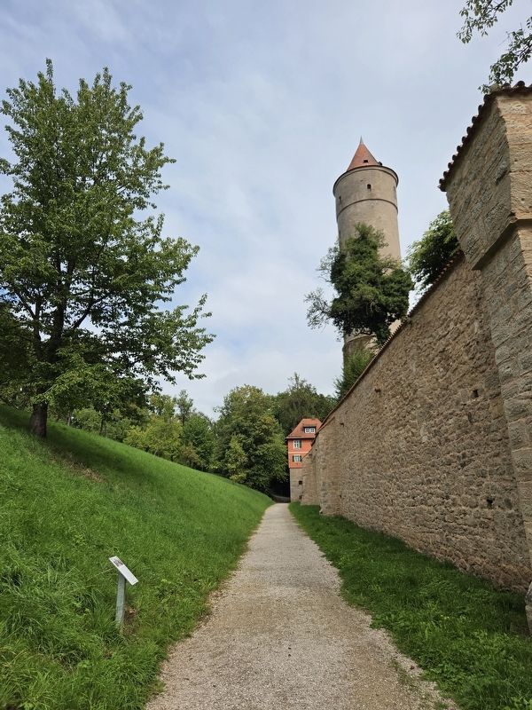
Location. 49° 4.185′ N, 10° 18.854′ E. Marker is in Dinkelsbühl, Bayern (Bavaria), in Ansbach. It is on Kapuzinerweg. The marker is located along the outer wall walkway. Touch for map. Marker is at or near this postal address: Kapuzinerweg 1, Dinkelsbühl BY 91550, Germany. Touch for directions.

Regionally, this marker is in German Franconia and on the Romantic Road. Globally, it is in Europe, the European Union, Atlantic Europe, Central Europe, the Schengen Area, Western Europe, and the Western World. Historically, it finds itself in what was once the Holy Roman Empire and also the former West Germany.
Other nearby markers. At least 8 other markers are within walking distance of this marker: Kornscheune / Grain Barn (within shouting distance of this marker); Kapuzinerkloster / Capuchin Monastery (within shouting distance of this marker); Ein Ende ist nicht in Sicht / No End Is in Sight (within shouting distance of this marker); Zerstörung Magdeburgs und Schlacht bei Breitenfeld / Magdeburg and the Battle of Breitenfeld (about 90 meters away, measured in a direct line); Dreikönigskapelle / Chapel of the Three Kings (about 90 meters away); Segringer Tor / Segringen Gate (about 120 meters away); Die Gerichtstafeln in den Dinkelsbühler Stadttoren (about 120 meters away); Wallensteins Ermordung – Schlacht bei Nördlingen / Wallenstein’s Assassination – Battle of Nördlinge (about 120 meters away). Touch for a list and map of all markers in Dinkelsbühl.
Credits. This page was last revised on October 9, 2026. It was originally submitted on October 9, 2026, by James Hulse of Medina, Texas. This page has been viewed 5 times since then. Photos: 1, 2. submitted on October 9, 2026, by James Hulse of Medina, Texas.
