Near Farmville in Prince Edward County, Virginia — The American South (Mid-Atlantic)
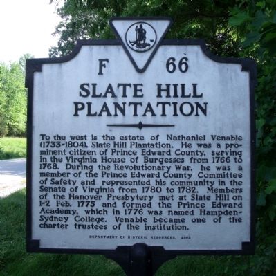
Slate Hill Plantation
Erected 2003 by Department of Historic Resources. (Marker Number F-66.)
Topics and series. This historical marker is listed in these topic lists: Agriculture • Colonial Era • Education • Settlements & Settlers • War, US Revolutionary. In addition, it is included in the Virginia Department of Historic Resources (DHR) series list. A significant historical year for this entry is 1766.
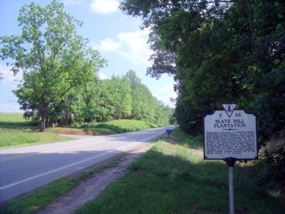
Location. 37° 13.081′ N, 78° 26.551′ W. Marker is near Farmville, Virginia, in Prince Edward County. Marker is on Farmville Road (U.S. 15) 0.8 miles south of Worsham Road (County Route 665), on the right when traveling south. Touch for map. Marker is in this post office area: Farmville VA 23901, United States of America. Touch for directions.
Other nearby markers. At least 8 other markers are within 2 miles of this marker, measured as the crow flies. Providence (approx. 0.8 miles away); Campaign of 1781 (approx. 0.8 miles away); History of Worsham (approx. 0.8 miles away); The Beneficial Benevolent Society of the Loving Sisters and Brothers of Hampden County (approx. 1.4 miles away); Randolph-Macon Medical School (approx. 1.4 miles away); The Birthplace (approx. 1.8 miles away); Hampden-Sydney College (approx. 1.9 miles away); Presbyterian Seminary (approx. 1.9 miles away). Touch for a list and map of all markers in Farmville.
Credits. This page was last revised on December 26, 2019. It was originally submitted on May 31, 2010, by Bernard Fisher of Richmond, Virginia. This page has been viewed 1,861 times since then and 53 times this year. Photos: 1, 2, 3. submitted on May 31, 2010, by Bernard Fisher of Richmond, Virginia.


