Hiawatha in Minneapolis in Hennepin County, Minnesota — The American Midwest (Upper Plains)
Stoney Valve Operating Mechanism
Photographed by McGhiever, May 28, 2023
1. Stoney Valve Operating Mechanism Marker
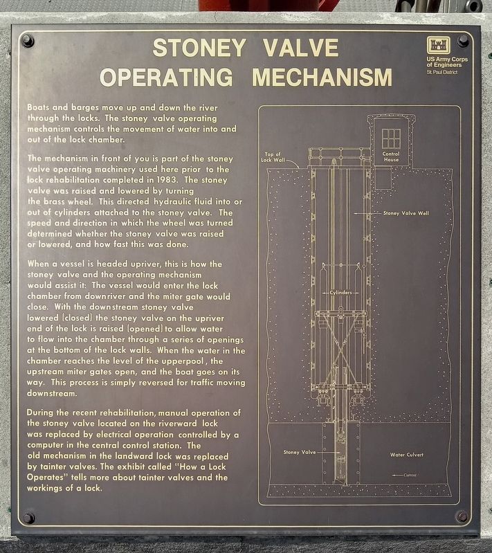
Boats and barges move up and down the river through the locks. The stoney valve operating mechanism controls the movement of water into and out of the lock chamber.
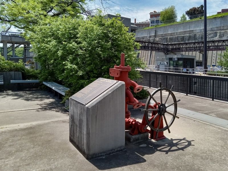
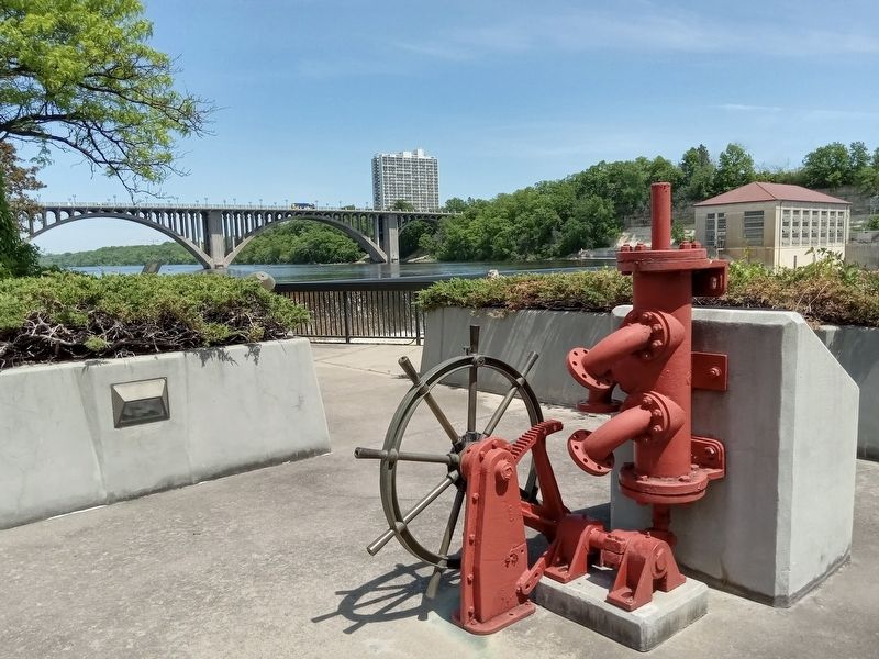
The mechanism in front of you is part of the stoney valve operating machinery used here prior to the lock rehabilitation completed in 1983. The stoney valve was raised and lowered by turning the brass wheel. This directed hydraulic fluid into or out of cylinders attached to the stoney valve. The speed and direction in which the wheel was turned determined whether the stoney valve was raised or lowered, and how fast this was done.
When a vessel is headed upriver, this is how the stoney valve and the operating mechanism would assist it: The vessel would enter the lock chamber from downriver and the miter gate would close. With the downstream stoney valve lowered (closed) the stoney valve on the upriver end of the lock is raised (opened) to allow water to flow into the chamber through a series of openings at the bottom of the lock walls. When the water in the chamber reaches the level of the upperpool, the upstream miter gates open, and the boat goes on
this page online
During the recent rehabilitations, manual operation of the stoney valve located on the riverward lock was replaced by electrical operation controlled by a computer in the central control station. The old mechanism in the landward lock was replaced by tainter valves. The exhibit called "How a Lock Operates" tells more about tainter valves and the workings of a lock.
Erected by U.S. Army Corps of Engineers, St. Paul District.
Topics. This historical marker is listed in this topic list: Man-Made Features. A significant historical year for this entry is 1983.
Location. 44° 54.873′ N, 93° 12.124′ W. Marker is in Minneapolis, Minnesota, in Hennepin County. It is in Hiawatha. It can be reached from W. River Parkway, on the left when traveling south. The marker is at Lock and Dam No. 1, on the eastern lock wall. Touch for map. Marker is at or near this postal address: 5000 W River Parkway, Minneapolis MN 55417, United States of America. Touch for directions.

Regionally, this marker is in the Twin Cities Metropolitan Area. It is also in the American Midwest, in
Photographed by McGhiever, May 28, 2023
2. Stoney Valve Operating Mechanism Marker at Lock and Dam No. 1
Other nearby markers. At least 8 other markers are within walking distance of this marker: Wing Dams (within shouting distance of this marker); The Lock and Dam No. 1 Story (within shouting distance of this marker); A River Highway (within shouting distance of this marker); Big Water / Stairway of Water (within shouting distance of this marker); Miter Gate Operating Mechanism (about 400 feet away, measured in a direct line); Welcome to Lock and Dam No. 1 / The Federal Engineer (about 500 feet away); Welcome to the Wabun Picnic Family Play Area! (approx. 0.2 miles away); Hydro Electric Turbine (approx. 0.2 miles away). Touch for a list and map of all markers in Minneapolis.
Photographed by McGhiever, May 28, 2023
3. Hand-operated Stoney valve operating mechanism behind the marker
Credits. This page was last revised on October 9, 2026. It was originally submitted on October 9, 2026, by McGhiever of Minneapolis, Minnesota. This page has been viewed 2 times since then. Photos: 1, 2, 3. submitted on October 9, 2026, by McGhiever of Minneapolis, Minnesota.
