Dinkelsbühl in Ansbach, Bavaria, Germany — Central Europe
Sicherung der habsburgischen Kernlande
1635–1648 Schwedisch-Französischer Krieg
⎯⎯⎯
Securing the Habsburg Heartlands
1635–1648 Swedish–French War
| — | 1646 | — |
Photographed by James Hulse, September 14, 2026
1. Sicherung der habsburgischen Kernlande / Securing the Habsburg Heartlands Marker

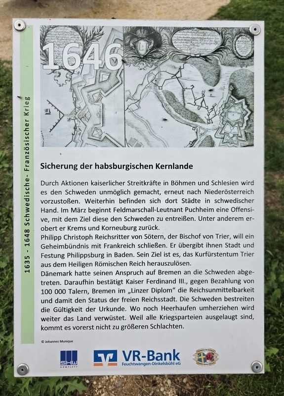
Durch Aktionen kaiserlicher Streitkräfte in Böhmen und Schlesien wird es den Schweden unmöglich gemacht, erneut nach Niederösterreich vorzustoßen. Weiterhin befinden sich dort Städte in schwedischer Hand. Im März beginnt Feldmarschall-Leutnant Puchheim eine Offensive mit dem Ziel, diese den Schweden zu entreißen. Unter anderem erobert er Krems und Korneuburg zurück.
Philipp Christoph Reichsritter von Sötern, der Bischof von Trier, will ein Geheimbündnis mit Frankreich schließen. Er übergibt ihnen Stadt und Festung Philippsburg in Baden. Sein Ziel ist es, das Kurfürstentum Trier aus dem Heiligen Römischen Reich herauszulösen.
Dänemark hatte seinen Anspruch auf Bremen an die Schweden abgetreten. Daraufhin bestätigt Kaiser Ferdinand III. gegen Bezahlung von 100.000 Talern Bremen im „Linzer Diplom“ die Reichsunmittelbarkeit und damit den Status der freien Reichsstadt. Die Schweden bestreiten die Gültigkeit der Urkunde. Wo noch Heerhaufen umherziehen, wird weiter das Land verwüstet. Weil alle Kriegsparteien ausgelaugt sind, kommt es vorerst nicht zu größeren Schlachten.
© Johannes Munique
Securing the Habsburg Heartlands
Actions
this page online
Philipp Christoph, Imperial Knight of Sötern and Bishop of Trier, sought to conclude a secret alliance with France. He handed the town and fortress of Philippsburg in Baden over to the French. His objective was to remove the Electorate of Trier from the Holy Roman Empire.
Denmark had transferred its claim to Bremen to Sweden. In response, Emperor Ferdinand III issued the “Linz Diploma,” confirming Bremen’s imperial immediacy—and therefore its status as a Free Imperial City—in return for payment of 100,000 thalers. The Swedes disputed the validity of the document. Wherever armies continued to roam, the countryside was further devastated. Because all the warring parties were exhausted, no major battles took place for the time being.
Erected by SHW Komplett, VR-Bank Feuchtwangen-Dinkelsbühl eG and Octavus Rex König Gustav Adolf 1632 e.V.
Topics.
Photographed by James Hulse
2. Sicherung der habsburgischen Kernlande / Securing the Habsburg Heartlands Marker
Location. 49° 3.968′ N, 10° 19.499′ E. Marker is in Dinkelsbühl, Bayern (Bavaria), in Ansbach. It is at the intersection of Nördlinger Straße and Am Brühl on Nördlinger Straße. Touch for map. Marker is at or near this postal address: Nördlinger Str 62, Dinkelsbühl BY 91550, Germany. Touch for directions.

Regionally, this marker is in German Franconia and on the Romantic Road. Globally, it is in Europe, the European Union, Atlantic Europe, Central Europe, the Schengen Area, Western Europe, and the Western World. Historically, it finds itself in what was once the Holy Roman Empire and also the former West Germany.
Other nearby markers. At least 8 other markers are within walking distance of this marker: Stadtmühle / Town Mill (here, next to this marker); a different marker also named Stadtmühle / Town Mill (within shouting distance of this marker); Jankau, Herbsthausen, Alerheim (within shouting distance of this marker); Waffenstillstand von Ulm und weitere Kämpfe / The Truce of Ulm and Further Fighting (within
Photographed by James Hulse, September 14, 2026
3. Sicherung der habsburgischen Kernlande / Securing the Habsburg Heartlands Marker
Credits. This page was last revised on October 11, 2026. It was originally submitted on October 10, 2026, by James Hulse of Medina, Texas. This page has been viewed 7 times since then. Photos: 1, 2, 3. submitted on October 11, 2026, by James Hulse of Medina, Texas.
