Dinkelsbühl in Ansbach, Bavaria, Germany — Central Europe
Gedenkweg zum Dreißigjährigen Krieg in Dinkelsbühl
⎯⎯⎯
Thirty Years’ War Memorial Trail in Dinkelsbühl
Photographed by James Hulse, September 14, 2026
1. Gedenkweg zum Dreißigjährigen Krieg in Dinkelsbühl / Thirty Years’ War Memorial Trail in Dinkelsbühl

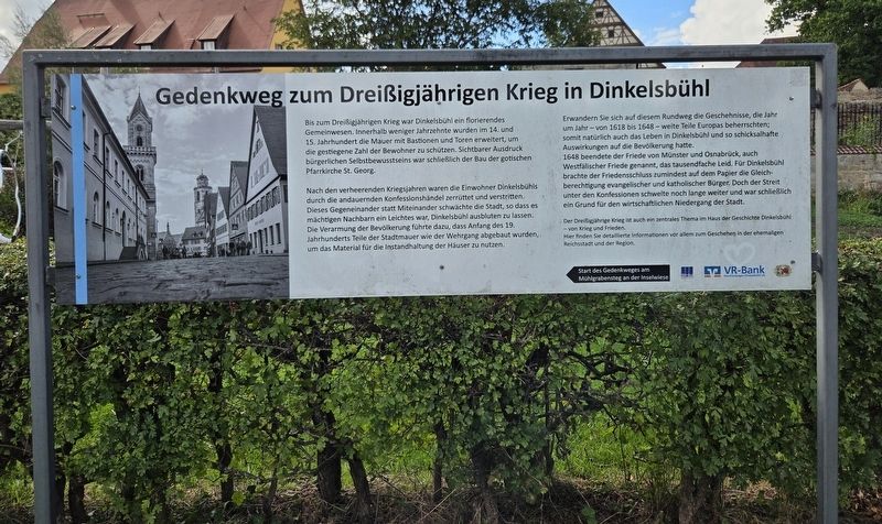
Bis zum Dreißigjährigen Krieg war Dinkelsbühl ein florierendes Gemeinwesen. Innerhalb weniger Jahrzehnte wurden im 14. und 15. Jahrhundert die Mauer mit Bastionen und Toren erweitert, um die gestiegene Zahl der Bewohner zu schützen. Sichtbarer Ausdruck bürgerlichen Selbstbewusstseins war schließlich der Bau der gotischen Pfarrkirche St. Georg.
Nach den verheerenden Kriegsjahren waren die Einwohner Dinkelsbühls durch die andauernden Konfessionshändel zerrüttet und verstritten. Dieses Gegeneinander statt Miteinander schwächte die Stadt, sodass es mächtigen Nachbarn ein Leichtes war, Dinkelsbühl ausbluten zu lassen. Die Verarmung der Bevölkerung führte dazu, dass Anfang des 19. Jahrhunderts Teile der Stadtmauer wie der Wehrgang abgebaut wurden, um das Material für die Instandhaltung der Häuser zu nutzen.
Erwandern Sie sich auf diesem Rundweg die Geschehnisse, die Jahr um Jahr – von 1618 bis 1648 – weite Teile Europas beherrschten; somit natürlich auch das Leben in Dinkelsbühl und so schicksalhafte Auswirkungen auf die Bevölkerung hatten.
1648 beendete der Friede
this page online
Der Dreißigjährige Krieg ist auch ein zentrales Thema im Haus der Geschichte Dinkelsbühl – von Krieg und Frieden. Hier finden Sie detaillierte Informationen vor allem zum Geschehen in der ehemaligen Reichsstadt und der Region.
Start des Gedenkweges am Mühlgrabenteich an der it's
Thirty Years’ War Memorial Trail in Dinkelsbühl
Before the Thirty Years’ War, Dinkelsbühl was a flourishing community. During the 14th and 15th centuries, its walls, bastions and gates were expanded within the space of only a few decades to protect its growing population. The construction of the Gothic parish church of St George ultimately became a visible expression of the citizens’ confidence and prosperity.
After the devastating war years, Dinkelsbühl’s inhabitants were divided
Photographed by James Hulse, September 14, 2026
2. Gedenkweg zum Dreißigjährigen Krieg in Dinkelsbühl / Thirty Years’ War Memorial Trail in Dinkelsbühl
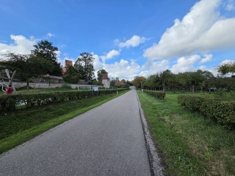
The marker is located on the left side of the trail.
This circular trail introduces the events that dominated large parts of Europe year after year from 1618 to 1648, affecting life in Dinkelsbühl and having fateful consequences for its population.
In 1648, the Peace of Münster and Osnabrück, also known as the Peace of Westphalia, ended immeasurable suffering. For Dinkelsbühl, the peace settlement established—at least on paper—equal rights for Protestant and Catholic citizens. Religious conflict nevertheless continued to smoulder for many years and ultimately contributed to the town’s economic decline.
The Thirty Years’ War is also a central subject at the Dinkelsbühl House of History—Of War and Peace. Detailed information is available there, particularly about events in the former Free Imperial City and the surrounding region.
The memorial trail begins at the Mühlgraben pond beside the Inselwiese.
Erected by SHW Komplett, VR-Bank Feuchtwangen-Dinkelsbühl eG and Octavus Rex King Gustav Adolf 1632 Association.
Topics. This historical marker is listed in this topic list: Wars, Non-US. A significant historical year for this entry is 1618.
Location. 49° 4.278′ N, 10° 19.211′ E. Marker is in Dinkelsbühl, Bayern (Bavaria), in Ansbach. It is on Nikolaus-Eseler-Straße 0.1 kilometers north of Bleichweg, on the left when traveling north. Touch for map. Marker is in this post office area: Dinkelsbühl BY 91550, Germany. Touch for directions.

Regionally, this marker is in German Franconia and on the Romantic Road. Globally, it is in Europe, the European Union, Atlantic Europe, Central Europe, the Schengen Area, Western Europe, and the Western World. Historically, it finds itself in what was once the Holy Roman Empire and also the former West Germany.
Other nearby markers. At least 8 other markers are within walking distance of this marker: Der Krieg verwüstet die Pfalz / War devastates the Palatinate (here, next to this marker); Der Kaiser gewinnt an Boden / The Emperor Gains Ground (within shouting distance of this marker); Der Kaiser hat den Sieg vor Augen / The emperor has victory in sight (within shouting distance of this marker); Spital / Hospital (about 90 meters away, measured in a direct line); a different marker also named Spital / Hospital (about 90 meters away); a different marker also named Spital / Hospital (about 120 meters away); a different marker also named Spital / Hospital (about 120 meters away); Die Gerichtstafeln in den Dinkelsbühler Stadttoren (about 120 meters away). Touch for a list and map of all markers in Dinkelsbühl.
Credits. This page was last revised on October 11, 2026. It was originally submitted on October 10, 2026, by James Hulse of Medina, Texas. This page has been viewed 9 times since then. Photos: 1, 2. submitted on October 11, 2026, by James Hulse of Medina, Texas.
