
Lichfield in Staffordshire, England, United Kingdom — Northwestern Europe (the British Isles)
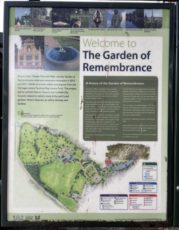
Welcome to the Garden of Remembrance
Photographed by Ray Gurganus, May 11, 2026
1. Welcome to the Garden of Remembrance Marker
A history of the Garden of Remembrance
In the early 1300s, a crenellated wall surrounded Cathedral Close and formed part of the cathedral's fortifications. According to an 18th century map, the wall passed through the centre of what is now the Garden of Remembrance.
Over time, as parts of Minster Pool silted up, the area of land where the garden now stands doubled in size and by 1738 it was large enough to warrant a lease and attract rent. Through the years, it has been used for a variety of purposes, including livestock grazing.
Following the First World War, the people of Lichfield were anxious to create a memorial to those who had lost their lives. Three projects were proposed. These included: peace celebrations, a permanent war memorial, and an assembly room for concerts. It was decided that a permanent war memorial should be built, and a public appeal was launched to help raise money towards the costs.
The area was chosen because of its picturesque setting.
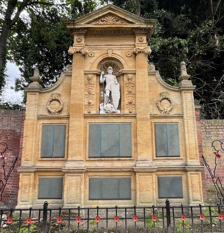
The War Memorial was designed by the prominent architect, Charles Edward Bateman, and created by local stonemasons, Bridgeman and Sons of Lichfield.
this page online
Work on laying out the garden began in 1919. The stone lions on the gate piers reputedly came from Moxhull Hall in Warwickshire and the 18th century stone balustrades and plinth came from Shenstone Court, just outside Lichfield.
A ceremony of dedication was held on 20 October 1920.
Lower panels were later added to the war memorial, which were dedicated to those who had died in the Second World War and later struggles.
The Garden of Remembrance is owned and managed by Lichfield City Council.
Beacon Park, Minster Pool and Walk, and the Garden of Remembrance underwent extensive renovation in 2010 and 2011, thanks to a multi-million pound grant from the Heritage Lottery Fund and Big Lottery Fund. The project. led by Lichfield District Council and Lichfield City Council, helped to restore many of the park's and gardens' historic features, as well as develop new facilities.
Erected by Lichfield District Council.
Topics. This historical marker is listed in these topic lists:
Photographed by Ray Gurganus, May 11, 2026
2. The War Memorial
Location. 52° 41.058′ N, 1° 49.916′ W. Marker is in Lichfield, England, in Staffordshire. It is on Bird Street, on the right when traveling north. Touch for map. Marker is at or near this postal address: 5 Bird Street, Lichfield, England WS13 6PY, United Kingdom. Touch for directions.

Regionally, this marker is in the Midlands. Globally, it is on the Atlantic Ocean, in the North Atlantic Region, in Europe, in Atlantic Europe, on one of the British Isles, in the Western World, and in the Anglosphere. Historically, it finds itself in what was once the Roman Empire.
Other nearby markers. At least 8 other markers are within walking distance of this marker: Newton's Garden (within shouting distance of this marker); Promenades and Pleasure Gardens (about 90 meters away, measured in a direct line); Commander Edward John Smith RD RNR (1850-1912) (about 120 meters away); Inns and Outs (about 210 meters away); 1910 London To Manchester Flight (about 210 meters away); George Farquhar (1677-1707) (about 210 meters away); St Mary's Corner (about 210 meters away); A Close Encounter (about 240 meters away). Touch for a list and map of all markers in Lichfield.
Credits. This page was last revised on October 12, 2026. It was originally submitted on October 12, 2026, by Ray Gurganus of Washington, District of Columbia. This page has been viewed 5 times since then. Photos: 1, 2. submitted on October 12, 2026, by Ray Gurganus of Washington, District of Columbia. • Andrew Ruppenstein was the editor who published this page.
Editor’s want-list for this marker. photo of the marker within its surroundings • Can you help?
