Near Winter Harbor in Hancock County, Maine — The American Northeast (New England)
Summit to Sea
⎯⎯⎯
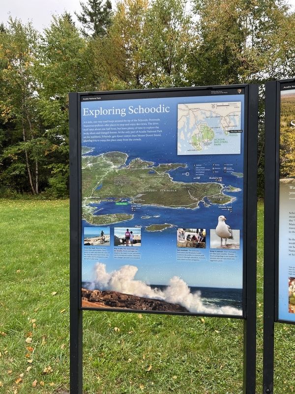
Exploring Schoodic
Photographed by Steve Stoessel, October 8, 2026
1. Summit to Sea Panel
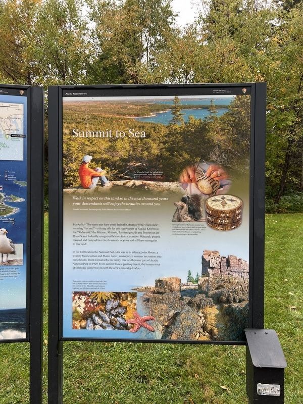
Summit to Sea
Walk in respect on this land so in the next thousand years your descendants will enjoy the beauties around you.
Donald Soctomah, Passamaquody Tribal Historic Preservation Officer
Schoodic-The name may have come from the Micmac word "eskwodek" meaning "the end"—a fitting title for this remote part of Acadia. Known as the "Wabanaki," the Micmac, Maliseet, Passamaquoddy and Penobscot are Maine's four federally recognized Native American tribes. Wabanaki people traveled and camped here for thousands of years and still have strong ties to this land.
In the 1890s when the National Park idea was in its infancy, John Moore, a wealthy businessman and Maine native, envisioned a summer recreation aréa on Schoodic Point. Donated by his family, this land became part of Acadia National Park in 1929. From summit to sea, past to present, the human story at Schoodic is interwoven with the area's natural splendors.
[ Photo Captions, top to bottom: ]
- On Schoodic Head, the highest point on the peninsula, shady woodlands
- Throughout time, Wabanaki people have created and used objects such as porcupine quill baskets and birch bark canoes. These crafts reflect the beauty of a land that continues to inspire artists today.
- Tide pools-only accessible at low tide-are one of many habitats that nurture Schoodic's rich variety of life. The difference between high and low tide here can reach 8-12 feet.
Exploring Schoodic
A
this page online
[ Photo Captions, left to right: ]
- Share the road. Watch for cars, buses, bikes, and wildlife. Carry plenty of water and obey the rules of the road. Bicyclists must follow one-way traffic and be prepared to ride the full 11-mile loop.
- Play it safe. The shoreline can be deadly. Rocks and algae are slippery, the water is cold, and waves can be strong and sudden. Dramatic tide changes can leave you stranded.
- Get involved. The Schoodic Education and Research Center connects the public to current park research through education, lectures, and citizen science programs.
- Keep it natural. Don't feed gulls or other park wildlife. Human food and garbage is not healthy for animals and can turn them into aggressive pests.
Erected by Acadia
Photographed by Steve Stoessel, October 8, 2026
2. Exploring Schoodic Panel
Topics. This historical marker is listed in this topic list: Parks & Recreational Areas. A significant historical year for this entry is 1929.
Location. 44° 22.488′ N, 68° 4.501′ W. Marker is near Winter Harbor, Maine, in Hancock County. It is on Frazer Point Road north of Schoodic Loop Road, on the right. Marker is located at the Frazer Point Picnic Grounds in Acadia National Park. Touch for map. Marker is in this post office area: Winter Harbor ME 04693, United States of America. Touch for directions.

Regionally, this marker is on Mount Desert Island and in Downeast Maine. It is also in the American Northeast, in New England, and on the Eastern Seaboard. Globally, it is in the North Atlantic Region, North America, the Great North Woods, the Western Hemisphere, the Western World, and the Anglosphere. Historically, it finds itself in what was once the Viceroyalty of New France and also Acadia.
Other nearby markers. At least 8 other markers are within 3 miles of this marker, measured as the crow flies: Footsteps Before You (a few steps from this marker); Karl A. Jacobson (approx. 0.6 miles away); Connected by Water
Photographed by Steve Stoessel, October 8, 2026
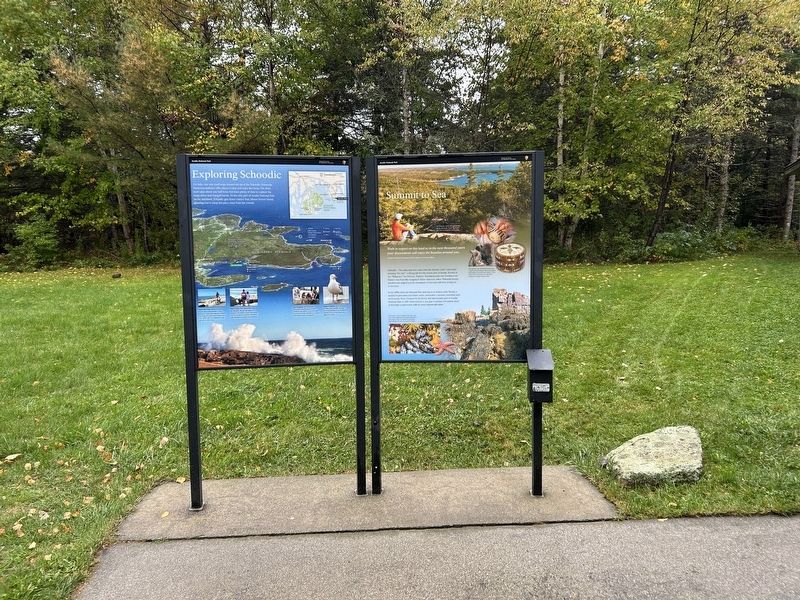
3. Summit to Sea / Exploring Schoodic Marker
More about this marker. Marker is a two panel marker.
Credits. This page was last revised on October 12, 2026. It was originally submitted on October 12, 2026, by Steve Stoessel of Niskayuna, New York. This page has been viewed 5 times since then. Photos: 1, 2, 3. submitted on October 12, 2026, by Steve Stoessel of Niskayuna, New York.
