Fowler in Otero County, Colorado — The American Mountains (Southwest)
Two Rivers and a Place to Land
Photographed by Leslie Eudy, October 2, 2026
1. Two Rivers and a Place to Land Marker
Two Rivers and a Place to Land
Fowler
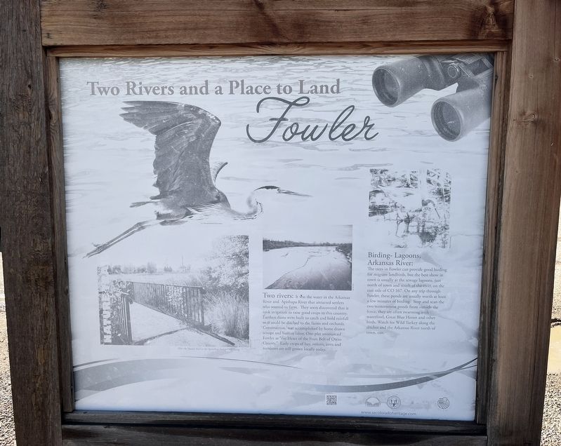
Two Rivers: It was the water in the Arkansas River and Apishapa River that attracted settlers who wanted to farm. They soon discovered that it took irrigation to raise good crops in this country. Earthen dams were built to catch and hold rainfall so it could be ditched to the farms and orchards. Construction was accomplished by horse drawn scoops and human labor. One plat announced Fowler as “the Heart of the Fruit Belt of Otero County.” Early crops of hay, onions, corn, and tomatoes are still grown locally today.
Birding-Lagoons, Arkansas River: The trees in Fowler can provide good birding for migrant landbirds, but the best show in town is usually the sewage lagoons, just north of town and south of the river, on the east side of CO 167. On any trip through Fowler, these ponds are usually worth at least a few minutes of birding. Stop and scan the two westernmost ponds from outside the fence, they are often swarming with waterfowl, Great Blue Heron, and other birds. Watch for Wild Turkey along the ditches and the Arkansas River north of town, too.
Topics. This historical
this page online
Location. 38° 7.846′ N, 104° 1.458′ W. Marker is in Fowler, Colorado, in Otero County. It is on Highway 50, on the right when traveling east. Hwy 50 in Fowler just east of Main street. Touch for map. Marker is in this post office area: Fowler CO 81039, United States of America. Touch for directions.

Regionally, this marker is in the Arkansas River Valley and in the Eastern Plains. It is also in the American Mountain West, on the Great Plains, on the Southern Plains, on the High Plains, and on the Santa Fe Trail Corridor. Globally, it is in North America, the Western Hemisphere, the Western World, and the Anglosphere. Historically, it finds itself in what was once the Comanchería, the Dust Bowl, and the Republic of Texas.
Other nearby markers. At least 3 other markers are within 10 miles of this marker, measured as the crow flies: A Visionary, An Uncle, and Scandinavians (here, next to this marker); Crowley (approx. 10 miles away); Crowley Communities / National Sugar Company / Last Days of the Buffalo / Crowley Country
Photographed by Leslie Eudy, October 2, 2026
2. Two Rivers and a Place to Land Marker Wide View
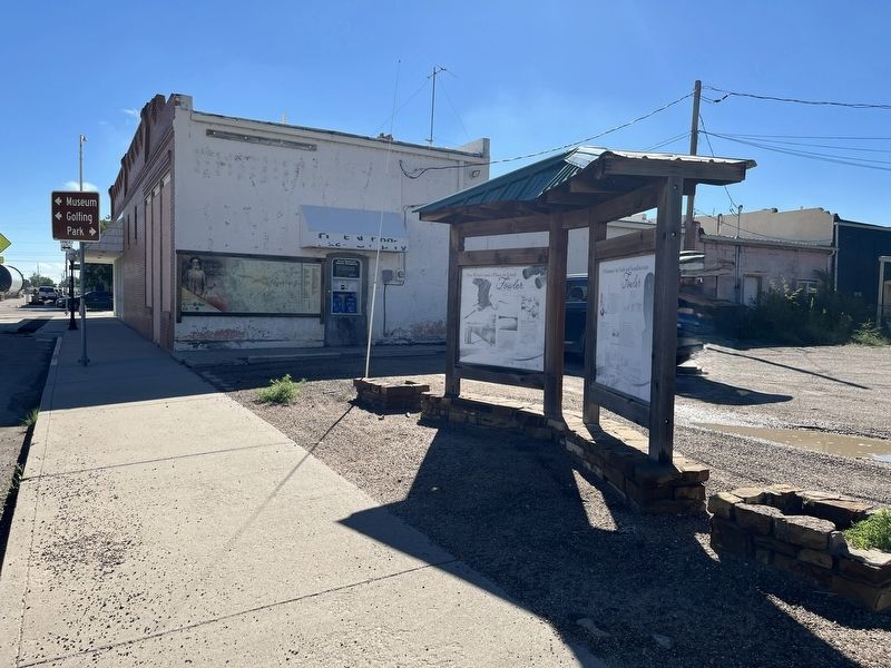
Marker on the left
Credits. This page was last revised on October 12, 2026. It was originally submitted on October 12, 2026, by Leslie Eudy of Golden, Colorado. This page has been viewed 5 times since then. Photos: 1, 2. submitted on October 12, 2026, by Leslie Eudy of Golden, Colorado. • Andrew Ruppenstein was the editor who published this page.
