Melton Mowbray in Leicestershire, England, United Kingdom — Northwestern Europe (the British Isles)
Burton Street
| — | Melton Mowbray Heritage Trail | — |
Photographed by Ray Gurganus, May 5, 2026
1. Burton Street Marker
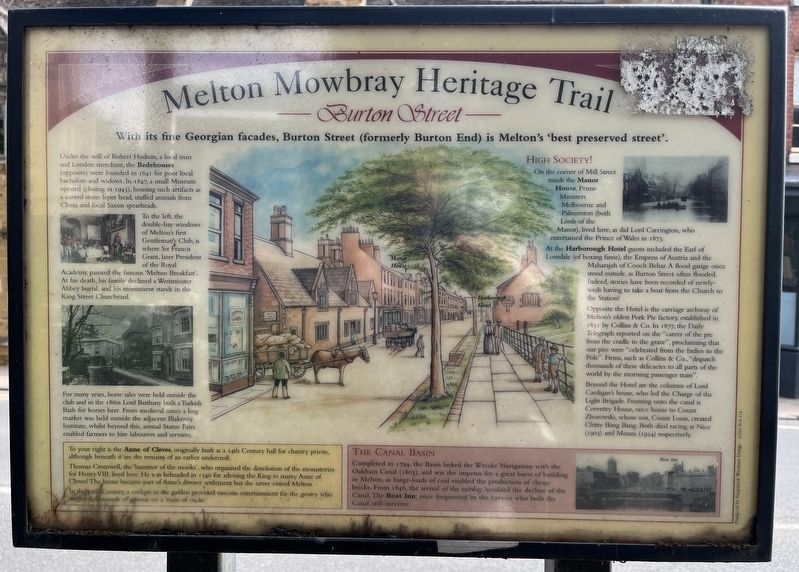
Under the will of Robert Hudson, a local man and London merchant, the Bedehouses (opposite) were founded in 1641 for poor local bachelors and widows. In 1847, a small Museum opened (closing in 1945), housing such artifacts as a carved stone leper head, stuffed animals from China and local Saxon spearheads.
To the left, the double-bay windows of Melton's first Gentleman's Club, is where Sir Francis Grant, later President of the Royal Academy, painted the famous 'Melton Breakfast'.
At his death, his family declined a Westminster Abbey burial, and his monument stands in the King Street Churchyard.
For many years, horse sales were held outside the club and in the 1860s Lord Batthany built a Turkish Bath for horses here. From medieval times a hog market was held outside the adjacent Blakeney Institute, whilst beyond this, annual Statue Fairs enabled farmers to hire labourers and servants.
To your right is the Anne of Cleves, originally built as a 14th Century hall for chantry priests, although beneath it are
this page online
Thomas Cromwell, the 'hammer of the monks', who organised the dissolution of the monasteries for Henry VIII, lived here. He was beheaded in 1540 for advising the King to marry Anne of Cleves! The house became part of Anne's divorce settlement but she never visited Melton.
In the 19th Century, a cockpit in the garden provided raucous entertainment for the gentry who wagered thousands of guineas on a 'main of cocks'.
High Society!
On the corner of Mill Street stands the Manor House. Prime Ministers Melbourne and Palmerston (both Lords of the Manor), lived here, as did Lord Carrington, who entertained the Prince of Wales in 1873.
At the Harborough Hotel guests included the Earl of Lonsdale (of boxing fame), the Empress of Austria and the Maharajah of Cooch Behar. A flood gauge once stood outside, as Burton Street often flooded. Indeed, stories have been recorded of newly-weds having to take a boat from the Church to the Station!
Opposite the Hotel is the carriage archway of Melton's oldest Pork Pie factory, established in 1831 by Collins & Co. In 1877, the Daily Telegraph reported on the "career of the pie from the cradle to the grave", proclaiming that our pies were "celebrated from the Indies to the Pole". Firms, such as Collins & Co., "dispatch thousands of these delicacies to all parts of the world by the morning passenger train".
Beyond the Hotel are the columns of Lord Cardigan's house, who led the Charge of the Light Brigade. Fronting onto the canal is Coventry House, once home to Count Zborowski, whose son, Count Louis, created Chitty Bang Bang. Both died racing at Nice (1903) and Monza (1924) respectively.
The Canal Basin
Completed in 1794, the Basin linked the Wreake Navigation with the Oakham Canal (1803), and was the impetus for a great burst of building in Melton, as barge-loads of coal enabled the production of cheap bricks. From 1846, the arrival of the railway heralded the decline of the Canal, The Boat Inn, once frequented by the navvies who built the Canal, still survives.
Topics. This historical marker is listed in these topic lists: Notable Places • Roads & Vehicles.
Location. 52° 45.804′ N, 0° 53.119′ W. Marker is in Melton Mowbray, England, in Leicestershire. It is on Burton Street. Touch for map. Marker is at or near this postal address: 12 Burton St, Melton Mowbray, England LE13 1AY, United Kingdom. Touch for directions.

Regionally, this marker is in the Midlands. Globally, it is on the Atlantic Ocean, in the North Atlantic Region, in Europe, in Atlantic Europe, on one of the British Isles, in the Western World, and in the Anglosphere. Historically, it finds itself in what was once the Roman Empire.
Other nearby markers. At least 8 other markers are within 16 kilometers of this marker, measured as the crow flies: The London Road (about 90 meters away, measured in a direct line); Melton Mowbray Town Estate (about 150 meters away); King Street (about 210 meters away); The Medieval Garden King Street (about 210 meters away); Hudson's Cottage (approx. 14.6 kilometers away); Fit for a King (approx. 14.8 kilometers away); Friends Meeting House - Oakham (approx. 14.8 kilometers away); Ancient Customs (approx. 14.8 kilometers away). Touch for a list and map of all markers in Melton Mowbray.
Credits. This page was last revised on October 13, 2026. It was originally submitted on October 12, 2026, by Ray Gurganus of Washington, District of Columbia. This page has been viewed 6 times since then. Photo 1. submitted on October 12, 2026, by Ray Gurganus of Washington, District of Columbia. • Andrew Ruppenstein was the editor who published this page.
Editor’s want-list for this marker. photo of the marker within its surroundings • Can you help?
