Oxford in Oxfordshire, England, United Kingdom — Northwestern Europe (the British Isles)
Osney Lock
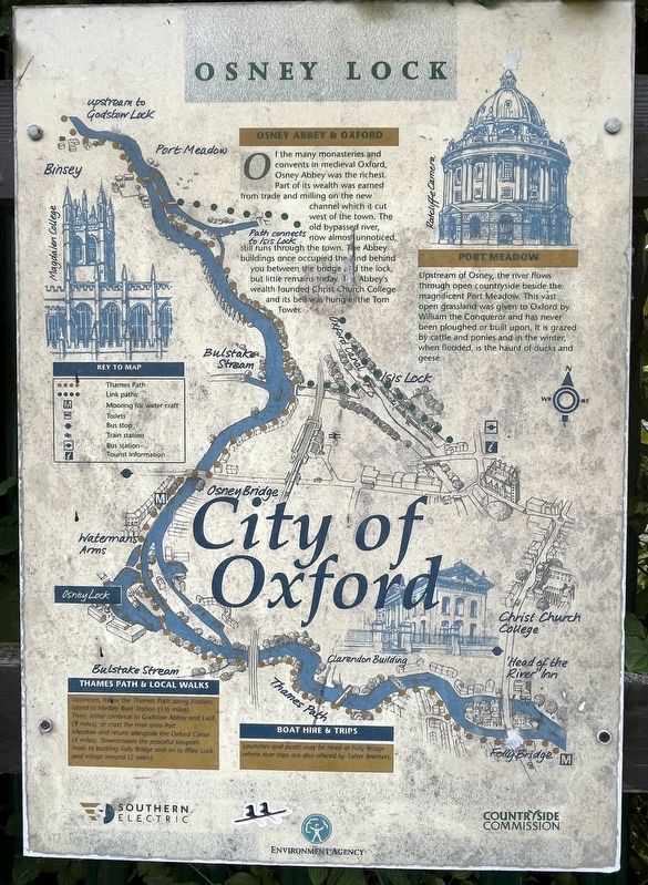
Photographed by Ray Gurganus, May 24, 2026
1. Osney Lock Marker
Osney Abbey & Oxford
Of the many monasteries and convents in medieval Oxford, Osney Abbey was the richest. Part of its wealth was earned from trade and milling on the new channel which it cut west of the town. The old bypassed river, now almost unnoticed, still runs through the town. The Abbey buildings once occupied the [illegible] behind you between the bridge and the lock, but little remains today. The Abbey's wealth founded Christ Church College and its bell was hung in the Tom Tower.
Port Meadow
Upstream of Osney, the river flows through open countryside beside the magnificent Port Meadow. This vast open grassland was given to Oxford by William the Conqueror and has never been ploughed or built upon. It is grazed by cattle and ponies and in the winter, when flooded, is the haunt of ducks and geese.
Topics. This historical marker is listed in these topic lists: Religion & Religious Structures • Waterways & Vessels.
Location. 51° 44.981′ N, 1° 16.35′ W. Marker is in Oxford, England, in Oxfordshire. It can be reached from Bridge Street. Touch for map. Marker
this page online

Regionally, this marker is in the Greater South East. Globally, it is on the Atlantic Ocean, in the North Atlantic Region, in Europe, in Atlantic Europe, on one of the British Isles, in the Western World, and in the Anglosphere. Historically, it finds itself in what was once the Roman Empire.
Other nearby markers. At least 8 other markers are within walking distance of this marker: Edgar George Wilson Memorial (approx. half a kilometer away); Park End Street (approx. 0.6 kilometers away); Baptists of Oxford (approx. 0.6 kilometers away); Hythe Bridge Street (approx. 0.6 kilometers away); Oxford Castle Timeline (approx. 0.7 kilometers away); Prison D Wing (approx. 0.7 kilometers away); Welcome to the Rewley Road Swing Bridge (approx. 0.7 kilometers away); Prison Debtors’ Tower (approx. 0.7 kilometers away). Touch for a list and map of all markers in Oxford.
Credits. This page was last revised on October 13, 2026. It was originally submitted on October 13, 2026, by Ray Gurganus of Washington, District of Columbia. This page has been viewed 4 times since then. Photo 1. submitted on October 13, 2026, by Ray Gurganus of Washington, District of Columbia. • Andrew Ruppenstein was the editor who published this page.
Editor’s want-list for this marker. photo of the marker within its surroundings • Can you help?
