Ludlow in Shropshire, England, United Kingdom — Northwestern Europe (the British Isles)
Welcome to the Jubilee Garden
Photographed by Ray Gurganus, May 17, 2026
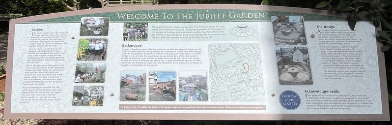
1. Welcome to the Jubilee Garden Marker
Background
In 2003 a developer sought planning permission to build five executive houses on this site. The application was fiercely resisted by the people of Ludlow, who were unhappy to see an inappropriate development driven for the pursuit of profit. What was wanted instead was an amenity that would serve the community as a whole. After nearly a decade the battle was won with the purchase of the site by the Ludlow Civic Society in 2012. The result is what you see before you a quiet and secluded garden in which individuals and families can relax and enjoy themselves and a brand new almshouse to provide accommodation for the elderly.
History
The Jubilee Garden sits in the shadow of the 900 year old Church of St Laurence behind you, the medieval Reader's House on your left, and the new almshouse on your
this page online
From the 1300s onwards this was an enclosed and isolated piece of land between the churchyard wall and the rear walls of the buildings on the Bull Ring. Archaeological work has shown that there were buildings here before the churchyard wall was built.
Once it had been saved, the southern part of the site was acquired by the Hosyer Foxe Charity, who built a brand new almshouse with four flats. When that project was completed in 2016 the construction of the garden could begin. Much undergrowth had to be removed, and the ancient walls needed significant repair before the garden layout could be formed.
As an archaeologically sensitive site, the garden had to be built upwards rather than digging down into the ground. This meant that more than 25 tonnes of material had be brought in one bag at a time through the narrow alleyway by the Church entrance.
The Design
As a walled haven of calm in the middle of a busy market town, the garden is laid out with places to sit and take in the impressive surroundings. To fit in
Photographed by Ray Gurganus, May 17, 2026
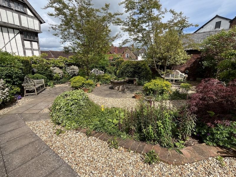
2. The Jubilee Garden
The central millstone, a gift from Ludlow Town Council, had been in use in the 1800s at Hockey's Mill at the bottom of Mill Street. Then, for many years, it was used as a decorative feature in the Buttercross at the top of Broad Street. The stove itself is a "composite" millstone, made of shaped blacks of French chert which could be transported easily and then assembled on site and bound together with an iron ring.
The planting scheme uses varieties that all thrive locally, and is intended to provide all-year interest and scent, whilst being easy to maintain.
Acknowledgements
This garden is the result of the campaigning, hard work and dedication of the great number of local residents who fought long and hard to save this land, and also of the generosity of the many individuals and organisations who supported it. Ludlow Civic Society is very proud to have led the fundraising to buy the site, and to have designed and built the garden.
Erected by Ludlow Civic Society.
Topics. This historical marker is listed in these topic lists: Horticulture & Forestry • Parks & Recreational Areas.
Location. 52° 22.096′ N, 2° 43.087′ W. Marker is in Ludlow, England, in Shropshire. It can be reached from Bull Ring. The garden is located to the east of the church. Touch for map. Marker is at or near this postal address: 4 Bull Ring, Ludlow, England SY8 1AD, United Kingdom. Touch for directions.

Regionally, this marker is in the Midlands. It is also on the British Marches. Globally, it is on the Atlantic Ocean, in the North Atlantic Region, in Europe, in Atlantic Europe, on one of the British Isles, in the Western World, and in the Anglosphere. Historically, it finds itself in what was once the Roman Empire.
Other nearby markers. At least 8 other markers are within walking distance of this marker: The Bull Ring (within shouting distance of this marker); 7-10 King Street (within shouting distance of this marker); Fish Street (within shouting distance of this marker); The Bull Hotel (within shouting distance of this marker); 4-5 King Street (within shouting distance of this marker); The Tolsey (within shouting distance of this marker); Feathers Hotel (within shouting distance of this marker); 22 and 23 The Bull Ring (within shouting distance of this marker). Touch for a list and map of all markers in Ludlow.
Credits. This page was last revised on October 13, 2026. It was originally submitted on October 13, 2026, by Ray Gurganus of Washington, District of Columbia. This page has been viewed 9 times since then. Photos: 1, 2. submitted on October 13, 2026, by Ray Gurganus of Washington, District of Columbia. • Andrew Ruppenstein was the editor who published this page.
