Altstadt in Koblenz, Rhineland-Palatinate, Germany — Central Europe
Kastorhof
Photographed by James Hulse
1. Kastorhof Marker

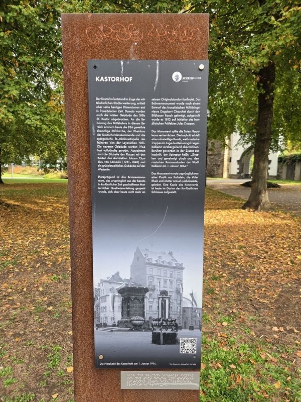
Der Kastorhof entstand im Zuge der mittelalterlichen Stadterweiterung, erhielt aber seine heutigen Dimensionen erst in französischer Zeit. Damals wurden auch die letzten Gebäude des Stifts St. Kastor abgebrochen. An die Bebauung des Mittelalters in diesem Bereich erinnern heute die 836 geweihte ehemalige Stiftskirche, der Rheinbau der Deutschordenskommende und die spätgotische St.-Jakobus-Kapelle des früheren Von der Leyenschen Hofs. Die neueren Gebäude wurden 1944 fast vollständig zerstört. Ausnahmen sind die Südseite des Platzes mit den Bauten des Architekten Johann Claudius von Lassaulx (1781–1848) und ein gründerzeitliches Gebäude auf der Westseite.
Platzprägend ist das Brunnenmonument, das ursprünglich aus der bereits in kurfürstlicher Zeit geschaffenen Metternicher Quellwasserleitung gespeist wurde, sich aber heute nicht mehr an seinem Originalstandort befindet. Das Brunnenmonument wurde nach einem Entwurf des französischen Militäringenieurs Dagobert Chauchet durch den Bildhauer Rauch gefertigt, aufgestellt wurde es 1812 auf Initiative des französischen Präfekten Jules Doazan.
Das Monument sollte die Taten Napoleons verherrlichen. Die Inschrift erhielt eine unfreiwillige Komik, weil russische Truppen im Zuge des Befreiungskrieges Koblenz vorübergehend übernahmen. Berühmt geworden ist der Zusatz zur Inschrift, der übersetzt heißt: „Gesehen und genehmigt durch uns, den russischen Kommandanten der Stadt Koblenz am 1. Januar 1814.“
Das Monument wurde ursprünglich von einer Plastik aus Kalkstein, die Vater Rhein und Mutter Mosel symbolisierte, gekrönt. Eine Kopie des Kunstwerks ist
this page online
Kastorhof
Kastorhof was created during the medieval expansion of the city, although it did not acquire its present dimensions until the French period. At that time, the last remaining buildings of the St. Kastor collegiate foundation were demolished. The former collegiate church, consecrated in 836, the riverside wing of the Teutonic Order’s commandery and the late Gothic St. James Chapel of the former Von der Leyen estate still recall the medieval buildings that once stood here. The newer buildings were almost completely destroyed in 1944. The surviving exceptions are the south side of the square, with buildings by architect Johann Claudius von Lassaulx (1781–1848), and a late-19th-century building on the western side.
The fountain monument dominates the square. It was originally supplied by the Metternich spring-water conduit, which had been constructed during the electoral period, although the monument is no longer at its original location. It was designed by French military engineer Dagobert Chauchet and made by the sculptor Rauch. It was erected in 1812 at the initiative of French prefect Jules Doazan.
The monument was intended to glorify Napoleon’s achievements. Its inscription acquired an unintended comic quality when Russian troops temporarily occupied Koblenz during the Wars of Liberation. The famous addition to the inscription translates as: “Seen and approved by us, the Russian commander of the city of Koblenz, on January 1, 1814.”
The monument was originally crowned by a limestone sculpture symbolizing Father Rhine and
Photographed by James Hulse, October 3, 2026
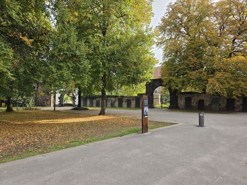
2. Kastorhof Marker
Erected by Spurensuche Koblenz.
Topics. This historical marker is listed in this topic list: Man-Made Features. A significant historical date for this entry is January 1, 1814.
Location. 50° 21.747′ N, 7° 36.223′ E. Marker is in Koblenz, Rheinland-Pfalz (Rhineland-Palatinate). It is in Altstadt. It is at the intersection of Esther-Bejarano-Straße and Kastorhof on Esther-Bejarano-Straße. Touch for map. Marker is at or near this postal address: Esther-Bejarano-Str 5, Koblenz RP 56068, Germany. Touch for directions.

Regionally, this marker is in the German Rhineland, in the Upper Middle Rhine Valley, and specifically in the Moselle Valley. Globally, it is in Europe, the European Union, Atlantic Europe, Central Europe, the Schengen Area, Western Europe, and the Western World. Historically, it finds itself in what was once the Roman Empire, the Holy Roman Empire, and the former West Germany.
Other nearby markers. At least 8 other markers are within walking distance of this marker: Kastorbrunnen (a few steps from this marker); Kastorbrunnen Memorial (a few steps from this marker); Spätgotische Kapelle / Late Gothic Chapel (within shouting distance of this marker); Historical Findings at St. Kastor (about 90 meters away, measured in a direct line); Römische Zeit/ Roman Period (about 90 meters away); Vor- und Frühgeschichte / Pre and Early History (about 90 meters away); Geologie - Landschftsentwicklung / Geology - Landscape Development (about 90 meters away); Moderne: Deutsches Eck Mit Kaiser-Wilhelm-Denkmal (about 90 meters away). Touch for a list and map

Photographed by James Hulse
3. Basilica of St. Castor
Photographed by James Hulse, October 3, 2026
4. Kastorhof Marker
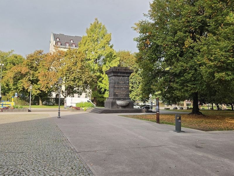
The view of the marker with the Napoleonsbrunnen (fountain) in the background.
Credits. This page was last revised on October 14, 2026. It was originally submitted on October 13, 2026, by James Hulse of Medina, Texas. This page has been viewed 10 times since then. Photos: 1, 2, 3, 4. submitted on October 14, 2026, by James Hulse of Medina, Texas.
