Altstadt in Koblenz, Rhineland-Palatinate, Germany — Central Europe
Löhrrondell
Photographed by James Hulse, October 2, 2026
1. Löhrrondell Marker

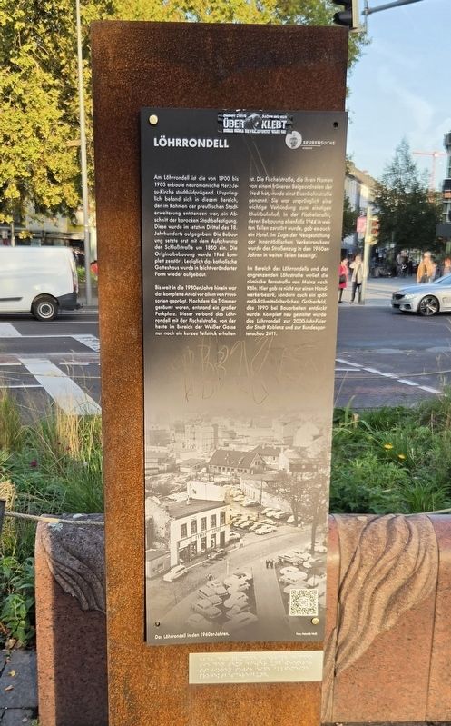
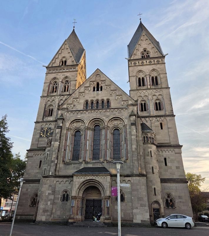
Am Löhrrondell ist die von 1900 bis 1903 erbaute neuromanische Herz-Jesu-Kirche stadtbildprägend. Ursprünglich befand sich in diesem Bereich, der im Rahmen der preußischen Stadterweiterung entstanden war, ein Abschnitt der barocken Stadtbefestigung. Diese wurde im letzten Drittel des 18. Jahrhunderts aufgegeben. Die Bebauung setzte erst mit dem Aufschwung der Schloßstraße um 1850 ein. Die Originalbebauung wurde 1944 komplett zerstört. Lediglich das katholische Gotteshaus wurde in leicht veränderter Form wieder aufgebaut.
Bis weit in die 1980er-Jahre hinein war das komplette Areal vor allem von Provisorien geprägt. Nachdem die Trümmer geräumt waren, entstand ein großer Parkplatz. Dieser verband das Löhrrondell mit der Fischelstraße, von der heute im Bereich der Weißer Gasse nur noch ein kurzes Teilstück erhalten ist. Die Fischelstraße, die ihren Namen von einem früheren Beigeordneten der Stadt hat, wurde einst Eisenbahnstraße genannt. Sie war ursprünglich eine wichtige Verbindung zum einstigen Rheinbahnhof. In der Fischelstraße, deren Bebauung ebenfalls 1944 in weiten Teilen zerstört wurde, gab es auch ein Hotel. Im Zuge der Neugestaltung der innerstädtischen Verkehrsachsen wurde der Straßenzug in den 1960er-Jahren in weiten Teilen beseitigt.
Im Bereich des Löhrrondells und der angrenzenden Löhrstraße verlief die römische Fernstraße von Mainz nach Köln. Hier gab es nicht nur einen Handwerkerbezirk, sondern auch ein spätantik-frühmittelalterliches Gräberfeld, das 1990 bei Bauarbeiten entdeckt wurde. Komplett neu gestaltet wurde das Löhrrondell zur 2000-Jahr-Feier der Stadt Koblenz und zur Bundesgartenschau 2011.
Das Löhrrondell in den 1960er-Jahren.
Foto: Heinrich Wolf
Löhrrondell
The neo-Romanesque Sacred Heart Church, built between 1900 and 1903, dominates
this page online
Well into the 1980s, the entire area was largely characterized by temporary arrangements. After the rubble was cleared, a large parking lot was created. It connected Löhrrondell with Fischelstraße, of which only a short section near Weißer Gasse survives today. Fischelstraße, named after a former deputy mayor, was once called Eisenbahnstraße. It originally provided an important connection to the former Rhine railway station. The street also had a hotel, and most of its buildings were destroyed in 1944. During the redevelopment of the city’s main traffic routes in the 1960s, much of the street was removed.
The Roman highway from Mainz to Cologne passed through Löhrrondell and the adjoining Löhrstraße. The area contained
Photographed by James Hulse, October 2, 2026
2. Löhrrondell Marker
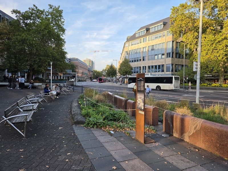
Löhrrondell in the 1960s.
Photo: Heinrich Wolf
Erected by Spurensuche Koblenz.
Topics. This historical marker is listed in these topic lists: Industry & Commerce • Roads & Vehicles • Settlements & Settlers. A significant historical year for this entry is 1900.
Location. 50° 21.436′ N, 7° 35.474′ E. Marker is in Koblenz, Rheinland-Pfalz (Rhineland-Palatinate). It is in Altstadt. It is on Löhrrondell 0.1 kilometers north of Moselring, on the left when traveling north. Touch for map. Marker is at or near this postal address: Löhrrondell 1A, Koblenz RP 56068, Germany. Touch for directions.

Regionally, this marker is in the German Rhineland, in the Upper Middle Rhine Valley, and specifically in the Moselle Valley. Globally, it is in Europe, the European Union, Atlantic Europe, Central Europe, the Schengen Area, Western Europe, and the Western World.
Photographed by James Hulse, October 2, 2026
3. Neo-Romanesque Sacred Heart Church
Other nearby markers. At least 8 other markers are within walking distance of this marker: Pfarrkirche Herz-Jesu / Sacred Heart Parish Church (within shouting distance of this marker); Markus Ramler (approx. 0.3 kilometers away); Manfred Ramler (approx. 0.3 kilometers away); Paula Ramler (approx. 0.3 kilometers away); Helmut Ramler (approx. 0.3 kilometers away); Ernst Brasch (approx. 0.3 kilometers away); Ilse Erika Brasch (approx. 0.3 kilometers away); Emma Brasch (approx. 0.3 kilometers away). Touch for a list and map of all markers in Koblenz.
Credits. This page was last revised on October 14, 2026. It was originally submitted on October 13, 2026, by James Hulse of Medina, Texas. This page has been viewed 7 times since then. Photos: 1, 2, 3. submitted on October 14, 2026, by James Hulse of Medina, Texas.
