Irving in Erie County, New York — The American Northeast (Mid-Atlantic)
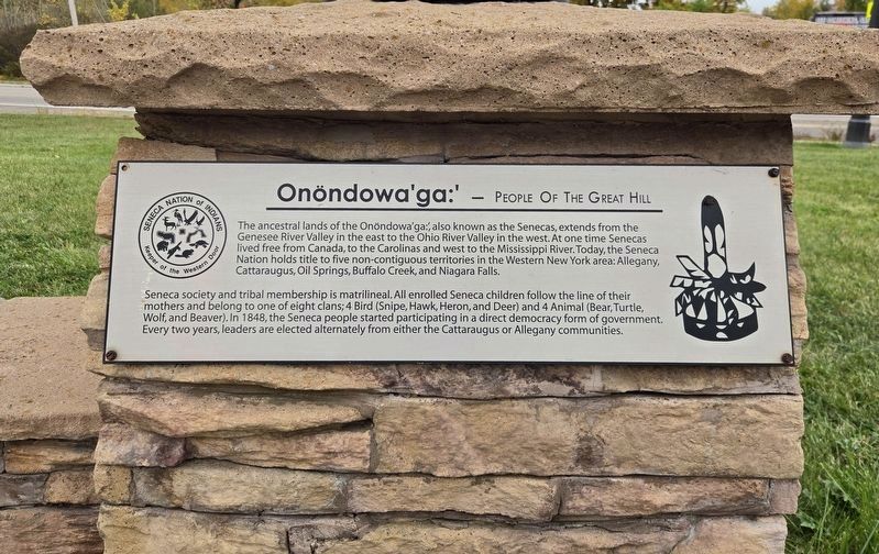
Onöndowa'ga:' - People of the Great Hill
Photographed by Bradley Owen, October 14, 2026
1. Onöndowa'ga:' - People of the Great Hill Marker
The ancestral lands of the Onöndowa'ga:', also known as the Senecas, extends from the Genesee River Valley in the east to the Ohio River Valley in the west. At one time Senecas lived free from Canada, to the Carolinas and west to the Mississippi River. Today, the Seneca Nation holds title to five non-contiguous territories in the Western New York area: Allegany, Cattaraugus, Oil Springs, Buffalo Creek, and Niagara Falls.
Seneca society and tribal membership is matrilineal. All enrolled Seneca children follow the line of their mothers and belong to one of eight clans; 4 Bird (Snipe, Hawk, Heron, and Deer) and 4 Animal (Bear, Turtle, Wolf, and Beaver). In 1848, the Seneca people started participating in a direct democracy form of government. Every two years, leaders are elected alternately from either the Cattaraugus or Allegany communities.
Erected by Seneca Nation of Indians.
Topics. This historical marker is listed in this topic list: Indigenous Peoples and Communities. A significant historical year for this entry is 1848.
Location. 42° 34.212′ N, 79° 6.075′ W. Marker is in Irving, New York, in Erie County. It
this page online

Regionally, this marker is in Upstate New York, specifically in Western New York, and in the Buffalo Metropolitan Area. It is also in the American Northeast and in the Mid-Atlantic. Globally, it is in North America, on the Great Lakes, in the Western Hemisphere, in the Western World, and in the Anglosphere. Historically, it finds itself in what was once the Viceroyalty of New France, the Haudenosaunee (Iroquois) Confederacy, New Netherland, and one of the original Thirteen Colonies.
Other nearby markers. At least 8 other markers are within 4 miles of this marker, measured as the crow flies: Hodinöhso:ni' (here, next to this marker); Oda'ä:de'- Sky Dome (a few steps from this marker); gëöya'geo:nö' yagö:gweh - Skywoman (a few steps from this marker); Everett R. Burmaster (approx. 0.6 miles away); Amos Sottle (approx. 0.6 miles away); American Revolution (approx. 1½ miles away); Farnham Veterans Memorial
Photographed by Bradley Owen, October 14, 2026
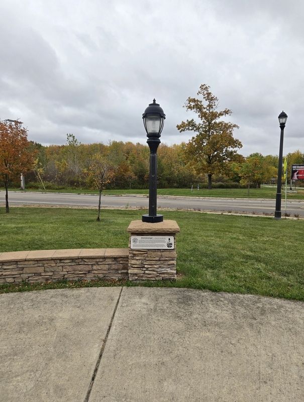
2. Onöndowa'ga:' - People of the Great Hill Marker
Credits. This page was last revised on October 15, 2026. It was originally submitted on October 15, 2026, by Bradley Owen of Morgantown, West Virginia. This page has been viewed 4 times since then. Photos: 1, 2. submitted on October 15, 2026, by Bradley Owen of Morgantown, West Virginia.
