Irving in Erie County, New York — The American Northeast (Mid-Atlantic)
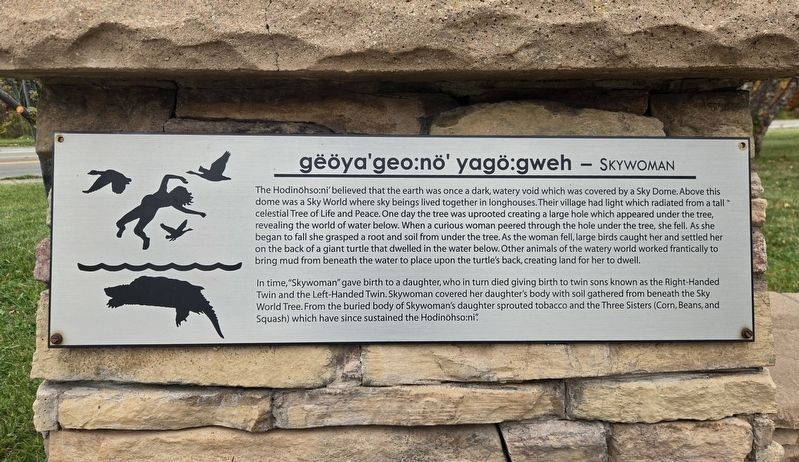
gëöya'geo:nö' yagö:gweh - Skywoman
Photographed by Bradley Owen, October 14, 2026
1. gëöya'geo:nö' yagö:gweh - Skywoman Marker
The Hodinöhso:ni' believed that the earth was once a dark, watery void which was covered by a Sky Dome. Above this dome was a Sky World where sky beings lived together in longhouses. Their village had light which radiated from a tall celestial Tree of Life and Peace. One day the tree was uprooted creating a large hole which appeared under the tree, revealing the world of water below. When a curious woman peered through the hole under the tree, she fell. As she began to fall she grasped a root and soil from under the tree. As the woman fell, large birds caught her and settled her on the back of a giant turtle that dwelled in the water below. Other animals of the watery world worked frantically to bring mud from beneath the water to place upon the turtle's back, creating land for her to dwell.
In time, "Skywoman" gave birth to a daughter, who in turn died giving birth to twin sons known as the Right-Handed Twin and the Left-Handed Twin. Skywoman covered her daughter's body with soil gathered from beneath the Sky World Tree. From the buried body of Skywoman's daughter sprouted tobacco and the Three Sisters (Corn, Beans,
this page online
Erected by Seneca Nation of Indians.
Topics. This historical marker is listed in this topic list: Indigenous Peoples and Communities.
Location. 42° 34.217′ N, 79° 6.083′ W. Marker is in Irving, New York, in Erie County. It is at the intersection of Erie Road (New York State Route 5) and U.S. 20, on the right when traveling north on Erie Road. Touch for map. Marker is in this post office area: Irving NY 14081, United States of America. Touch for directions.

Regionally, this marker is in Upstate New York, specifically in Western New York, and in the Buffalo Metropolitan Area. It is also in the American Northeast and in the Mid-Atlantic. Globally, it is in North America, on the Great Lakes, in the Western Hemisphere, in the Western World, and in the Anglosphere. Historically, it finds itself in what was once the Viceroyalty of New France, the Haudenosaunee (Iroquois) Confederacy, New Netherland, and one of the original Thirteen Colonies.
Other nearby markers. At least 8 other markers are within 4 miles of
Photographed by Bradley Owen, October 14, 2026
2. gëöya'geo:nö' yagö:gweh - Skywoman Marker
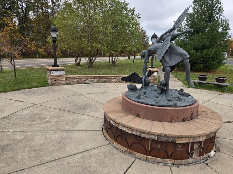
Skywoman artwork and the marker at the left rear.
Photographed by Bradley Owen, October 14, 2026
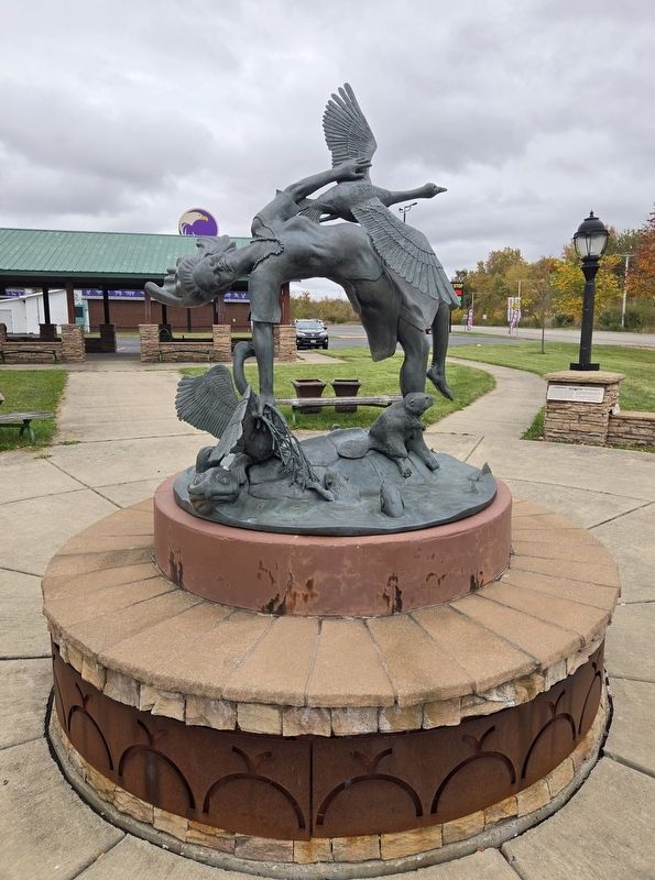
3. Skywoman Artwork
Credits. This page was last revised on October 15, 2026. It was originally submitted on October 15, 2026, by Bradley Owen of Morgantown, West Virginia. This page has been viewed 9 times since then. Photos: 1, 2, 3. submitted on October 15, 2026, by Bradley Owen of Morgantown, West Virginia.
