Coxsackie in Greene County, New York — The American Northeast (Mid-Atlantic)
Look West to the Kalkberg Trail
Photographed by Trudi Jacobson, October 7, 2026
1. Look West to the Kalkberg Trail Marker
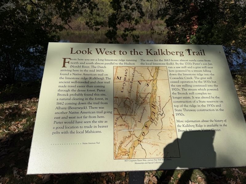
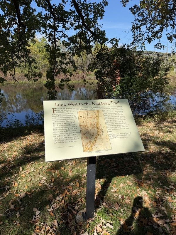
From here you see a long limestone ridge running north and south almost parallel to the Hudson (Nordt) River. The Dutch arriving here in the mid 1600s found a Native American trail on the limestone ridge (Kalkberg). The ancient well-traveled and clear trail made travel easier than coming through the dense forest. Pieter Bronck probably found this site, a natural clearing in the forest, in 1662 coming down the trail from Albany (Beverwyck). There was another Native American trail going east and west not far from here. Pieter would have seen the site as a good location to trade in beaver pelts with the local Mahicans.
The stone for the 1663 house almost surely came from the local limestone (kalk). By the 1700s Pieter’s son Jan ran a saw mill and a grist mill near here powered by a stream falling down the limestone ridge into the Coxsackie Creek. The grist mill ceased operation by the 1830s but the saw milling continued into the 1920s. The stream which powered the Bronck mill complex no longer exists. It was altered by the construction of a State reservoir on top of the ridge in the 1930s and State Thruway construction
this page online
More information about the history of the Kalkberg Ridge is available in the Bronck Museum Visitor Center.
[Caption:]
1673 Coeymans Patent Map, courtesy New York State Library, Manuscripts and Special Collections.” The green dotted line is identified as the Native American Trail.
Erected by Greene County Historical Society.
Topics. This historical marker is listed in these topic lists: Indigenous Peoples and Communities • Industry & Commerce • Settlements & Settlers. A significant historical year for this entry is 1662.
Location. 42° 20.747′ N, 73° 50.796′ W. Marker is in Coxsackie, New York, in Greene County. It can be reached from Peter Bronk Road. The marker is behind the house complex. Touch for map. Marker is at or near this postal address: 31 Peter Bronk Rd, Coxsackie NY 12051, United States of America. Touch for directions.

Regionally, this marker is in Upstate New York and in the Hudson Valley. It is also in the American Northeast and in the Mid-Atlantic. Globally, it is in North America, the Western Hemisphere, the Western World, and the Anglosphere. Historically, it finds itself
Photographed by Trudi Jacobson, October 7, 2026
2. Look West to the Kalkberg Trail Marker
Other nearby markers. At least 8 other markers are within walking distance of this marker: Bronck House (within shouting distance of this marker); a different marker also named Bronck House (within shouting distance of this marker); Bronck Museum (within shouting distance of this marker); The Bronck Farm (within shouting distance of this marker); The Coxsackie Resolutions (within shouting distance of this marker); The Bronck Family (within shouting distance of this marker); Bronck Homestead (about 300 feet away, measured in a direct line); The Bronck Burying Ground (about 400 feet away). Touch for a list and map of all markers in Coxsackie.
Regarding Look West to the Kalkberg Trail. The Kalkberg Ridge was an important transportation corridor long before European settlement. Its limestone terrain supported a well-traveled Indigenous trail that offered an alternative to moving through dense forest. The marker suggests that Pieter Bronck may have followed this route from Beverwyck (Albany) in 1662 before establishing his homestead near Coxsackie Creek.
The ridge also provided building material for the Bronck family's 1663 stone house and waterpower for the sawmill and gristmill subsequently operated by Pieter's son Jan. The gristmill ceased operating by the 1830s, while sawmilling continued into the twentieth century.
The landscape has since changed substantially. Construction of a state reservoir in the 1930s and the New York State Thruway in the 1950s altered the stream that once powered the Bronck mills.
The accompanying reproduction of the 1673 Coeymans Patent Map provides a historical perspective on the region's waterways and transportation routes.
Sources:
Greene County Historical Society. About the Bronck Family & Farmstead. Provides historical context for the Bronck family's settlement and subsequent ownership.
Greene County Historical Society. About the Bronck House & Barns. Confirms Pieter Bronck's 1662 land purchase and the construction of the 1663 stone house.
New York State Library. New York State History — Colonial Period. Includes a description of the Coeymans Patent map. An interesting correction: although the patent dates to 1673, the library identifies the surviving map as having been drawn by Simon Metcalfe around 1770. Thus, 1673 Coeymans Patent Map refers to the patent date, not necessarily the map's creation date.
Credits. This page was last revised on October 16, 2026. It was originally submitted on October 16, 2026, by Trudi Jacobson of Slingerlands, New York. This page has been viewed 13 times since then. Photos: 1, 2. submitted on October 16, 2026, by Trudi Jacobson of Slingerlands, New York. • Devry Becker Jones was the editor who published this page.
