Downtown in Rapid City in Pennington County, South Dakota — The American Midwest (Upper Plains)
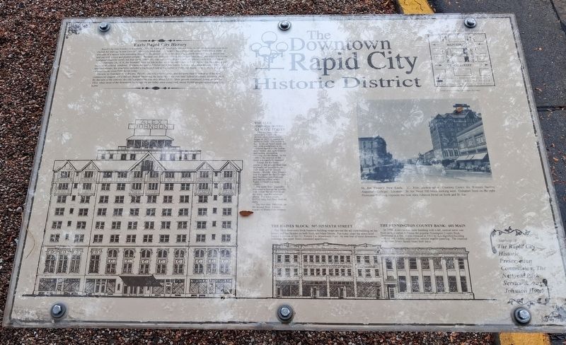
Early Rapid City History
The Downtown Rapid City Historic District
Photographed by William Fischer, Jr., September 20, 2026
1. Early Rapid City History Marker
Rapid City was founded in February, 1876, by a party of failed gold miners, who, as one of them said, saw more chance for starting "a new Denver", obviously predestined to become the commercial center of the Black Hills. A townsite of a square mile extending from East Boulevard to West Boulevard and North Street to South Street was laid out with a rope and pocket compass. Because they failed to correct for compass deviation, the original townsite is aligned magnetic north, not true north. Their city was named for Rapid Creek, on whose banks it would stand.
On February 24, 1876, the founders drew for lots in the new town and began to build log cabins, including a one-room hotel without windows. Because the land still belonged to the Lakota Indians, who were known to have attacked miners, the structures included a log blockhouse at the corner of Fifth and Rapid Streets, about where the railroad tracks cross Fifth Street today.
Despite its founders' rosy dreams, the city was very slow to grow, and for some time it looked as if the new commercial magnet was a failure, despite becoming the location of the new state School
this page online
THE ALEX JOHNSON HOTEL: 523 SIXTH STREET
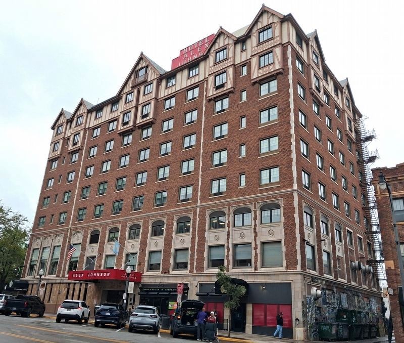
This ten story hotel has dominated Rapid City's skyline since construction began in 1927; it opened its doors in 1928. The building had an Indian motif inside and out, with medallions at the windows based on the Indian head nickel, and light fixtures and ceiling decoration carrying out the theme. In the 1980's, the interior of the hotel was carefully restored.
Except for the lobby entrance, the ground floor was originally all storefronts on both Sixth and St. Joseph Streets. Builder Alex Johnson was the agent for the Chicago and Northwestern Railroad, and had his office where Paddy O'Neill's is today (1996).
The tenth floor originally contained a lounge for guests, with Indian theme murals on the walls; and the solarium above. For some years, KOTA radio had their studios there.
The two story ballroom, on the second floor, features murals of
Photographed by William Fischer, Jr., September 20, 2026
2. Alex Johnson Hotel NRHP Marker
[Right photo caption reads]
St. Joe Street's New Look. (C. Rise, photographer) Location: St. Joe Street 500 block looking west. Duhamel Store on the right. Flormann Building opposite the new Alex Johnson Hotel on Sixth and St. Joe.
[Bottom right streetscape illustration reads]
THE HAINES BLOCK: 507-517 SIXTH STREET
This 1918 three-story brick business building wraps around the adjacent building on the corner, and has facades on both Sixth and Main Streets. For many years the street level housed a portion of the J.C. Penney Co. department store. As was true of most downtown buildings, the upper floors contained apartments.
THE PENNINGTON COUNTY BANK: 601 MAIN [STREET]
In 1888, a substantial stone building with a tall, conical turret was built on this corner to house the popular Pennington County Bank. Destroyed in a fire, it was replaced in 1915 by this dignified building with its still visible, impressive, interior marble paneling. The classical style Main Street facade bears both dates.
———————————————
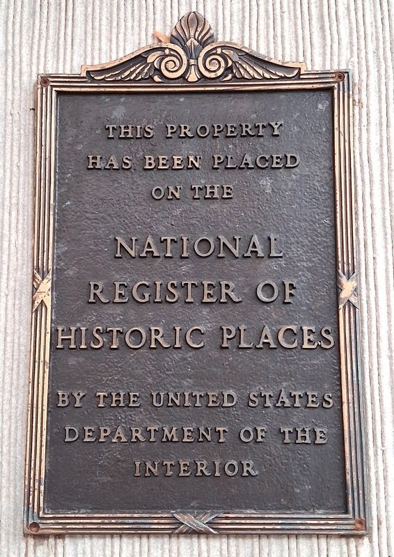
This property [Alex Johnson Hotel]
has been placed on the
National Register of Historic Places
by
Photographed by William Fischer, Jr., September 20, 2026
3. Alex Johnson Hotel NRHP Marker
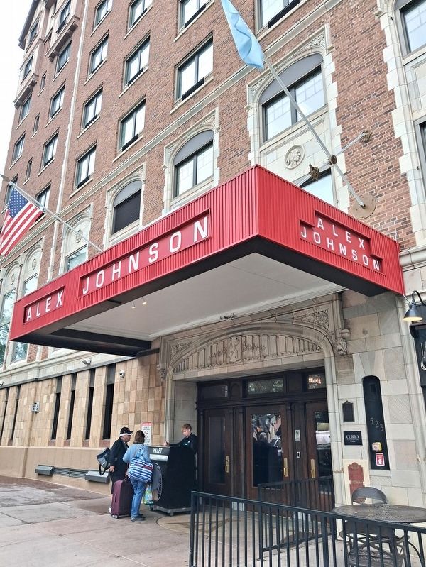
On wall to right of entrance
Erected 1996 by the Rapid City Historic Preservation Commission, the National Park Service & Alex Johnson Hotel.
Topics and series. This historical marker is listed in these topic lists: Architecture • Indigenous Peoples and Communities • Industry & Commerce • Settlements & Settlers. In addition, it is included in the National Register of Historic Places (NRHP) series list. A significant historical month for this entry is February 1876.
Location. 44° 4.81′ N, 103° 13.628′ W. Marker is in Rapid City, South Dakota, in Pennington County. It is in Downtown. It is at the intersection of 6th Street and St. Joseph Street (Business Interstate 90), on the right when traveling north on 6th Street. Touch for map. Marker is at or near this postal address: 530 6th Street, Rapid City SD 57701, United States of America. Touch for directions.

Regionally, this marker is in West River and in the Badlands. It is also in the American Black Hills, in the Lewis & Clark Corridor, on the prairies, and on the Northern Plains. Globally, it is in North America, the Western Hemisphere, the Western
Photographed by William Fischer, Jr., September 20, 2026
4. Alex Johnson Hotel
Primary elevation on 6th Street
Other nearby markers. At least 8 other markers are within walking distance of this marker: Ronald Reagan (here, next to this marker); Tourism and Hotels (a few steps from this marker); George Washington (within shouting distance of this marker); Donald J. Trump (within shouting distance of this marker); Jimmy Carter (within shouting distance of this marker); George Herbert Walker Bush (about 300 feet away, measured in a direct line); Mitakuye Oyasin (about 300 feet away); Hooky Jack Leary (about 300 feet away). Touch for a list and map of all markers in Rapid City.
Also see . . . Rapid City Historic Commercial District National Register Nomination Form. (Submitted on October 16, 2026, by William Fischer, Jr. of Reynoldsburg, Ohio.)
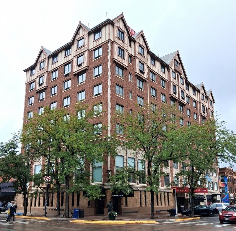
Photographed by William Fischer, Jr., September 20, 2026
5. Alex Johnson Hotel
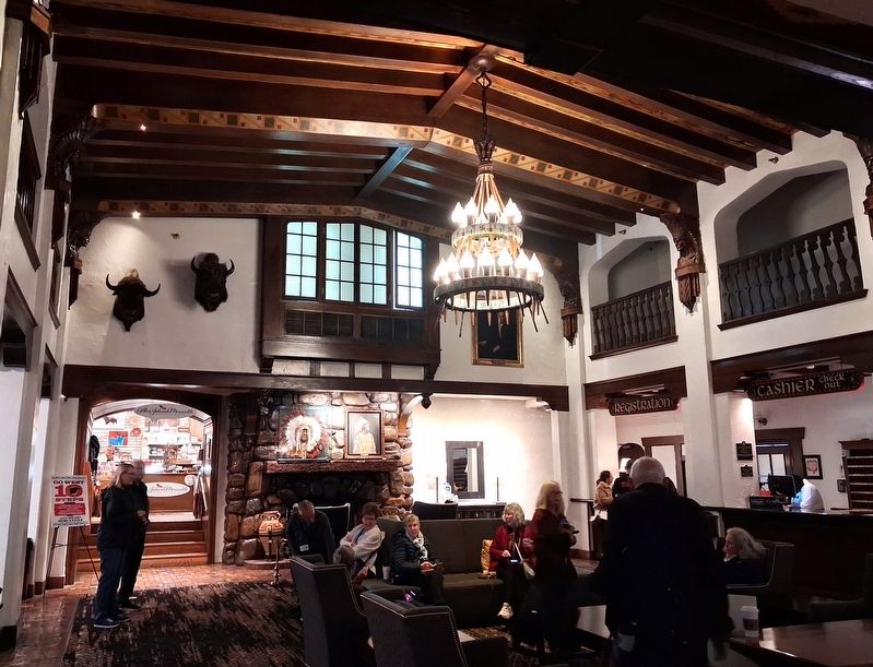
Photographed by William Fischer, Jr., September 20, 2026
6. Alex Johnson Hotel Lobby
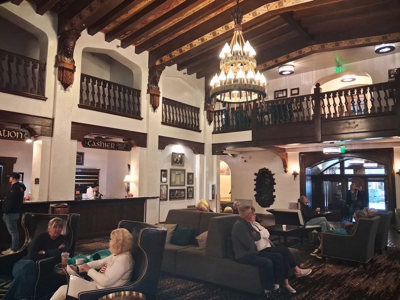
Photographed by William Fischer, Jr., September 20, 2026
7. Alex Johnson Hotel Lobby
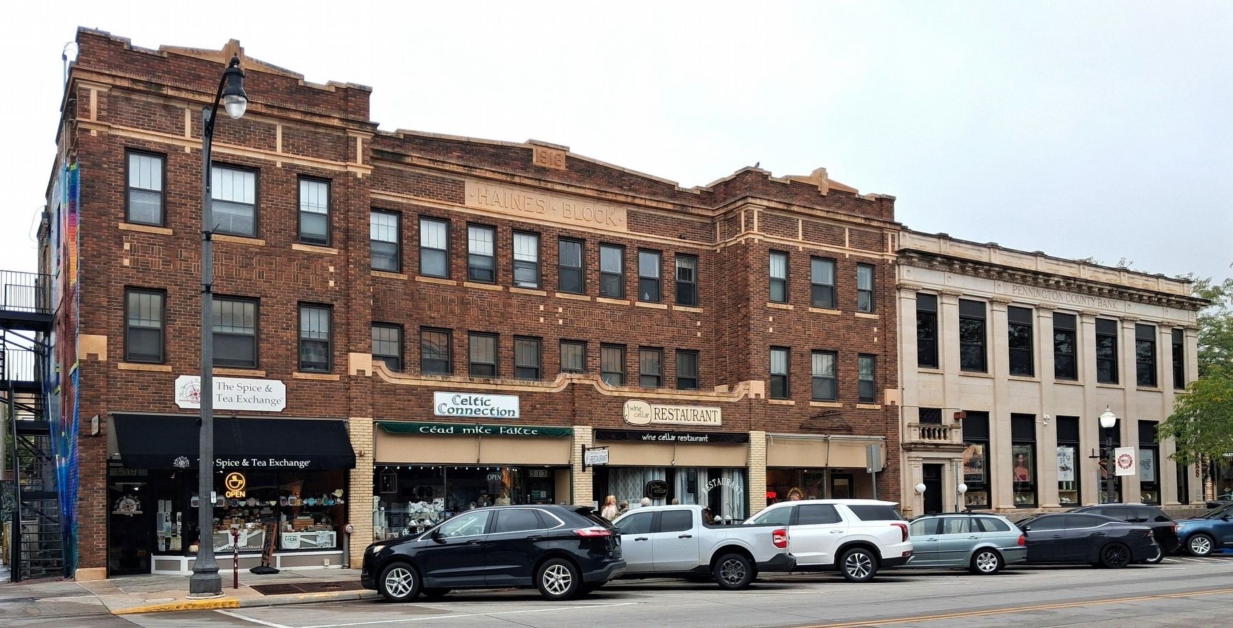
Photographed by William Fischer, Jr., September 20, 2026
8. Haines Block and Pennington County Bank Buildings
Credits. This page was last revised on October 16, 2026. It was originally submitted on October 16, 2026, by William Fischer, Jr. of Reynoldsburg, Ohio. This page has been viewed 7 times since then. Photos: 1, 2, 3, 4, 5, 6, 7, 8. submitted on October 16, 2026, by William Fischer, Jr. of Reynoldsburg, Ohio.
