Downtown in Rapid City in Pennington County, South Dakota — The American Midwest (Upper Plains)
Early Day Transportation
The Downtown Rapid City Historic District
Photographed by William Fischer, Jr., September 20, 2026
1. Early Day Transportation Marker
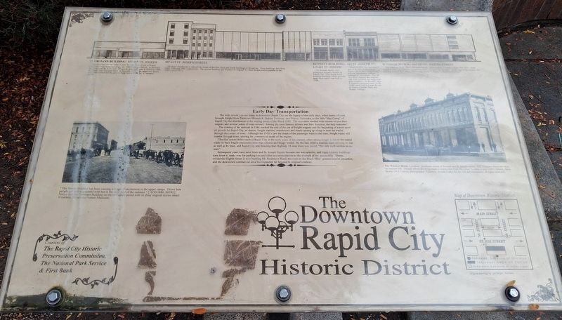
The wide streets you see today in downtown Rapid City are the legacy of the early days, when teams of oxen brought freight from Pierre and Bismarck, Dakota Territory, and Sidney, Nebraska, to the little "Hay Camp" of Rapid City for distribution to the mining towns of the Black Hills. The teamsters needed wide streets to turn their wagons and several yokes of oxen around. Among the most famous drivers was Mrs. Knutson, the lady teamster!
The coming of the railroad in 1886 marked the end of the era of freight wagons and the beginning of a new spurt of growth for Rapid City, as depots, freight stations, warehouses and hotels sprang up along or near the tracks through the center of town. Although the 1950's saw the death of the passenger train in the state, freight trains still rumble through town, serving the commercial needs of the region.
The first automobiles reached Rapid City in the early years of the century, often taking longer to travel the rutted roads on their fragile pneumatic tires than a horse and buggy would. By the late 1920's, tourists were arriving by car as well as by train, and Rapid City was boasting
this page online
Subsequent years have seen Main and St. Joseph Streets become one way arteries, and many historic buildings torn down to make way for parking lots and other accommodations to the triumph of the automobile. Sleepy, residential Eighth Street is now bustling Mt. Rushmore Road, the route to the Black Hills' greatest tourist attraction, and the downtown commercial area has expanded far beyond its original confines.
[Left photo caption reads]
"This female freighter has been causing a ripple of excitement in the upper camps. Down here people got well acquainted with her in the early part of the summer." [10/30/1886, BHWJ] Notice that the Flormann Building on the left stands proud with its three original stories intact.
[Right photo caption reads]
The Windsor Block. Location: Southeast corner of Seventh and St. Joseph Streets. G.S. Congdon Hardware store on extreme left. Though efforts are being made to restore this front, the corner building is now (1997) behind a false facade. (W.J. Collins, photographer)
[Top building streetscape illustration, left to right,
Photographed by William Fischer, Jr., September 20, 2026
2. Early Day Transportation Marker
FLORMANN BUILDING: 601-605 ST. JOSEPH [STREET]
The building you see today is only the first floor of one of Rapid City's first large brick buildings, the 1884 Flormann Block. In the early days it housed the K.D. Horn Drygoods store and, until it closed in 1886, the Black Hills National Bank. In the early 1950's the upper two floors were demolished and the ground floor was covered by a "modern" facade.
607-615 ST. JOSEPH STREET
"Modern" facades have claimed the fronts of the first, third and fourth buildings in this group. These buildings date from 1883, 1926 and 1886 respectively. The second building still display its original Art Deco facade, a style popular in the 1920's and 1930's.
BENNETT BUILDING: 619-621 ST. JOSEPH [STREET]
The Bennett family were prominent property owners in Rapid City. This sturdy brick business building, which proudly bears their name, was built in 1918.
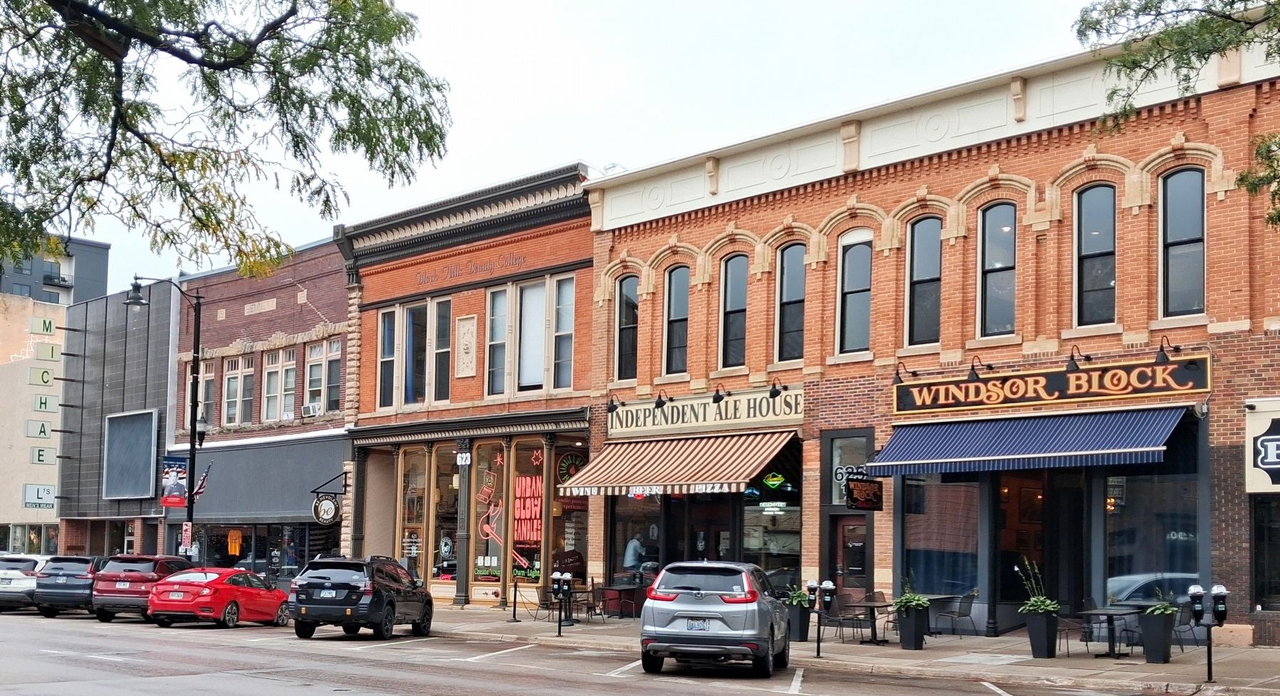
623 ST. JOSEPH ST.
Built in 1892, this building is one of the few in downtown Rapid City to have retained its original appearance without substantial renovation. The tall first floor features the original cast iron columns and large plate glass
Photographed by William Fischer, Jr., September 20, 2026
3. St. Joseph Street 600 Block Buildings
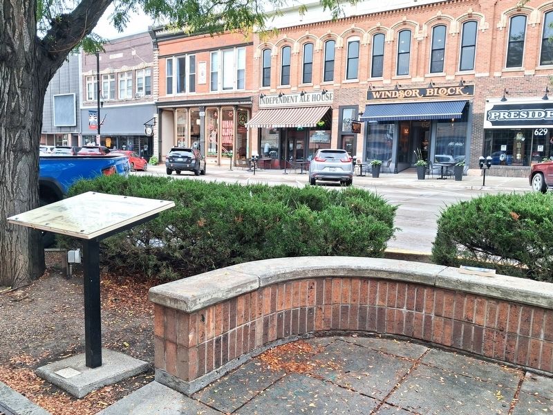
WINDSOR BLOCK: 625-629 ST. JOSEPH STREET
The elaborate brick 1880's Italianate facade, shown below, is hidden behind this 1950's front installed when Donaldson's Department Store occupied this location. At the turn of the century, the building house the Lathrop-Reeves Mercantile Company's department store.
Erected 1997 by the Rapid City Historic Preservation Commission, the National Park Service, and First Bank.
Topics and series. This historical marker is listed in these topic lists: Railroads & Streetcars • Roads & Vehicles • Settlements & Settlers. In addition, it is included in the National Register of Historic Places (NRHP) series list. A significant historical year for this entry is 1886.
Location. 44° 4.822′ N, 103° 13.729′ W. Marker is in Rapid City, South Dakota, in Pennington County. It is in Downtown. It is at the intersection of St. Joseph Street (Business Interstate 90) and 7th Street, on the left when traveling east on St. Joseph Street. Touch for map. Marker is at or near this postal address: 632 St Joseph Street, Rapid City SD 57701, United States of America. Touch for directions.

Regionally, this marker is in West River and in the Badlands. It is also in the American Black Hills, in the Lewis & Clark Corridor, on the prairies, and on the Northern Plains. Globally, it is in North America, the Western Hemisphere, the Western World, and the Anglosphere. Historically, it finds itself in what was once Rupert’s Land and also the Louisiana Purchase.
Other nearby markers. At least 8 other markers are within walking distance of this marker: Thomas Jefferson (a few steps from this marker); William Jefferson Clinton (within shouting distance of this marker); James Madison (within shouting distance of this marker); Gerald R. Ford (within shouting distance of this marker); The Growth of Rapid City (about 300 feet away, measured in a direct line); Rapid City's Downtown Historic District (about 300 feet away); James Monroe (about 300 feet away); 601st Bomb Squadron Army B-17 25226 Crash (about 300 feet away). Touch for a list and map of all markers in Rapid City.
Also see . . . Rapid City Commercial Historic District Nomination Form. (Submitted on October 16, 2026, by William Fischer, Jr. of Reynoldsburg, Ohio.)
Credits. This page was last revised on October 16, 2026. It was originally submitted on October 16, 2026, by William Fischer, Jr. of Reynoldsburg, Ohio. This page has been viewed 8 times since then. Photos: 1, 2, 3. submitted on October 16, 2026, by William Fischer, Jr. of Reynoldsburg, Ohio.
