Liverpool in Merseyside, England, United Kingdom — Northwestern Europe (the British Isles)
Chapel Street
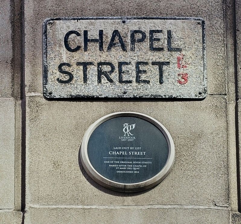
Laid out by 1257
Photographed by Ian Lefkowitz, September 13, 2026
1. Chapel Street Marker
One of the original seven streets
Named after the chapel of St Mary Del Quay
Demolished 1814
Erected 2007.
Topics. This historical marker is listed in these topic lists: Religion & Religious Structures • Roads & Vehicles. A significant historical year for this entry is 1257.
Location. 53° 24.476′ N, 2° 59.555′ W. Marker is in Liverpool, England, in Merseyside. It is at the intersection of Chapel Street and Old Hall Street, on the left when traveling west on Chapel Street. Touch for map. Marker is at or near this postal address: 36 Exchange Street E, Liverpool, England L2 2AW, United Kingdom. Touch for directions.

Regionally, this marker is in North West England. Globally, it is on the Atlantic Ocean, in the North Atlantic Region, in Europe, in Atlantic Europe, on one of the British Isles, in the Western World, and in the Anglosphere. Historically, it finds itself in what was once the Roman Empire.
Other nearby markers. At least 8 other markers are within walking distance of this marker: Liverpool Exchange Newsroom War Memorial (within shouting distance of this marker); High Street (about 120
this page online
Also see . . . Chapel Street, Liverpool (Wikipedia).
The street was one of the original seven streets that made up the medieval borough founded by King John in 1207, together with Water Street, Old Hall Street, Castle Street, High Street, Tithebarn Street and Dale Street. The street originally contained a chapel by the quayside, known as St. Mary atte Key. The first recorded reference to Chapel Street dates from 1368 on a deed for a burgage plot.(Submitted on October 16, 2026, by Ian Lefkowitz of New York, New York.)
Photographed by Ian Lefkowitz, September 13, 2026
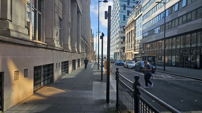
2. Chapel Street Marker
Looking west towards the River Mersey on Chapel Street.
Credits. This page was last revised on October 17, 2026. It was originally submitted on October 16, 2026, by Ian Lefkowitz of New York, New York. This page has been viewed 4 times since then. Photos: 1, 2. submitted on October 16, 2026, by Ian Lefkowitz of New York, New York. • Andrew Ruppenstein was the editor who published this page.
