Harwood in Anne Arundel County, Maryland — The American Northeast (Mid-Atlantic)
Rawlings’ Tavern
Photographed by F. Robby, December 31, 2003
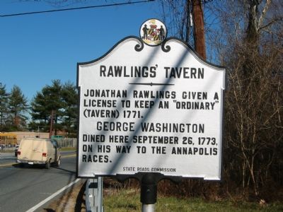
1. Rawlings' Tavern Marker
Jonathan Rawlings given a license to keep an “ordinary” (tavern) in 1771.
Erected 1934 by State Roads Commission.
Topics and series. This historical marker is listed in these topic lists: Colonial Era • Industry & Commerce. In addition, it is included in the Former U.S. Presidents: #01 George Washington, the George Washington Slept Here, and the Maryland Historical Trust series lists. A significant historical month for this entry is September 1922.
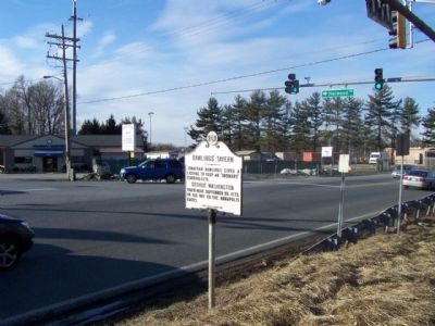
Location. 38° 51.933′ N, 76° 37.187′ W. Marker is in Harwood, Maryland, in Anne Arundel County. It is at the intersection of Solomons Island Road (Maryland Route 2) and Harwood Road, on the left when traveling south on Solomons Island Road. Touch for map. Marker is at or near this postal address: 18 Solomons Island Road, Harwood MD 20776, United States of America. Touch for directions.

Regionally, this marker is in Central Maryland. It is also in the American Mid-Atlantic and on the Eastern Seaboard. Globally, it is in the North Atlantic Region, North America, the Western Hemisphere,
this page online
Other nearby markers. At least 8 other markers are within 4 miles of this marker, measured as the crow flies: “Larkins Hills” (approx. 1½ miles away); a different marker also named William Penn (approx. 1.9 miles away); Cedar Park • Tulip Hill (approx. 3½ miles away); Old Quaker Burying Ground (approx. 3½ miles away); Site of First Quaker Regional Gathering (approx. 3.6 miles away); All Hallows Church (approx. 3.8 miles away); Let's Play Ball! (approx. 3.8 miles away); Property-Owning Pioneers (approx. 3.8 miles away). Touch for a list and map of all markers in Harwood.
Another marker is no longer nearby. William Penn (was approx. 0.9 miles away but has been confirmed missing).
Photographed by Mike Stroud, March 4, 2010
2. Rawlings’ Tavern Marker seen at the intersection State Road 2 and Harwood Road

Delos H. Smith, Historic American Buildings Survey, July 1940
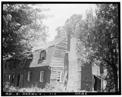
3. Rawlings’ Tavern, ca 1940
Delos H. Smith, Historic American Buildings Survey, July 1940
4. Rawlings’ Tavern, ca 1940
Photographed by Doris Phibbons, March 1968
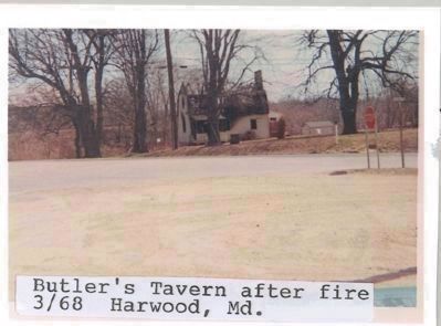
5. Butler's (earlier Rawlings') Tavern after a 1968 fire
Credits. This page was last revised on October 13, 2025. It was originally submitted on October 25, 2007, by F. Robby of Baltimore, Maryland. This page has been viewed 7,168 times since then and 259 times this year. Photos: 1. submitted on October 25, 2007, by F. Robby of Baltimore, Maryland. 2. submitted on March 7, 2010, by Mike Stroud of Bluffton, South Carolina. 3, 4, 5. submitted on April 30, 2008, by Tabitha Preast of Hanover, Maryland. • J. J. Prats was the editor who published this page.
