Near Wolf Creek in Lewis and Clark County, Montana — The American West (Mountains)
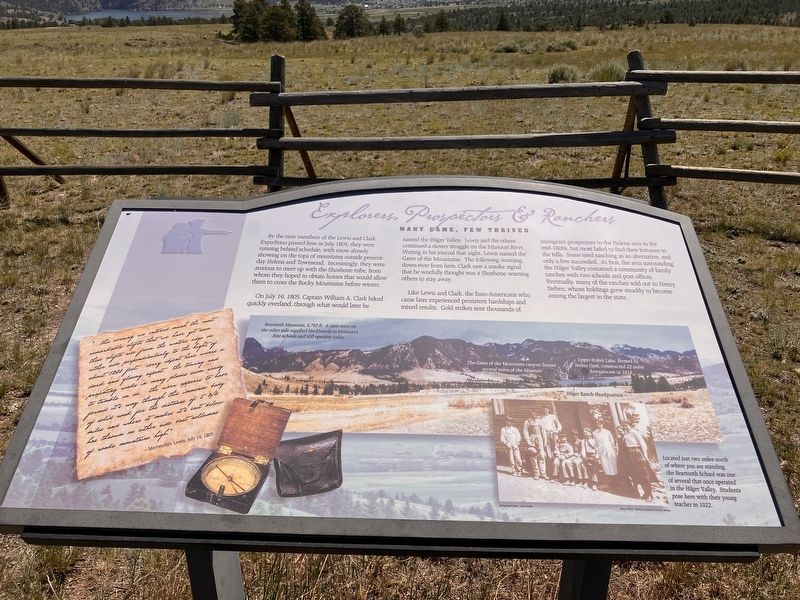
Explorers, Prospectors & Ranchers
Many Came, Few Thrived
Photographed by Barry Swackhamer, June 24, 2026
1. Explorers, Prospectors & Ranchers Marker
Captions: (background) The Gates of the Mountains canyon frames several miles of the Missouri. Upper Holter Lake formed by Holter Dam, constructed 22 miles downstream in 1918.; (bottom center) Located just two miles north of where you are standing, the Beartooth School was one of several that once operated in the Hilger Valley. Students pose here with their young teacher in 1922.
On July 19, 1805, Captain William A. Clark hiked quickly overland, through what would later be named the Hilger Valley. Lewis and the others continued a slower struggle on the Missouri River. Writing in his journal that night, Lewis named the Gates of the Mountains. The following morning, down river from here, Clark saw a smoke signal that he woefully thought was a Shoshone warning others to stay away.
Like Lewis and Clark, the Euro-Americans who came later experienced persistent hardships and mixed results. Gold strikes sent thousands of immigrant prospectors to the Helena area in the mid-1800s, but most failed to find their fortunes in the hills. Some tried ranching as an alternative. and only a few succeeded. At first, this area surrounding
this page online
"...this morning we entered much the most remarkable clifts that we have yet seen. These clifts rise from the waters edge on either side perpendicularly to the hight of about 1200 feet every object here wears a dark and gloomy aspect the towering and projecting rock in many places seem ready to tumble on us. the river appears to have forced it's way through this immence body of solid rock for the distance of 5 3/4 miles and where it makes it's exit below has thrown either side vast collumns of rock mountains high." - Meriwether Lewis, July 19, 1805
Erected by Montana State University, Bozeman; Department of the Interior; Montana Stock Growers Association.
Topics. This historical marker is listed in these topic lists: Exploration • Natural Features • Settlements & Settlers. A significant day of the year for for this entry is July 19.
Location. 46° 49.183′ N, 111° 59.821′ W. Marker is near Wolf Creek, Montana,
Photographed by Barry Swackhamer, June 24, 2026
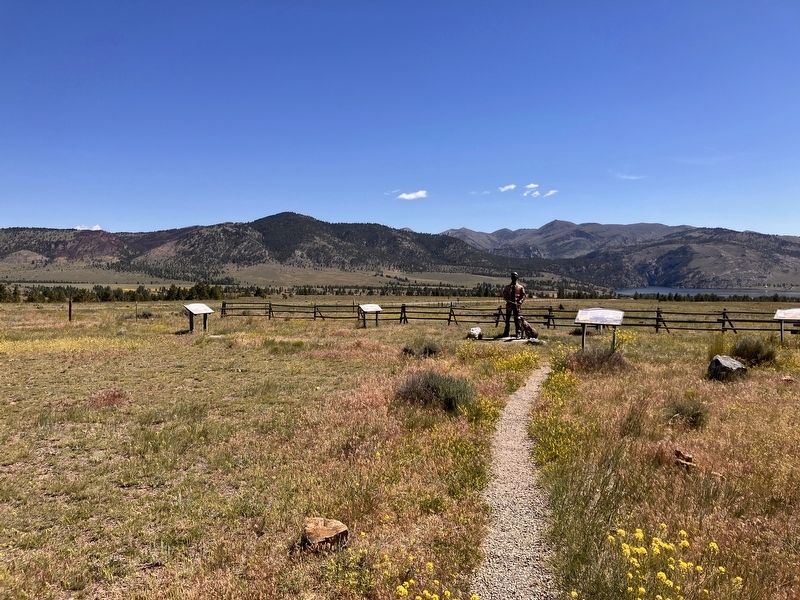
2. Gates of the Mountains markers

Regionally, this marker is in Central Montana, in Gold West Country and in Greater Helena. It is also in the American Mountain West and in the Lewis & Clark Corridor. Globally, it is in North America, the Rocky Mountains, the Western Hemisphere, the Western World, and the Anglosphere. Historically, it finds itself in what was once Rupert’s Land and also the Louisiana Purchase.
Other nearby markers. At least 8 other markers are within 11 miles of this marker, measured as the crow flies: Welcome to Gates of the Mountains (here, next to this marker); Shrewd Businessman, Caring Neighbor (here, next to this marker); Innovative Pioneer, Lasting Legacies (a few steps from this marker); Gates of the Mountains (approx. 2.3 miles away); Gates of the Mountain (approx. 5.7 miles away); Silver City Cemetery (approx. 10½ miles away); A Perfect Defile (approx. 10.6 miles away); The Montana Central Railroad (approx. 10.6 miles away). Touch for a list and map of all markers in Wolf Creek.
Credits. This page was last revised on October 17, 2026. It was originally submitted on October 17, 2026, by Barry Swackhamer of Brentwood, California. This page has been viewed 4 times since then. Photos: 1, 2. submitted on October 17, 2026, by Barry Swackhamer of Brentwood, California.
