Near Sulphur Springs in Hopkins County, Texas — The American South (West South Central)
Union Community
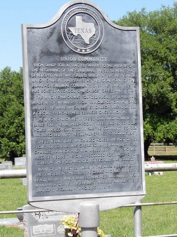
Photographed by Duane and Tracy Marsteller, May 3, 2026
1. Union Community Marker
The Union Church was founded about 1850 and was made up of members from various denominations. In 1885 the name Union Baptist Church was adopted. A circuit preacher held services once a month.
The Union Church met in the school building until the early 1900s. Then a three-room, three-teacher schoolhouse was constructed. In 1946, the community school was absorbed into the Sulphur Springs School District.
The general store, which also housed the post office from 1901 to 1906, was operated in its early years by Charles Hamrick and W.A. McKeever. These two men also served as the only recorded postmasters for Yesner, as the postal station officially was called.
Many of the first settlers in the area are buried in the cemetery at this site. The graveyard was in use at least by 1861 when James Thrasher was
this page online
Erected 1985 by Texas Historical Commission. (Marker Number 7331.)
Topics. This historical marker is listed in these topic lists: Cemeteries & Burial Sites • Industry & Commerce • Religion & Religious Structures • Settlements & Settlers. A significant historical year for this entry is 1850.
Location. 33° 1.833′ N, 95° 35.868′ W. Marker is near Sulphur Springs, Texas, in Hopkins County. It is on County Road 1444 0.4 miles west of County Road 1469, on the left when traveling west. Marker is at Union Cemetery's historical entrance. Touch for map. Marker is at or near this postal address: 569 Co Rd 1444, Sulphur Springs TX 75482, United States of America. Touch for directions.

Regionally, this marker is in the American South and in the Piney Woods. Globally, it is in North America, a Gulf of Mexico state, the Western Hemisphere, the Western World, and the Anglosphere. Historically, it finds itself in what was once New Spain, the Republic of Texas, one of the Confederate States of America, and the Antebellum
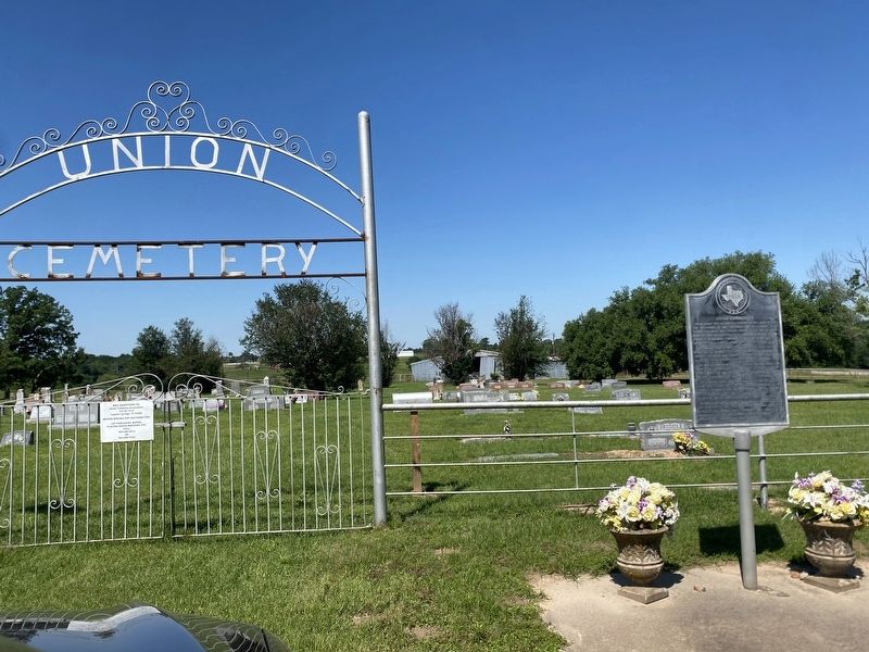
Photographed by Duane and Tracy Marsteller, May 3, 2026
2. Union Community Marker
Other nearby markers. At least 8 other markers are within 8 miles of this marker, measured as the crow flies: Shooks Chapel Methodist Church (approx. 3.1 miles away); Morning Chapel Missionary Baptist Church (approx. 7.2 miles away); St. Philip's Episcopal Church (approx. 7.4 miles away); Ashcroft House (approx. 7.4 miles away); First Presbyterian Church of Sulphur Springs (approx. 7.4 miles away); Home County of Texas Confederate General W. H. King / Texas in the Civil War (approx. 7½ miles away); Site of the Union Stockade (approx. 7½ miles away); Hopkins County Courthouse (approx. 7½ miles away). Touch for a list and map of all markers in Sulphur Springs.
Credits. This page was last revised on October 18, 2026. It was originally submitted on October 18, 2026, by Duane and Tracy Marsteller of Murfreesboro, Tennessee. This page has been viewed 3 times since then. Photos: 1, 2. submitted on October 18, 2026, by Duane and Tracy Marsteller of Murfreesboro, Tennessee.
