Downtown West in Minneapolis in Hennepin County, Minnesota — The American Midwest (Upper Plains)
Columbia Mill / Fuji-Ya
1870, 1882, 1883, 1968, 2021
| — | Historic Mill District | — |
Photographed by McGhiever, August 21, 2026
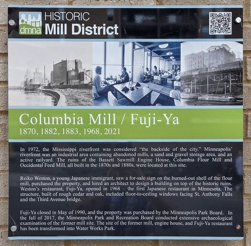
1. Columbia Mill / Fuji-Ya Marker
In 1972, the Mississippi riverfront was considered "the backside of the city." Minneapolis' riverfront was an industrial area containing abandoned mills, a sand and gravel storage area, and an active railyard. The ruins of the Bassett Sawmill Engine House, Columbia Flour Mill and Occidental Feed Mill, all built in the 1870s and 1880s, were located at this site.
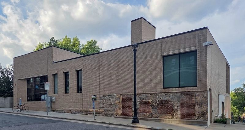
Reiko Weston, a young Japanese immigrant, saw a for-sale sign on the burned-out shell of the flour mill, purchased the property, and hired an architect to design a building on top of the historic ruins. Weston's restaurant, Fuji-Ya, opened in 1968 – the first Japanese restaurant in Minnesota. The structure, built of rough cedar and oak, included floor-to-ceiling windows facing St. Anthony Falls and the Third Avenue bridge.
Fuji-Ya closed in May of 1990, and the property was purchased by the Minneapolis Park Board. In the fall of 2017, the Minneapolis Park and Recreation Board conducted extensive archaeological examination of the former mill site. The site of the former mill, engine house, and Fuji-Ya restaurant has been transformed into Water Works Park.
Erected by the
this page online
Topics. This historical marker is listed in these topic lists: Asian Americans • Food & Drink • Industry & Commerce • Women. A significant historical year for this entry is 1968.
Location. 44° 58.864′ N, 93° 15.614′ W. Marker is in Minneapolis, Minnesota, in Hennepin County. It is in Downtown West. It is on 1st Street S. west of 5th Avenue S., on the right. Touch for map. Marker is at or near this postal address: 420 1st Street S, Minneapolis MN 55401, United States of America. Touch for directions.

Regionally, this marker is in the Twin Cities Metropolitan Area. It is also in the American Midwest, in the Corn Belt, and in the Great River Road Region. Globally, it is in North America, the Western Hemisphere, the Western World, and the Anglosphere. Historically, it finds itself in what was once Rupert’s Land, the territory of the Mississippian Culture, and the Louisiana Purchase.
Other nearby markers. At least 8 other markers are within walking distance of this marker: New Uses for Old Mills (within shouting distance of this marker); The Washburn and Pillsbury Clans
Photographed by McGhiever, August 21, 2026
2. Columbia Mill / Fuji-Ya Marker (center) on the former Fuji-Ya building
Also see . . . Columbia Mill / Fuji-Ya (QR code on marker). (Submitted on October 18, 2026, by McGhiever of Minneapolis, Minnesota.)
Credits. This page was last revised on October 18, 2026. It was originally submitted on October 18, 2026, by McGhiever of Minneapolis, Minnesota. This page has been viewed 3 times since then. Photos: 1, 2. submitted on October 18, 2026, by McGhiever of Minneapolis, Minnesota.
