Near Great Falls in Cascade County, Montana — The American West (Mountains)
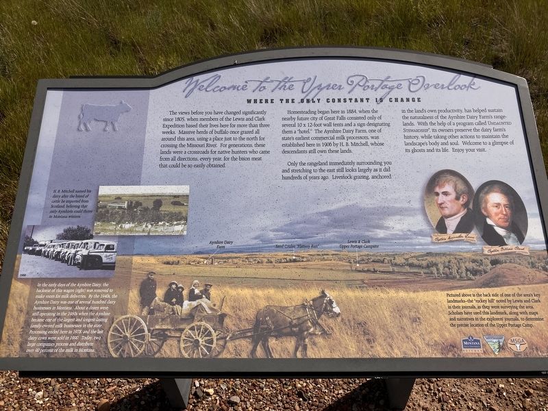
Welcome to the Upper Portage Overlook
Where the Only Only Constant is Change
Photographed by Barry Swackhamer, June 23, 2026
1. Welcome to the Upper Portage Overlook Marker
Captions: (middle left) H.B. Mitchell named his dairy after the breed of cattle he imported from Scotland, believing that only Ayrshires could thrive in Montana winters.; (lower left) In the early days of the Ayrshire Dairy, the backseat of the wagon (right) was removed to make room for milk deliveries. By the 1940s, the Ayrshire Dairy was one of several hundred dairy businesses in Montana. About a dozen were still operating in the 1960s when the Ayrshire became one of the largest and longest-lasting family-owned milk businesses in the state. Processing ended here in 1978, and the last day cows were sold in 1990. Today, two large companies process and distribute over 90 percent of the milk in Montana.; (bottom right background) Pictured above is the back side of one of the area's key landmarks - the "rocky hill" noted by Lewis and Clark in their journals, as they were surveying the area. Scholars have used this landmark, along with maps and narratives in the explorers journals, to determine the precise location of the Upper Portage Camp.
Homesteading began here in 1884, when the nearby future city of Great Falls consisted one of several 10 x 12-foot wall tents and a sign designating them a "hotel." The Ayrshire Dairy Farm, one of state's earliest commercial milk processors, was established here in 1906 by H.B. Mitchell, whose descendants still own these lands.
Only the rangeland immediately surrounding you and stretches to the east still look largely as it did hundreds of years ago. Livestock grazing, anchored in the land's own productivity, has helped sustain the naturalness of the Ayrshire Dairy Farm's rangelands. With the help of a program called Undaunted Stewardship, its owners preserve the dairy farm's history,
this page online
Erected by Montana State University, Bozeman; U.S. Dept. of the Interior; Montana Stock Growers Association.
Topics and series. This historical marker is listed in these topic lists: Agriculture • Exploration • Landmarks • Settlements & Settlers. In addition, it is included in the Lewis & Clark Expedition series list.
Location. 47° 27.874′ N, 111° 17.617′ W. Marker is near Great Falls, Montana, in Cascade County. It can be reached from 40the Avenue South near 13th Street South, on the left when traveling west. Touch for map. Marker is at or near this postal address: 700 40th Avenue South, Great Falls MT 59401, United States of America. Touch for directions.

Regionally, this marker is in andspecifically entral Montana in Russell Country. It is also in the American Mountain West and in the Lewis & Clark Corridor. Globally, it is in North America, the Rocky Mountains, the Western Hemisphere, the Western World, and the Anglosphere.
Photographed by Barry Swackhamer, June 23, 2026
2. Welcome to the Upper Portage Overlook Marker
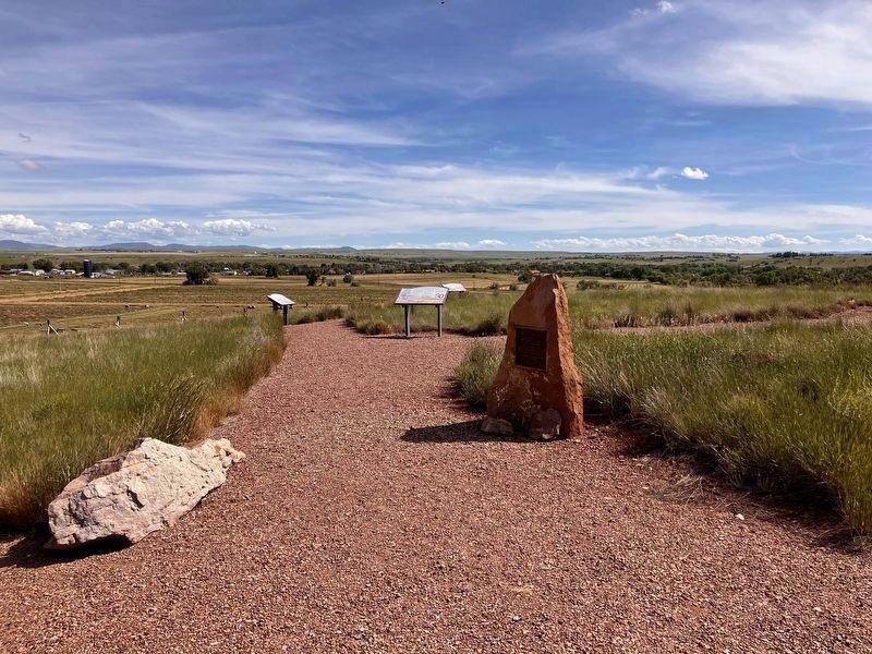
Marker located where the path splits.
Other nearby markers. At least 8 other markers are within 2 miles of this marker, measured as the crow flies: The Portage Route (a few steps from this marker); Lewis's Grand Experiment (a few steps from this marker); Upper Portage Camp (a few steps from this marker); White Bear Islands (within shouting distance of this marker); Commissary of the Plains (approx. 2 miles away); The Falls: Obstacle or Opportunity (approx. 2 miles away); The Portage Around the Falls (approx. 2 miles away); Explorers at the Portage (approx. 2 miles away). Touch for a list and map of all markers in Great Falls.
Photographed by Barry Swackhamer, June 23, 2026
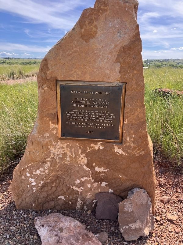
3. Great Falls Portage Historic Landmark
has been designated a
Registered National
Historic Landmark
under the provisions of the historic sites act of August 21, 1935. this site possesses exceptional value in commemorating or illustrating the history of the United States.
U.S. Department of the Interior
National Par Service
1966
Credits. This page was last revised on October 18, 2026. It was originally submitted on October 18, 2026, by Barry Swackhamer of Brentwood, California. This page has been viewed 5 times since then. Photos: 1, 2, 3. submitted on October 18, 2026, by Barry Swackhamer of Brentwood, California.
