Rapid City in Pennington County, South Dakota — The American Midwest (Upper Plains)
Flood Changed Community Forever
Remembrance and Renewal • Rapid City Flood of 1972
Photographed by William Fischer, Jr., September 21, 2026
1. Flood Changed Community Forever Marker
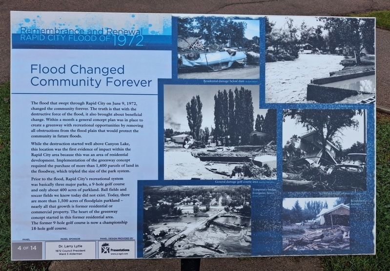
The flood that swept through Rapid City on June 9, 1972, changed the community forever. The truth is that with the destructive force of the flood, it also brought about beneficial change. Within a month a general concept plan was in place to create a greenway with recreational opportunities by removing all obstructions from the flood plain that would protect the community in future floods.
While the destruction started well above Canyon Lake, this location was the first evidence of impact within the Rapid City area because this was an area of residential development. Implementation of the greenway concept required the purchase of more than 1,400 parcels of land in the floodway, which tripled the size of the park system.
Prior to the flood, Rapid City's recreational system was basically three major parks, a 9-hole golf course and only about 400 acres of parkland. Ball fields and soccer fields we know today did not exist. Today, there are more than 1,500 acres of floodplain parkland - nearly all that growth is former residential or commercial property. The heart of the greenway concept started in this
this page online
[Photo captions, clockwise from top center, read]
• Residential damage below dam
• Creek view
• General damage of area
• Residential damage
• Temporary bridge Evergreen Street
• General damage golf course area
Erected by Dr. Larry Lytle and the City of Rapid City. (Marker Number 4 of 14.)
Topics. This historical marker is listed in these topic lists: Disasters • Waterways & Vessels. A significant historical date for this entry is June 9, 1972.
Location. 44° 3.812′ N, 103° 16.68′ W. Marker is in Rapid City, South Dakota, in Pennington County. It is on Jackson Boulevard (State Highway 44), on the right when traveling east. Marker is near the Meadowbrook Golf Course parking lot. Touch for map. Marker is at or near this postal address: 3625 Jackson Boulevard, Rapid City SD 57702, United States of America. Touch for directions.

Regionally, this marker is in West River and in the Badlands. It is also in the American Black Hills, in the Lewis & Clark Corridor, on the prairies, and on the Northern Plains. Globally, it is
Photographed by William Fischer, Jr., September 21, 2026
2. Flood Changed Community Forever Marker
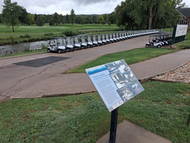
Rapid Creek visible beyond golf carts
Other nearby markers. At least 8 other markers are within 2 miles of this marker, measured as the crow flies: A Massive Surge (approx. ¾ mile away); Welcome to the Chapel in the Hills (approx. 1.4 miles away); History of the Chapel in the Hills (approx. 1.4 miles away); The Chapel in the Hills (approx. 1½ miles away); Edward Nielsen (approx. 1½ miles away); Rune Stones (approx. 1½ miles away); Skyline Drive (approx. 1.6 miles away); Apatosaurus (approx. 1.9 miles away). Touch for a list and map of all markers in Rapid City.
Also see . . . The Black Hills-Rapid City flood of June 9-10, 1972: A description of the storm and flood (USGS). (Submitted on October 18, 2026, by William Fischer, Jr. of Reynoldsburg, Ohio.)
Credits. This page was last revised on October 18, 2026. It was originally submitted on October 18, 2026, by William Fischer, Jr. of Reynoldsburg, Ohio. This page has been viewed 11 times since then. Photos: 1, 2. submitted on October 18, 2026, by William Fischer, Jr. of Reynoldsburg, Ohio.
