Near Great Falls in Cascade County, Montana — The American West (Mountains)
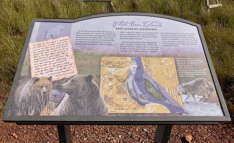
White Bear Islands
Ever-changing Riverbanks
Photographed by Barry Swackhamer, June 23, 2026
1. White Bear Islands Marker
Caption: (middle left) Extensive research had produced this areal view, using a recent photo to compare today's landscape with the one from 1805. Bob Bergantino, widely recognized as the world's leading expert on locating the expedition's travel routes and campsites, used Clark's map and narrative to determine the precise location of the Upper Portage Camp and extent of the White Bear Islands. This map also illustrates Bergantino's conclusions about the route followed by the portage crew in its final approach t the campsite.
Years of constant geologic action-along with the effects of human development-have narrowed the Missouri River here, making it difficult to picture the location of both the Upper Portage Camp and Lewis and Clark's three "White Bear Islands." Upstream dams change seasonal water flows and increased the quantity of natural sedimentation. Slowly, sediments deposited here have been linking the islands to the riverbank. As you look to the south, use the aerial photo-map below to get a better idea of what this area was like when Lewis and Clark camped here in 1805.
"the White bear have become so troublesome to us that I do not think it prudent to send one man alone on an errand of any kind, particularly where he has to pass through the brush we have seen two of them on the large Island opposite to us today but are so much engaged that we could not spare the time to hunt. they come close arround our camp every night but have never yet ventured to attack us and our dog gives us timely notice of their visits.... I have made the men sleep with their arms by them as usual for fear of accedents."
this page online
Meriwether Lewis, June 28, 1805
Erected by Montana State University, Bozeman; U.S. Dept. of the Interior; Montana Stock Growers Association.
Topics and series. This historical marker is listed in these topic lists: Animals • Exploration • Natural Features. In addition, it is included in the Lewis & Clark Expedition series list.
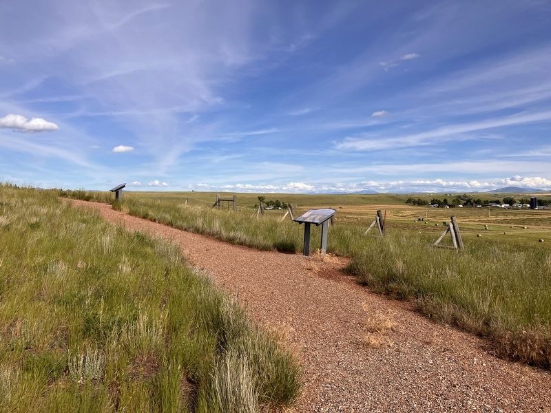
Location. 47° 27.859′ N, 111° 17.641′ W. Marker is near Great Falls, Montana, in Cascade County. It can be reached from 40th Avenue South near 13th Street South, on the left when traveling west. Touch for map. Marker is at or near this postal address: 700 40th Avenue South, Great Falls MT 59405, United States of America. Touch for directions.

Regionally, this marker is in andspecifically entral Montana in Russell Country. It is also in the American Mountain West and in the Lewis & Clark Corridor. Globally, it is in North America, the Rocky Mountains, the Western Hemisphere, the Western World, and the Anglosphere. Historically, it finds itself in what was once Rupert’s Land and also the Louisiana Purchase.
Other nearby markers. At
Photographed by Barry Swackhamer, June 23, 2026
2. White Bear Islands Marker
Credits. This page was last revised on October 18, 2026. It was originally submitted on October 18, 2026, by Barry Swackhamer of Brentwood, California. This page has been viewed 8 times since then. Photos: 1, 2. submitted on October 18, 2026, by Barry Swackhamer of Brentwood, California.
