Ipswich in Suffolk, England, United Kingdom — Northwestern Europe (the British Isles)
Christchurch Park
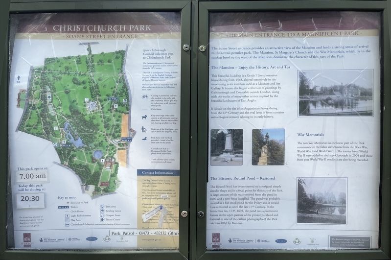
Soane Street Entrance - the Main Entrance to a Magnificent Park
Photographed by Ray Gurganus, April 19, 2026
1. Christchurch Park Marker
The Park extends over 33 hectares of picturesque grounds and its history dates from the 12th century.
The Park is designated County Wildlife Site and is on the English Heritage Register of Historic Parks and Gardens of Special Historic Interest.
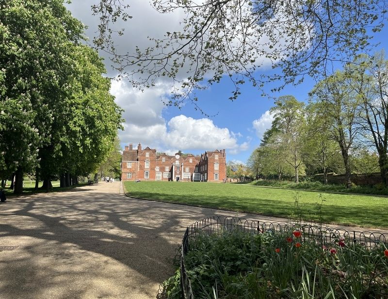
The Soane Street entrance provides an attractive view of the Mansion and lends a strong sense of arrival to the town's premier park. The Mansion. St Margaret's Church and the War Memorials, which lie in the sunken bowl to the west of the Mansion, dominate the character of this part of the Park.
The Mansion - Enjoy the History, Art and Tea
This beautiful building is a Grade I Listed mansion house dating from 1548, altered extensively in the intervening years and now used as a Museum and Art Gallery. It houses the largest collection of paintings by Gainsborough and Constable outside London, along with the works of many other artists inspired by the beautiful landscapes of East Anglia.
It is built on the site of an Augustinian Priory dating from the 12th Century and the oval lawn in front contains archaeological
this page online
War Memorials
The two War Memorials in the lower part of the Park commemorate the fallen servicemen from the Boer War, World War I and World War II. The names from World War II were added to the large Cenotaph in 2004 and those from post World War II conflicts are also being recorded.
The Historic Round Pond - Restored
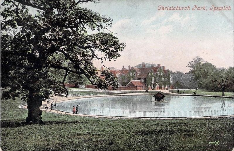
The Round Pond has been restored to its original simple circular shape and is a focal point for this part of the Park. A large amount of silt was removed from the pond in 2007 and a new fence installed. The pond was probably created as a fish stock pond for the Priory and it would have remained so until the late 17th Century. In the Fonnereau era, 1735-1895, the pond was a prominent feature in the open pasture of the private parkland and featured in one of the earliest photographs of the Park taken in 1865 by Burrows.
Erected by Ipswich Borough Council.
Topics. This historical marker is listed in this topic list: Parks & Recreational Areas.
Location. 52° 3.58′ N, 1° 9.445′ E. Marker is in Ipswich, England, in Suffolk.
Photographed by Ray Gurganus, April 19, 2026
2. Christchurch Park

Regionally, this marker is in East Anglia. Globally, it is on the Atlantic Ocean, in the North Atlantic Region, in Europe, in Atlantic Europe, on one of the British Isles, in the Western World, and in the Anglosphere. Historically, it finds itself in what was once the Roman Empire.
Other nearby markers. At least 8 other markers are within 11 kilometers of this marker, measured as the crow flies: Mary Whitmore, MBE (approx. 0.4 kilometers away); John Glyde (approx. half a kilometer away); Ipswich Blackfriars (approx. half a kilometer away); Ipswich Almshouses (approx. half a kilometer away); Dr. Kurt Erich Glauber (approx. 1.2 kilometers away); Ipswich (approx. 1.4 kilometers away); Gipeswic (approx. 1.4 kilometers away); Woodbridge (approx. 11.4 kilometers away). Touch for a list and map of all markers in Ipswich.
Photographed by John Valentine & Sons, Co., circa 1910
3. Round Pond - Christchurch Park, Ipswich
Credits. This page was last revised on November 1, 2026. It was originally submitted on October 19, 2026, by Ray Gurganus of Washington, District of Columbia. This page has been viewed 5 times since then. Photos: 1, 2. submitted on October 19, 2026, by Ray Gurganus of Washington, District of Columbia. 3. submitted on November 1, 2026. • Andrew Ruppenstein was the editor who published this page.
