Bandelier National Monument in Los Alamos County, New Mexico — The American Mountains (Southwest)
A Lasting Legacy
| — | Bandelier National Monument | — |
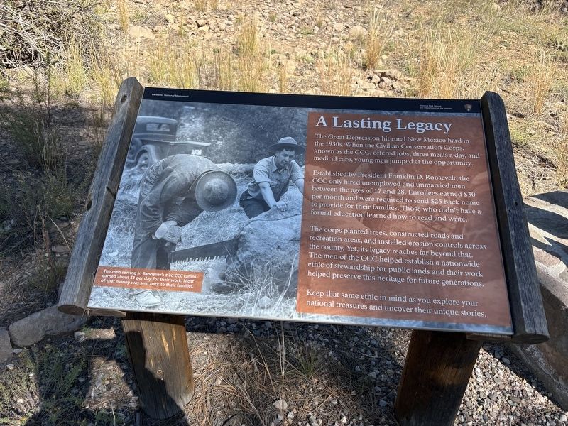
Photographed by Benjamin Rubin, October 16, 2026
1. A Lasting Legacy Marker
The Great Depression hit rural New Mexico hard in the 1930s. When the Civilian Conservation Corps, known as the CCC, offered jobs, three meals a day, and medical care, young men jumped at the opportunity.
Established by President Franklin D. Roosevelt, the CCC only hired unemployed and unmarried men between the ages of 17 and 28. Enrollees earned $30 per month and were required to send $25 back home to provide for their families. Those who didn't have a formal education learned how to read and write.
The corps planted trees, constructed roads and recreation areas, and installed erosion controls across the county. Yet, its legacy reaches far beyond that. The men of the CCC helped establish a nationwide ethic of stewardship for public lands and their work helped preserve this heritage for future generations.
Keep that same ethic in mind as you explore your national treasures and uncover their unique stories.
(caption)
The men serving in Bandelier's two CCC camps earned about $1 per day for their work. Most of that money was sent back to their families.
Erected by National Park Service, U.S. Department
this page online
Topics and series. This historical marker is listed in these topic lists: Charity & Public Work • Parks & Recreational Areas. In addition, it is included in the Civilian Conservation Corps (CCC) series list.
Location. 35° 47.74′ N, 106° 16.923′ W. Marker is in Bandelier National Monument, New Mexico, in Los Alamos County. It is on Campground Road. The marker is located at the Juniper Campground. Touch for map. Marker is at or near this postal address: 300 Campground Rd, White Rock NM 87547, United States of America. Touch for directions.

Regionally, this marker is in Northern New Mexico. It is also in the American Southwest. Globally, it is in North America, the Rocky Mountains, the Western Hemisphere, the Western World, and the Anglosphere. Historically, it finds itself in what was once New Spain and also the territory of the Ancestral Puebloans.
Other nearby markers. At least 8 other markers are within 6 miles of this marker, measured as the crow flies: A Living Legacy (here, next to this marker); Houses (approx. 0.4 miles away); Plants (approx. 0.6 miles away); The Role of Fire (approx. 0.7 miles away); Sacred Spaces (approx. 0.7 miles away); Tyuonyi Overlook (approx. 0.8 miles away); Los Alamos Project Main Gate Park (approx. 5.8 miles away); Los Alamos (approx. 5.8 miles away). Touch for a list and map of all markers in Bandelier National Monument.
Credits. This page was last revised on November 1, 2026. It was originally submitted on October 22, 2026, by Benjamin Rubin of Columbia, South Carolina. This page has been viewed 13 times since then. Photo 1. submitted on October 22, 2026, by Benjamin Rubin of Columbia, South Carolina. • Andrew Ruppenstein was the editor who published this page.
