Near Richmond in Madison County, Kentucky — The American South (East South Central)
Civil War Field Hospital
Photographed by Lee Hattabaugh, May 12, 2010
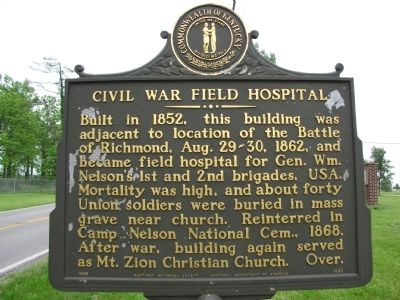
1. Civil War Field Hospital Marker
Built in 1852, this building was adjacent to location of the Battle of Richmond, Aug. 29-30, 1862, and became field hospital for Gen. Wm. Nelson's 1st and 2nd brigades, USA. Mortality was high, and about forty Union soldiers were buried in mass grave near church. Reinterred in Camp Nelson National Cem., 1868. After war, building again served as Mt. Zion Christian Church. Over.
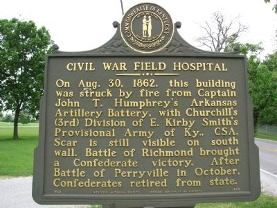
(Back):
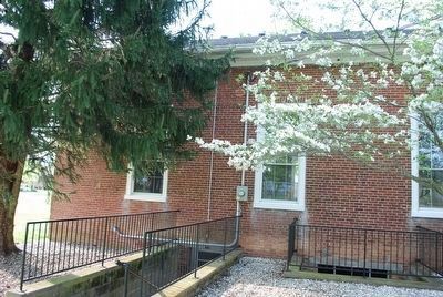
On Aug. 30, 1862, this building was struck by fire from Captain John T. Humphrey's Arkansas Artillery Battery, with Churchill's (3rd) Division of E. Kirby Smith's Provisional Army of Ky., CSA. Scar is still visible on south wall. Battle of Richmond brought a Confederate victory. After Battle of Perryville in October, Confederates retired from state.
Erected 1988 by Kentucky Historical Society / Kentucky Department of Highways. (Marker Number 1825.)
Topics and series. This historical marker is listed in these topic lists: Religion & Religious Structures • War, US Civil. In addition, it is included in the Kentucky Historical Society series list. A significant historical date for this entry is August 29, 1862.
Location. 37° 40.422′ N, 84° 15.223′ W.
this page online

Regionally, this marker is in the American South, specifically in the Upper South, in Appalachia, and specifically in Southern Appalachia. Globally, it is in North America, the Western Hemisphere, the Western World, and the Anglosphere. Historically, it finds itself in what was once the territory of the Mississippian Culture and also the Antebellum South.
Other nearby markers. At least 8 other markers are within walking distance of this marker: Mt. Zion Church - Field Hospital (a few steps from this marker); Michigan Light Artillery Regiment / Batteries F and G (about 300 feet away, measured in a direct line); Union Artillery (about 500 feet away); The Confederates Crush The Union Left (approx. 0.2 miles away); Manson's First Line (approx. 0.2 miles away); The Skirmishers (approx. 0.3 miles away); Manson's Mistake (approx. half
Photographed by Lee Hattabaugh, May 12, 2010
2. Civil War Field Hospital Marker
Related marker. Click here for another marker that is related to this marker. To better understand the relationship, study each marker in the order shown.
Photographed by Lee Hattabaugh, May 6, 2010
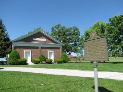
3. Civil War Field Hospital Marker
Photographed by Brandon Fletcher, March 30, 2012
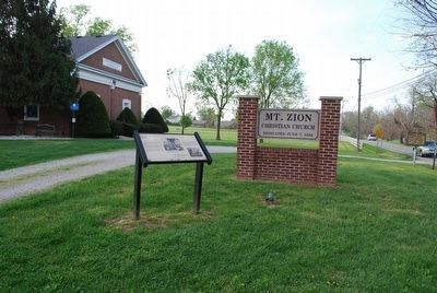
4. Civil War Field Hospital Marker
Marker is on the far right of photo
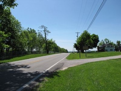
Photographed by Lee Hattabaugh, May 6, 2010
5. Civil War Field Hospital Marker
Looking South along US 421.
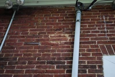
Photographed by Brandon Fletcher, March 30, 2012
6. Where Church was struck by cannonball - close-up
Photographed by Brandon Fletcher, March 30, 2012
7. Where Church was struck by cannonball - Wide-view
See center of photo, near top of church and near power inlet.
Credits. This page was last revised on February 21, 2021. It was originally submitted on May 19, 2010, by Lee Hattabaugh of Capshaw, Alabama. This page has been viewed 2,730 times since then and 60 times this year. Last updated on June 2, 2010, by Lee Hattabaugh of Capshaw, Alabama. Photos: 1, 2, 3. submitted on May 19, 2010, by Lee Hattabaugh of Capshaw, Alabama. 4. submitted on July 27, 2015, by Brandon Fletcher of Chattanooga, Tennessee. 5. submitted on May 19, 2010, by Lee Hattabaugh of Capshaw, Alabama. 6, 7. submitted on July 27, 2015, by Brandon Fletcher of Chattanooga, Tennessee. • Craig Swain was the editor who published this page.
