Liverpool in Merseyside, England, United Kingdom — Northwestern Europe (the British Isles)
'Sailortown' Triangle
| — | The Heritage Trail at Liverpool ONE | — |
Photographed by Ian Lefkowitz, September 13, 2026
1. 'Sailortown' Triangle Marker
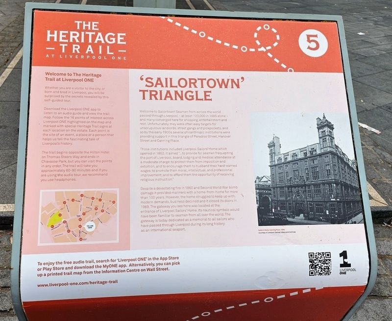
Those institutions included Liverpool Sailors’ Home which opened in 1852. It aimed “…to provide for seamen frequenting the port of Liverpool, board, lodging and medical attendance at a moderate charge; to protect them from imposition and extortion, and to encourage them to husband their hard-earned wages; to promote their moral, intellectual, and professional improvement; and to afford them the opportunity of receiving religious instruction.”
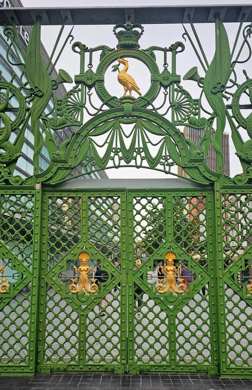
Despite a devastating fire in 1860 and Second World War bomb damage it provided mariners with a home-from-home for more than 100 years. However, the home struggled to keep up with modern demands, business declined and it closed its doors in 1969. The gateway you
this page online
(Captions)
Sailor’s Home, Canning Place, 1906. Courtesy of Liverpool Central Library and Archives.
Welcome to The Heritage Trail at Liverpool One
Whether you are a visitor to the city, or born and bred in Liverpool, you will be surprised by the secrets revealed by this self-guided tour.
Download the Liverpool ONE app to listen to an audio guide and view the trail map. Follow the 16 points of interest across Liverpool ONE highlighted on the map and marked with special Heritage Trail signs at each location on the estate. Each point is the site of an event, a place or a person that helps us tell the fascinating tale of Liverpool’s history.
The trail begins opposite the Hilton Hotel on Thomas Steers Way and ends in Chavasse Park, but you can visit the points in any order. The trail will take you approximately 60–90 minutes and if you are using the audio tour,
Photographed by Ian Lefkowitz, September 13, 2026
2. 'Sailortown' Triangle Marker
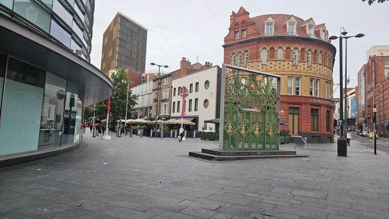
This marker is located next to the former nautical-themed gateway to the Liverpool Sailors' Home.
Erected by Liverpool ONE. (Marker Number 5.)
Topics. This historical marker is listed in these topic lists: Charity & Public Work • War, World II • Waterways & Vessels. A significant historical year for this entry is 1852.
Location. 53° 24.16′ N, 2° 59.161′ W. Marker is in Liverpool, England, in Merseyside. It is at the intersection of Paradise Street and Hanover Street, in the median on Paradise Street. Touch for map. Marker is at or near this postal address: 56 Paradise St, Liverpool, England L1 3EB, United Kingdom. Touch for directions.

Regionally, this marker is in North West England. Globally, it is on the Atlantic Ocean, in the North Atlantic Region, in Europe, in Atlantic Europe, on one of the British Isles, in the Western World, and in the Anglosphere. Historically, it finds itself in what was once the Roman Empire.
Other nearby markers. At least 8 other markers are within walking distance of this marker: The Eagle Pub (a few steps from this marker); American Consulate (within shouting distance of this marker); Custom House and Canning Place (within shouting distance
Photographed by Ian Lefkowitz, September 13, 2026
3. Liverpool Sailors’ Home Gateway
Credits. This page was last revised on October 24, 2026. It was originally submitted on October 23, 2026, by Ian Lefkowitz of New York, New York. This page has been viewed 7 times since then. Photos: 1, 2, 3. submitted on October 23, 2026, by Ian Lefkowitz of New York, New York. • Andrew Ruppenstein was the editor who published this page.
