Martins-Viertel in Köln, North Rhine-Westphalia, Germany — Central Europe
„Schmitz-Säule“
⎯⎯⎯
“Schmitz Column”
Photographed by James Hulse, October 6, 2026
1. „Schmitz-Säule“ / “Schmitz Column” Marker

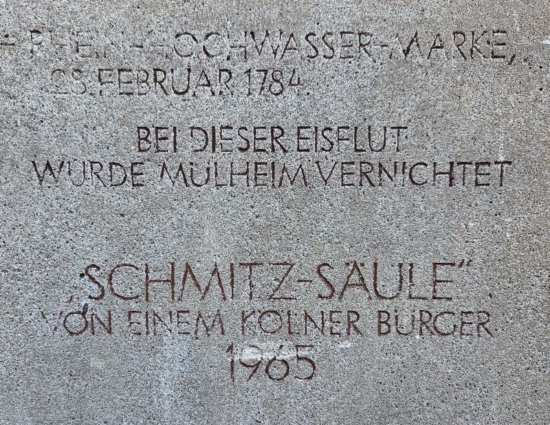
Rhein-Hochwasser-Marke, 28. Februar 1784.
Bei dieser Eisflut wurde Mülheim vernichtet.
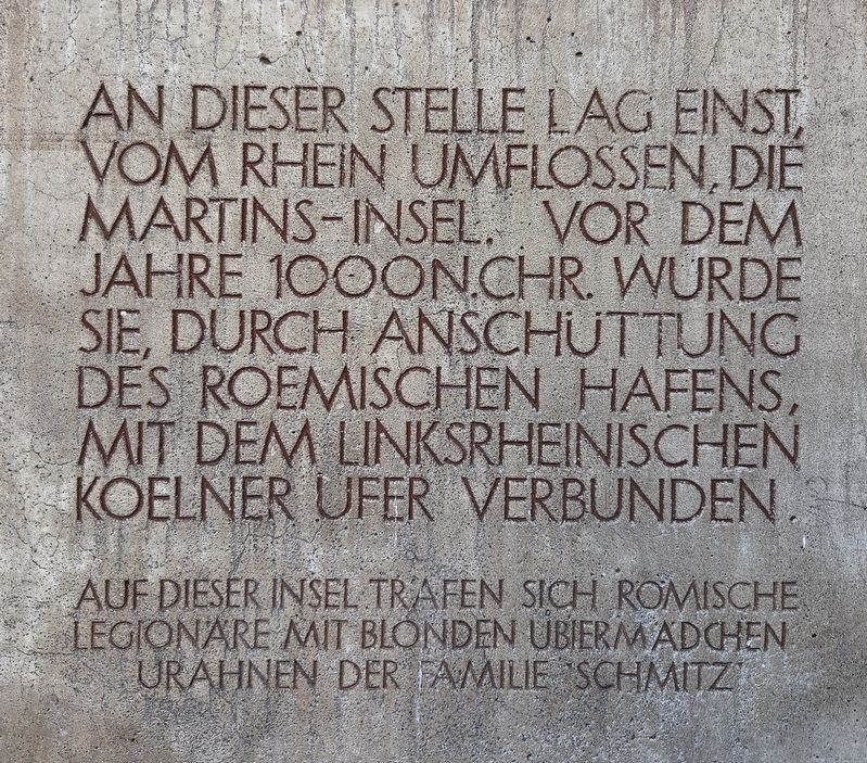
An dieser Stelle lag einst, vom Rhein umflossen, die Martins-Insel. Vor dem Jahre 1000 n. Chr. wurde sie, durch Anschüttung des roemischen Hafens, mit dem linksrheinischen Koelner Ufer verbunden. Auf dieser Insel trafen sich römische Legionäre mit blonden Ubier-Mädchen Urahnen der Familie Schmitz
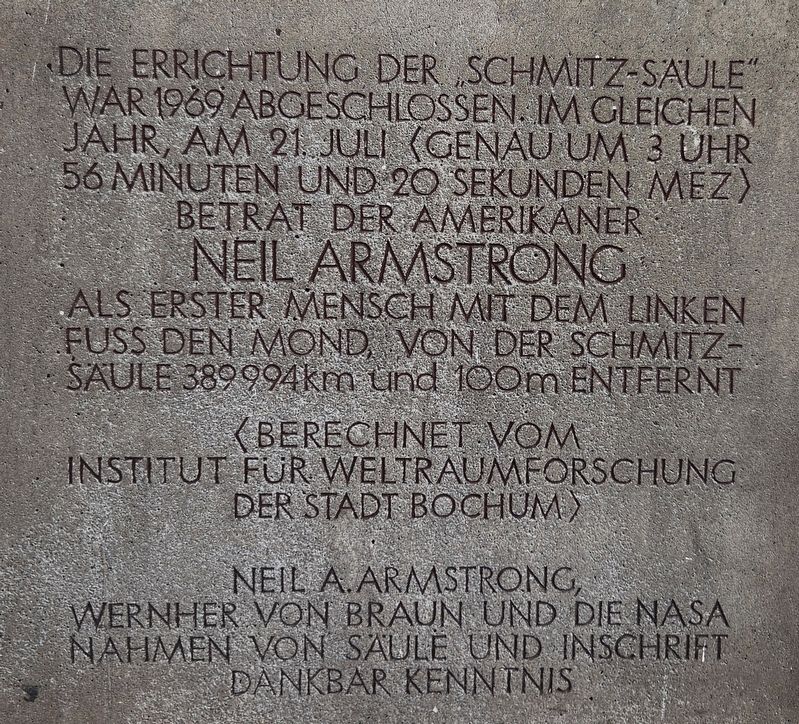
Die Errichtung der „Schmitz-Säule“ war 1969 abgeschlossen. Im gleichen Jahr, am 21. Juli (genau um 3 Uhr 56 Minuten und 20 Sekunden MEZ) betrat der Amerikaner Neil Armstrong als erster Mensch mit dem linken Fuss den Mond, von der Schmitz-Säule 389994 km und 100 m entfernt. (Berechnet vom Institut für Weltraumforschung der Stadt Bochum). Neil A. Armstrong, Wernher von Braun und die NASA nahmen von Säule und Inschrift dankbar Kenntnis.
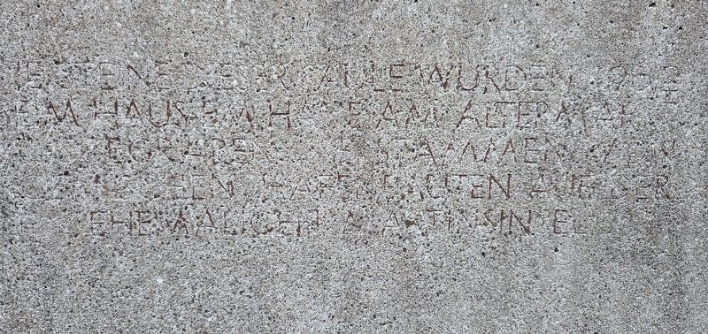
Die Steine dieser Säule wurden 1962 beim Haus Em Hahne am Altermarkt ausgegraben. Sie stammen von roemischen Hafenbauten auf der ehemaligen Martinsinsel.
“Schmitz Column”
Rhine high-water mark, February 28, 1784.
Mülheim was destroyed during this ice flood.
St. Martin’s Island once stood here, surrounded by the Rhine. Before the year 1000 AD, it was connected to Cologne’s left bank by filling in the Roman harbor. On this island, Roman legionaries met blonde Ubian girls. Ancestors of the Schmitz family
Construction of the “Schmitz Column” was completed in 1969. In the same year, on July 21 (at precisely 3:56:20 a.m. Central European Time), the American Neil Armstrong became the first person to set foot on the Moon, stepping onto it with
this page online
The stones of this column were excavated in 1962 at the house Em Hahne on the Alter Markt. They come from Roman harbor structures on the former St. Martin’s Island.
Erected 1965 by a citizen of Cologne.
Topics. This historical marker is listed in these topic lists: Notable Places • Waterways & Vessels. A significant historical date for this entry is February 28, 1784.
Location. 50° 56.297′ N, 6° 57.664′ E. Marker is in Köln, Nordrhein-Westfalen (North Rhine-Westphalia). It is in Martins-Viertel. It is on Brigittengäßchen just south of Martinspförtchen. Touch for map. Marker is in this post office area: Köln HE 50667, Germany. Touch for directions.

Regionally, this marker is in the German Rhineland. Globally, it is in Europe, the European Union, Atlantic Europe, Central Europe, the Schengen Area, Western Europe, and the Western World. Historically, it finds itself in what was once the Roman Empire, the Holy Roman Empire, the Hanseatic League, and the former West Germany.
Other nearby markers. At least 8 other markers are within walking distance of this marker: Groß St. Martin (within shouting distance of this marker); Kaiser Friedrich III. (within shouting distance of this marker); Martinspförtchen / St. Martin’s Little Gateway (within shouting distance of this marker); Robert Blum (about 90 meters away, measured in a direct line); Stapelhaus / Staple House (about 90
Photographed by James Hulse, October 6, 2026
2. „Schmitz-Säule“ / “Schmitz Column” Marker
Photographed by James Hulse, October 6, 2026
3. „Schmitz-Säule“ / “Schmitz Column” Marker
Photographed by James Hulse, October 6, 2026
4. „Schmitz-Säule“ / “Schmitz Column” Marker
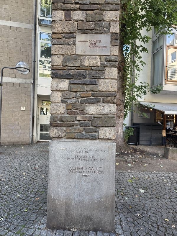
Photographed by James Hulse
5. „Schmitz-Säule“ / “Schmitz Column” Marker
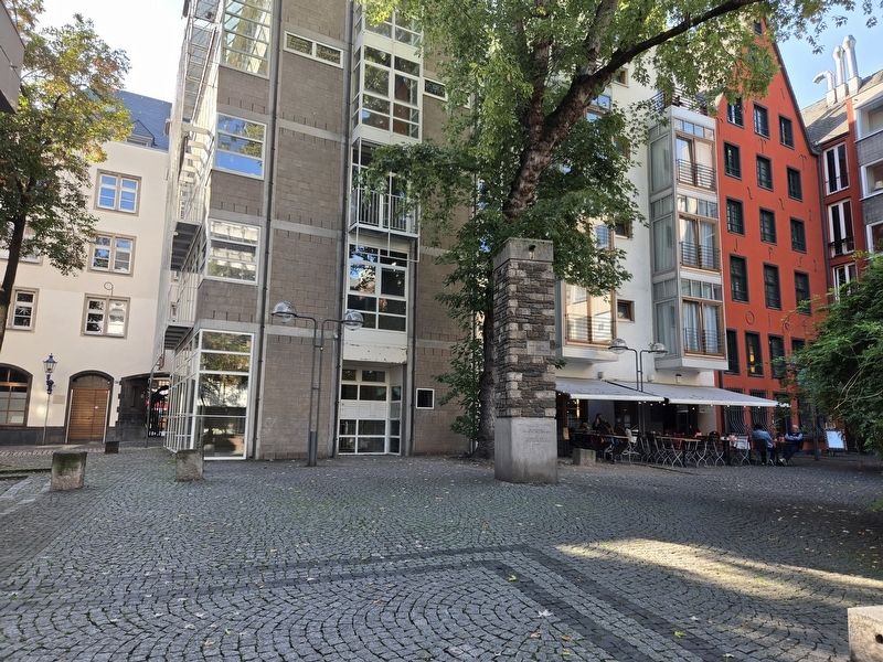
Photographed by James Hulse, October 6, 2026
6. „Schmitz-Säule“ / “Schmitz Column” Marker
Credits. This page was last revised on October 24, 2026. It was originally submitted on October 24, 2026, by James Hulse of Medina, Texas. This page has been viewed 10 times since then. Photos: 1, 2, 3, 4, 5, 6. submitted on October 24, 2026, by James Hulse of Medina, Texas.
