Liverpool in Merseyside, England, United Kingdom — Northwestern Europe (the British Isles)
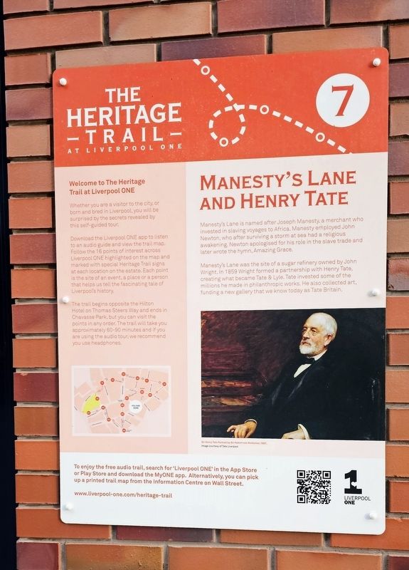
Manesty's Lane and Henry Tate
| — | The Heritage Trail at Liverpool ONE | — |
Photographed by Ian Lefkowitz, September 13, 2026
1. Manesty's Lane and Henry Tate Marker
Manesty’s Lane was the site of a sugar refinery owned by John Wright. In 1859 Wright formed a partnership with Henry Tate, creating what became Tate & Lyle. Tate invested some of the millions he made in philanthropic works. He also collected art, funding a new gallery that we know today as Tate Britain.
(Captions)
Sir Henry Tate. Portrait by Sir Hubert von Herkomer, 1897. Image courtesy of Tate Liverpool.
Welcome to The Heritage Trail at Liverpool ONE
Whether you are a visitor to the city, or born and bred in Liverpool, you will be surprised by the secrets revealed by this self-guided tour.
Download the Liverpool ONE app to listen to an audio guide and view the trail map. Follow the 16 points of interest across Liverpool ONE highlighted on the map and marked with special Heritage Trail signs at each location on the estate. Each point is the site of
this page online
The trail begins opposite the Hilton Hotel on Thomas Steers Way and ends in Chavasse Park, but you can visit the points in any order. The trail will take you approximately 60–90 minutes and if you are using the audio tour, we recommend you use headphones.
Erected by Liverpool ONE.
Topics. This historical marker is listed in these topic lists: Industry & Commerce • Roads & Vehicles.
Location. 53° 24.207′ N, 2° 59.135′ W. Marker is in Liverpool, England, in Merseyside. It is on 6 Manesty's Lane east of Paradise Street, on the right when traveling east. Touch for map. Marker is at or near this postal address: 6 Manesty's Lane, Liverpool, England L1 3DL, United Kingdom. Touch for directions.

Regionally, this marker is in North West England. Globally, it is on the Atlantic Ocean, in the North Atlantic Region, in Europe, in Atlantic Europe, on one of the British Isles, in the Western World, and in the Anglosphere. Historically, it finds itself in what was once the Roman
Photographed by Ian Lefkowitz, September 13, 2026
2. Manesty's Lane and Henry Tate Marker
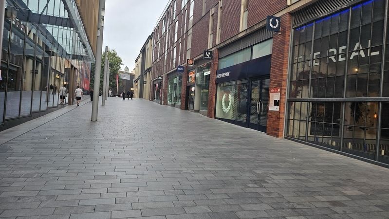
The marker is located on Manesty's Lane, part of the Liverpool ONE outdoor shopping centre.
Other nearby markers. At least 8 other markers are within walking distance of this marker: Brad Kella (within shouting distance of this marker); The Eagle Pub (within shouting distance of this marker); American Consulate (within shouting distance of this marker); 'Sailortown' Triangle (about 90 meters away, measured in a direct line); College Lane Warehouses and Maritime Trades (about 90 meters away); Hanover Street (about 120 meters away); The Old Dock and William Hutchinson (about 120 meters away); Paradise Street, Its People and Pleasures (about 120 meters away). Touch for a list and map of all markers in Liverpool.
Also see . . . Manestys Lane (Liverpool Slavery Streets).
The street originally housed Manesty’s home who owned slave trading ships such as the ones that John Newton sailed on as slave ship commander would then go on to house shops and even a school. Manesty Lane school opened in 1792.(Submitted on October 24, 2026, by Ian Lefkowitz of New York, New York.)
Credits. This page was last revised on October 25, 2026. It was originally submitted on October 24, 2026, by Ian Lefkowitz of New York, New York. This page has been viewed 8 times since then. Photos: 1, 2. submitted on October 24, 2026, by Ian Lefkowitz of New York, New York. • Andrew Ruppenstein was the editor who published this page.
