Near Buckland in Fauquier County, Virginia — The American South (Mid-Atlantic)
Buckland Mills Battle
Custer's Position
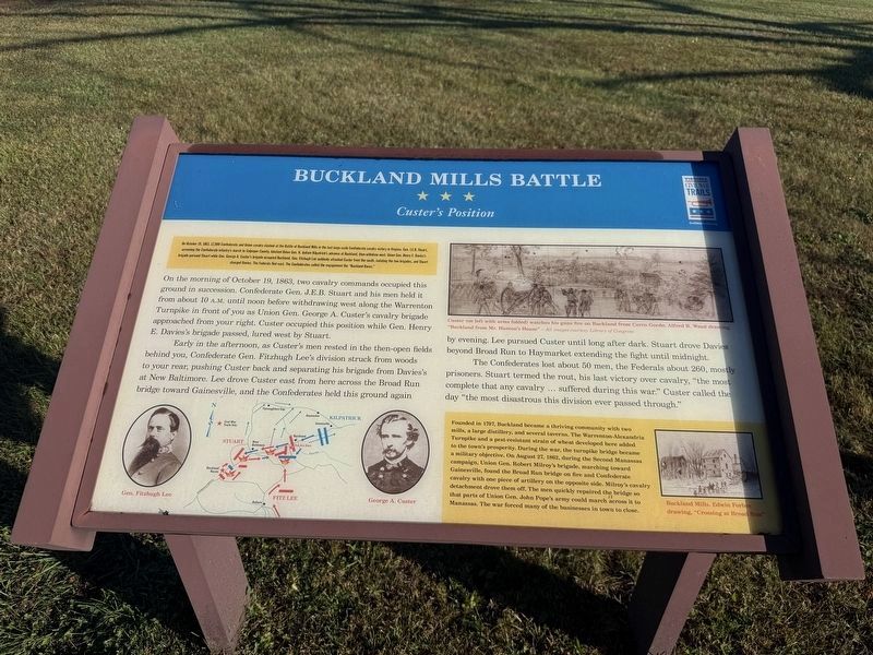
On October 19, 1863, 12,000 Confederate and Union cavalry clashed at the Battle of Buckland Mills in the last large-scale Confederate cavalry victory in Virginia. Gen. J.E.B. Stuart, screening the Confederate Infantry's march to Culpeper County, blocked Union Gen. H. Judson Kilpatrick's advance at Buckland, then withdrew west. Union Gen. Henry E. Davies's brigade pursued Stuart while Gen George A. Custer's brigade occupied Buckland Gen. Fitzhugh Lee suddently attacked Custer from the south, isolating the two brigades, and Stuart charged Davies. The Federals fled east. The Confederates called the engagement the "Buckland Races."
On the morning of October 19, 1863, two cavalry commands occupied this ground in succession. Confederate Gen. J.E.B. Stuart and his men held it from about 10 A.M. until noon before withdrawing west along the Warrenton Turnpike in front of you as Union Gen. George A. Custer's cavalry brigade approached from your right. Custer occupied this position while Gen. Henry E. Davies's brigade passed, lured west by Stuart.
Early in the afternoon, as Custer's men rested in the then-open fields behind
this page online
The Confederates lost about 50 men, the Federals about 260, mostly prisoners. Stuart termed the rout, his last victory over cavalry, "the most complete that any cavalry … suffered during this war." Custer called the day "the most disastrous this division ever passed through."
[Sidebar:]
Founded in 1797, Buckland became a thriving community with two mills, a large distillery, and several taverns. The Warrenton-Alexandria Turnpike and a pest-resistant strain of wheat developed here added to the town's prosperity. During the war, the turnpike bridge became a military objective. On August 27, 1862, during the Second Manassas campaign, Union Gen. Robert Milroy's brigade, marching toward Gainesville, found the Broad Run bridge on fire and Confederate cavalry with one piece of artillery on the opposite side. Milroy's cavalry detchment drove them off. The men quickly repaired the bridge so that parts of Union Gen. John Pope's army could march across it to Manassas. The war forced many of the businesses in town to close.
Erected by Virginia
Photographed by Devry Becker Jones (CC0), October 24, 2026
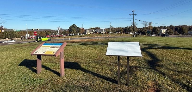
2. Buckland Mills Battle and Roadway Innovations Markers
Topics and series. This historical marker is listed in these topic lists: Settlements & Settlers • War, US Civil. In addition, it is included in the Virginia Civil War Trails series list. A significant historical date for this entry is August 27, 1862.
Location. 38° 46.636′ N, 77° 40.9′ W. Marker is near Buckland, Virginia, in Fauquier County. It is at the intersection of Vint Hill Road (Virginia Route 215) and Lee Highway (U.S. 15/29), on the right when traveling north on Vint Hill Road. Touch for map. Marker is at or near this postal address: 6265 Vint Hill Rd, Warrenton VA 20187, United States of America. Touch for directions.

Regionally, this marker is in the Washington Metropolitan Area and in Northern Virginia. It is also in the American South, specifically in the Upper South, and in the Mid-Atlantic. Globally, it is in North America, the Western Hemisphere, the Western World, and the Anglosphere. Historically, it finds itself in what was once the territory of the Mississippian Culture, one of the original Thirteen Colonies, one of the Confederate States of America, and the Antebellum South.
Other nearby markers. At least 8 other markers are within 3 miles of this marker, measured as the crow flies: Roadway Innovations (here, next to this marker); Buckland (approx. half a mile away); The Buckland Plan (approx. half a mile away); Lafayette's Tour (approx. half a mile away); The Buckland Mill (approx. half a mile away); Battle of Buckland Mills (approx. one mile away); Second Manassas Campaign (approx. 2.1 miles away); Vint Hill Farms Station (approx. 2.4 miles away). Touch for a list and map of all markers in Buckland.
Another marker is no longer nearby. Buckland Mills Battle (has been replaced with this marker).
Related marker. Click here for another marker that is related to this marker. This marker has replaced the linked marker.
Credits. This page was last revised on October 24, 2026. It was originally submitted on October 24, 2026, by Devry Becker Jones of Washington, District of Columbia. This page has been viewed 15 times since then. Photos: 1, 2. submitted on October 24, 2026, by Devry Becker Jones of Washington, District of Columbia.
