Vieux-Saint-Jean in Saint-Jean-sur-Richelieu in Montérégie, Québec — Central Canada (French-Canadian)
Fort Saint-Jean
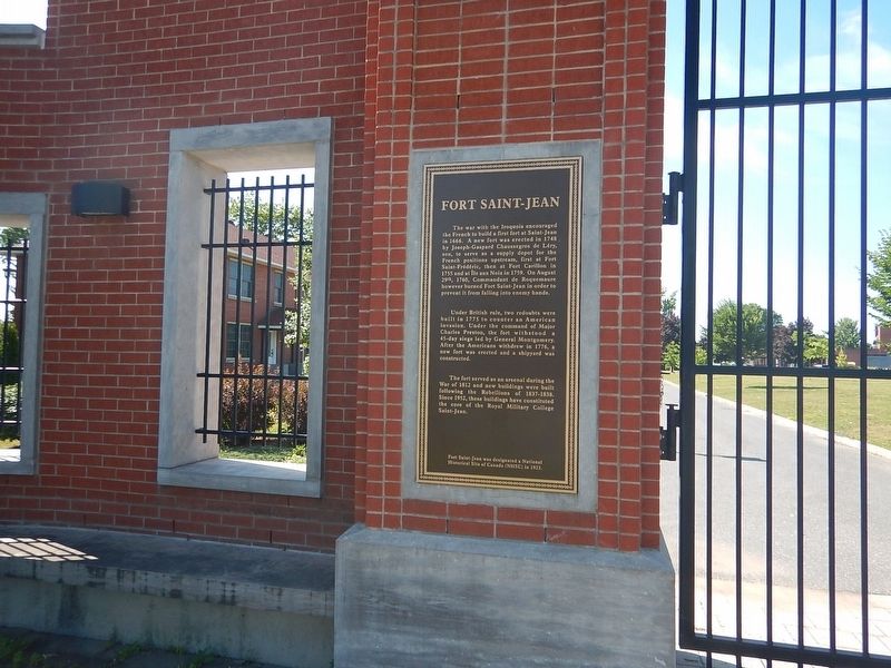
Photographed by Kevin Craft, July 17, 2026
1. Fort Saint-Jean Marker
The war with the Iroquois encouraged the French to build a first fort at Saint-Jean in 1666. A new fort was erected in 1748 by Joseph-Gaspard Chaussegros de Léry, son, to serve as a supply depot for the French positions upstream, first at Fort Saint-Frédéric, then at Fort Carillon in 1755 and at Île aux Noix in 1759. On August 29th, 1760, Commandant de Roquemaure however burned Fort Saint-Jean in order to prevent it from falling into enemy hands.
Under British rule, two redoubts were built in 1775 to counter an American invasion. Under the command of Major Charles Preston, the fort withstood a 45-day siege led by General Montgomery. After the Americans withdrew in 1776, a new fort was erected and a shipyard was constructed.
The fort served as an arsenal during the War of 1812 and new buildings were built following the Rebellions of 1837-1838. Since 1952, these buildings have constituted the core of the Royal Military College Saint-Jean.
Fort Saint-Jean was designated a National Historical Site of Canada (NHSC) in 1923.
Topics. This historical marker is listed in these topic lists: Education • Forts and Castles •
this page online
Location. 45° 18.079′ N, 73° 15.126′ W. Marker is in Saint-Jean-sur-Richelieu, Québec, in Montérégie. It is in Vieux-Saint-Jean. It is on rue des Remparts 0.1 kilometers south of rue Frontenac, on the right when traveling south. There is an identical marker in French on the other side of the gated entrance. Touch for map. Marker is in this post office area: Saint-Jean-sur-Richelieu QC J3B 8R8, Canada. Touch for directions.

Regionally, this marker is in Greater Montréal. It is also in Central Canada. Globally, it is in North America, the Western Hemisphere, and the Western World. Historically, it finds itself in what was once a British colony, the Viceroyalty of New France, the Haudenosaunee (Iroquois) Confederacy, and Rupert’s Land.
Other nearby markers. At least 8 other markers are within 11 kilometers of this marker, measured as the crow flies: First Railway in Canada (about 180 meters away, measured in a direct line); Former Grand Trunk Railway Station (about 210 meters away); a different marker also named Fort Saint-Jean (approx. 0.3
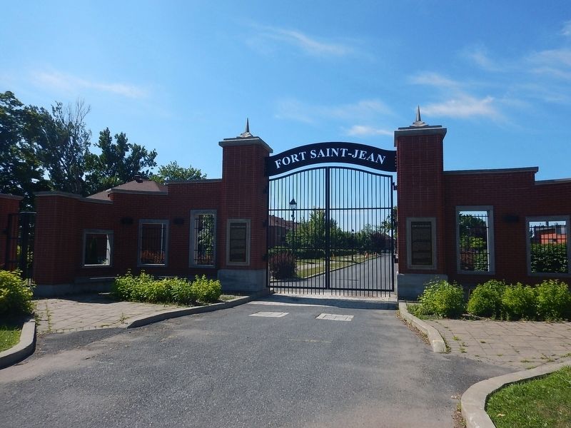
Photographed by Kevin Craft, July 17, 2026
2. Wideview of Fort Saint-Jean Marker
Credits. This page was last revised on October 24, 2026. It was originally submitted on October 24, 2026, by Kevin Craft of Bedford, Quebec. This page has been viewed 7 times since then. Photos: 1, 2. submitted on October 24, 2026, by Kevin Craft of Bedford, Quebec.
