Liverpool in Merseyside, England, United Kingdom — Northwestern Europe (the British Isles)
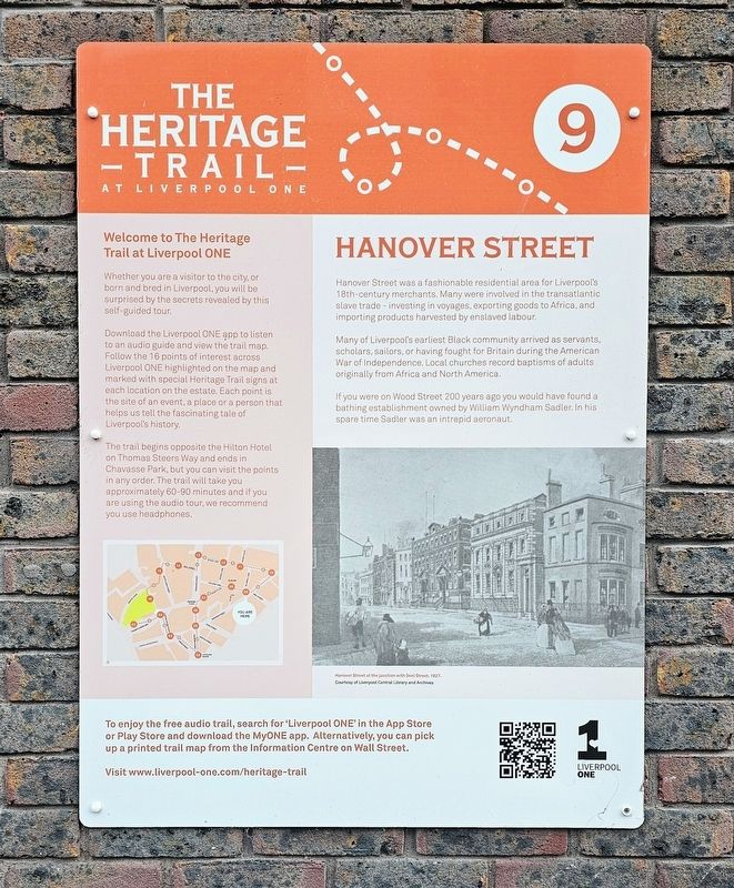
Hanover Street
| — | The Heritage Trail at Liverpool ONE | — |
Photographed by Ian Lefkowitz, September 13, 2026
1. Hanover Street Marker
Hanover Street was a fashionable residential area for Liverpool’s 18th-century merchants. Many were involved in the transatlantic slave trade — investing in voyages, exporting goods to Africa, and importing products harvested by enslaved labour.
Many of Liverpool’s earliest Black community arrived as servants, scholars, sailors, or having fought for Britain during the American War of Independence. Local churches record baptisms of adults originally from Africa and North America.
If you were on Wood Street 200 years ago you would have found a bathing establishment owned by William Wyndham Sadler. In his spare time Sadler was an intrepid aeronaut.
[Captions:]
Hanover Street at the junction with Seel Street, 1827. Courtesy of Liverpool Central Library and Archives
Welcome to The Heritage Trail at Liverpool ONE
Whether you are a visitor to the city, or born and bred in Liverpool, you will be surprised by the secrets revealed by this self-guided tour.
Download the Liverpool ONE app to listen to an audio guide and view the trail map. Follow the 16 points of interest across Liverpool ONE highlighted on the map
this page online
The trail begins opposite the Hilton Hotel on Thomas Steers Way and ends in Chavasse Park, but you can visit the points in any order. The trail will take you approximately 60–90 minutes and if you are using the audio tour, we recommend you use headphones.
Topics. This historical marker is listed in these topic lists: African Americans • Industry & Commerce • Roads & Vehicles. A significant historical year for this entry is 1827.
Location. 53° 24.224′ N, 2° 59.039′ W. Marker is in Liverpool, England, in Merseyside. It can be reached from College Lane east of College Court, on the right when traveling east. Touch for map. Marker is at or near this postal address: 24 College Lane, Liverpool, England L1 3AQ, United Kingdom. Touch for directions.

Regionally, this marker is in North West England. Globally, it is on the Atlantic Ocean, in the North Atlantic Region, in Europe, in Atlantic Europe, on one of the British Isles,
Photographed by Ian Lefkowitz, September 13, 2026
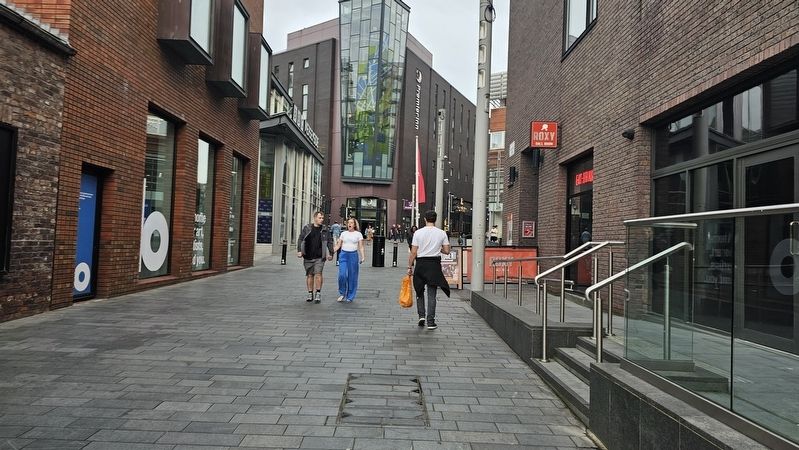
2. Hanover Street Marker
The marker is located next to Roxy Ballroom in this photograph.
Other nearby markers. At least 8 other markers are within walking distance of this marker: College Lane Warehouses and Maritime Trades (here, next to this marker); Brad Kella (within shouting distance of this marker); Bluecoat Hospital (within shouting distance of this marker); Liverpool Blue Coat School (about 90 meters away, measured in a direct line); School Lane and the Bluecoat (about 90 meters away); Bluecoat (about 90 meters away); Manesty's Lane and Henry Tate (about 120 meters away); The Athenaeum (about 120 meters away). Touch for a list and map of all markers in Liverpool.
Credits. This page was last revised on October 25, 2026. It was originally submitted on October 25, 2026, by Ian Lefkowitz of New York, New York. This page has been viewed 14 times since then. Last updated on October 25, 2026, by Ian Lefkowitz of New York, New York. Photos: 1, 2. submitted on October 25, 2026, by Ian Lefkowitz of New York, New York. • Devry Becker Jones was the editor who published this page.
