Upperville in Fauquier County, Virginia — The American South (Mid-Atlantic)
Upperville
Drama on Vineyard Hill
| — | Gettysburg Campaign | — |
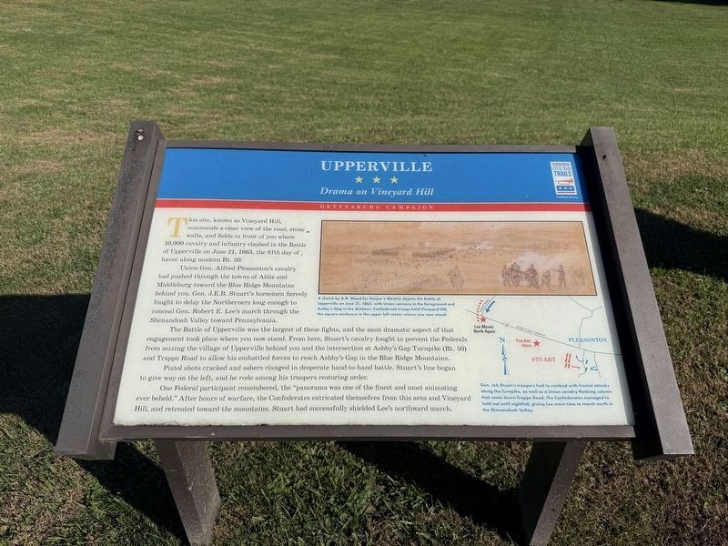
This site, known as Vineyard Hill, commands a clear view of the road, stone walls, and fields in front of you were 10,000 cavalry and infantry clashed in the Battle of Upperville on June 21, 1863, the fifth day of havoc along modern Rt. 50.
Union Gen. Alfred Pleasonton's cavalry had pushed through the towns of Aldie and Middleburg toward the Blue Ridge Mountains behind you. Gen. J.E.B. Stuart's horsement fiercely fought to delay the Northerners long enough to conceal Gen. Robert E. Lee's march through the Shenandoah Valley toward Pennsylvania.
The Battle of Upperville was the largest of these fights, and the most dramatic aspect of that engagement took place where you now stand. From here, Stuart's cavalry fought to prevent the Federals from seizing the village of Upperville behind you and the intersection at Ashby's Gap Turnpike (Rt. 50) and Trappe Road to allow his embattled forces to reach Ashby's Gap in the Blue Ridge Mountains.
Pistol shots cracked and sabers clanged in desparate hand-to-hand battle. Stuart's line began to give way on the left, and he rode among his troopers restoring order.
One Federal
this page online
[Captions:]
A sketch by A.R. Waud for Harper's Weekly depicts the Battle of Upperville on June 21, 1863, with Union cannons in the foreground and Ashby's Gap in the distance. Confederate troops held Vineyard Hill, the square enclosure in the upper left center where you now stand.
Gen. Jeb Stuart's troopers had to contend with frontal attacks along the Turnpike, as well as a Union cavalry falnking column that came down Trappe Road. The Confederates managed to hold out until nightfall, giving Lee more time to march north in the Shenandoah Valley.
Erected by Virginia Civil War Trails.
Topics and series. This historical marker is listed in this topic list: War, US Civil. In addition, it is included in the Virginia Civil War Trails series list. A significant historical date for this entry is June 21, 1863.
Location. 38° 59.434′ N, 77° 52.332′ W. Marker is in Upperville,
Photographed by Devry Becker Jones (CC0), October 24, 2026
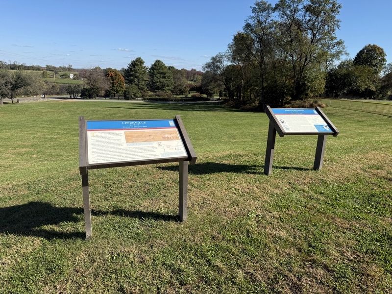
2. Upperville and Battle of Unison Markers

Regionally, this marker is in the Washington Metropolitan Area and in Northern Virginia. It is also in the American South, specifically in the Upper South, and in the Mid-Atlantic. Globally, it is in North America, the Western Hemisphere, the Western World, and the Anglosphere. Historically, it finds itself in what was once the territory of the Mississippian Culture, one of the original Thirteen Colonies, one of the Confederate States of America, and the Antebellum South.
Other nearby markers. At least 8 other markers are within one mile of this marker, measured as the crow flies: Battle of Unison (here, next to this marker); The Smith House (approx. ¼ mile away); The Gibson House (approx. 0.4 miles away); The Armistead House (approx. half a mile away); The Upperville Library (approx. half a mile away); This Stone (approx. 0.6 miles away); Mary Elizabeth Conover Mellon (approx. 0.6 miles away); Lee Moves North Again (approx. 1.1 miles away). Touch for a list and map of all markers in Upperville.
Other markers no longer nearby. Upperville (has been replaced with this marker); a different marker also named Battle of Unison (was here, next to this marker but has been permanently removed).
Credits. This page was last revised on November 2, 2026. It was originally submitted on October 25, 2026, by Devry Becker Jones of Washington, District of Columbia. This page has been viewed 7 times since then. Photos: 1, 2. submitted on October 25, 2026, by Devry Becker Jones of Washington, District of Columbia.
