Stanbridge East in Brome-Missisquoi, Québec — Central Canada (French-Canadian)
The Pike River
⎯⎯⎯
La Rivière aux Brochets

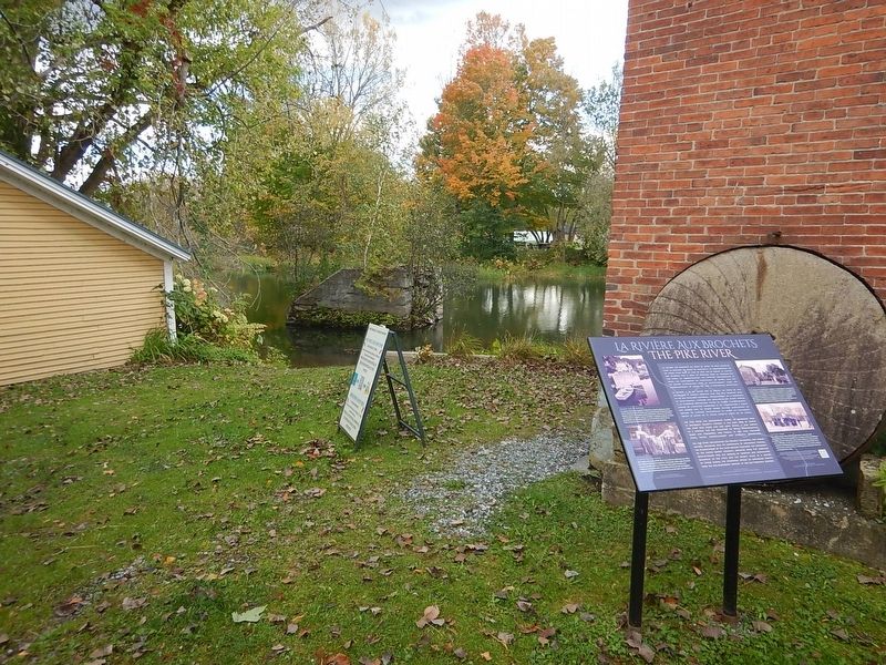
Photographed by Kevin Craft, October 5, 2026
1. The Pike River Marker
{English text}
The Pike River has consistently played an important role in Missisquoi County’s history. It has been used by people for over 5000 years and like most rivers, it has served as a highway for the transport of ideas, communication, trade and commerce, and people. It has also provided food, water, entertainment and spiritual reflection.
The Pike River has impacted the region’s ecological and human history, beginning with its importance to Indigenous peoples; the establishment of the Saint-Armand Seigniory; the settlement of the United Empire Loyalists, refugees from the American Revolutionary War; the growth of forestry and agriculture beginning in the 1790s; and the river’s value as a source of power during the industrial heyday of Missisquoi County from the mid-nineteenth century to the mid-twentieth century.
Fishing on the River
The rapids at the town of Pike River are at the last and lowest part of the river before it reaches Missisquoi Bay. Historically, yellow pike abounded in great numbers and were lifted out of the rapids with dip nets. Fishing is now provincially controlled and in some places forbidden because
this page online
The Mill Pond
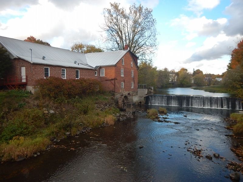
The mill pond was where children gathered to make rafts and to go fishing. They mostly caught bass, mackerel, smelts and bull pout (cat fish), and sometimes pike and sturgeon which seemed to go only as far as the dam. People also swam in the mill pond while others enjoyed canoeing or rowing on the river. There were even log rolling contests for several years. Ice fishing and ice skating were also practiced in the winter.
{French text}
La rivière aux Brochets n’a cessé de jouer un rôle essentiel dans la destinée du comté de Missisquoi. La fréquentation de ce cours d’eau date de plus de 5000 ans et comme la plupart des rivières, elle a servi de véhicule pour la transmission des idées, la communication, les activités commerciales et aussi, les mouvements de population. En outre, elle fut un centre d’attraction pour le ravitaillement, l’eau, les divertissements et enfin, un lieu d’inspiration spirituelle.
La rivière a eu un impact sur la région du point de vue écologique et humain, débutant avec son rôle essentiel dans la vie des peuplades indigènes; l’établissement
Photographed by Kevin Craft, October 5, 2026
2. Wideview of The Pike River Marker
Pêcher sur la rivière
Les chutes dans la municipalité de Pike River sont les plus basses de la rivière et les dernières à franchir aussi avant d’atteindre la baie Missisquoi. Depuis toujours, les brochets jaunes abondaient; on les retirait de l’eau avec des nasses. La pêche, qui est contrôlée actuellement par les autorités provinciales, est même interdite à certains endroits afin d’assurer la protection environnementale des tortues-molles à épines.
Le bassin du moulin
C’est au bassin du moulin que les enfants se rendaient pour construire des radeaux et pour pêcher. Ils prenaient surtout de la perche, du maquereau, de l’éperlan et du poisson-chat. À l’occasion, du brochet et de l’esturgeon, une espèce qui semblait s’arrêter au barrage. Les gens s’y baignaient également
Photographed by Kevin Craft, October 5, 2026
3. The Pike River
Erected by Missisquoi Historical Society.
Topics. This historical marker is listed in these topic lists: Settlements & Settlers • Waterways & Vessels.
Location. 45° 7.261′ N, 72° 54.9′ W. Marker is in Stanbridge East, Québec, in Brome-Missisquoi. It is at the intersection of River Street and Caleb Tree Street, on the right when traveling east on River Street. Marker is on the grounds of the Missisquoi Museum. Touch for map. Marker is in this post office area: Stanbridge East QC J0J 2C0, Canada. Touch for directions.

Regionally, this marker is in the Outaouais & Eastern Townships. It is also in Central Canada. Globally, it is in North America, the Western Hemisphere, and the Western World. Historically, it finds itself in what was once a British colony, the Viceroyalty of New France, the Haudenosaunee (Iroquois) Confederacy, and Rupert’s Land.
Other nearby markers. At least 8 other markers are within 11 kilometers of this marker, measured as the crow flies: Cornell Mill (here, next to this marker); a different marker also named Cornell Mill (within shouting distance of this marker); In honour of Capt. Caleb Tree (approx. half a kilometer away); Grange Alexander-Solomon-Walbridge (approx. 6.7 kilometers away); Quebec Women's Institutes (approx. 9.1 kilometers away); First Women's Institute (approx. 9.1 kilometers away); Adélard Godbout (approx. 9.5 kilometers away); Battle of Eccles Hill (approx. 11.3 kilometers away). Touch for a list and map of all markers in Stanbridge East.
Credits. This page was last revised on October 27, 2026. It was originally submitted on October 25, 2026, by Kevin Craft of Bedford, Quebec. This page has been viewed 5 times since then. Photos: 1, 2, 3. submitted on October 25, 2026, by Kevin Craft of Bedford, Quebec.
