Myrtle in Nez Perce County, Idaho — The American West (Mountains)
From the Journals
Photographed by Barry Swackhamer, June 16, 2026
1. From the Journals Marker
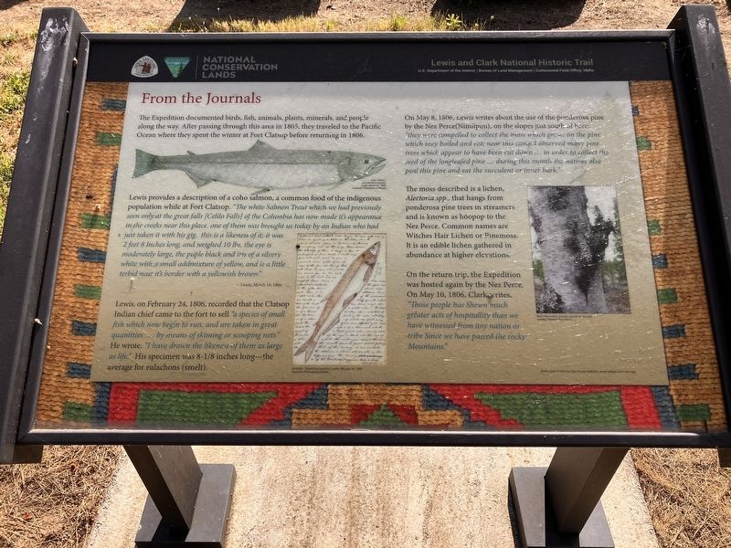
Captions: Coho Salmon Oncorhynchus kisutch, Lewis, March 16, 1806, American Philosophical Society; Eulachon, Thaloichrhys pacific us, Lewis, February 24, 1806, American Philosophical Society; Black tree lichens (the hairy growth on the W60) courtesy National Park Service
Lewis, on February 24,1806, recorded that the Clatsop Indian chief came to the fort to sell "a species of small fish which now begin to run, and are taken in great quantities...by means of skimming or scooping nets." He wrote, I have drawn the likeness of them as large as life." His specimen was 8-1/8 inches long - the average for eulachons (smelt).
On May 8, 1806, Lewis writes about the use of the ponderosa pine by the Nez Perce (Nimiipuu), on the slopes just south of here: "they were compelled to collect the moss which grew the pine which they boiled and eat; near this campo I observed many pine tree which appear to have been cut down ... in order to collect the seeds of the longleaf pine ... during this month the natives also peal this pine and eat the succulent or inner bark."
this page online
The moss described is a lichen, Alectoria app., that hangs from ponderosa pine trees in streamers and is known as hoopoe to the Nez Perce. Common names are Witches Hair Lichen or Pinemoss. It is an edible lichen gathered in abundance at higher elevations.
On the return trip, the Expedition was hosted again by the Nez Perce. On May 10, 1806, Clark writes, "Those people has Shewn much greater acts of hospitality than we have witnessed from any nation or tribe Since we have passed the rocky Mountains."
Erected by Lewis and Clark National Historic Trail, Bureau of Land Management.
Topics and series. This historical marker is listed in these topic lists: Animals • Exploration • Food & Drink • Indigenous Peoples and Communities. In addition, it is included in the Lewis & Clark Expedition series list. A significant historical date for this entry is May 8, 1806.
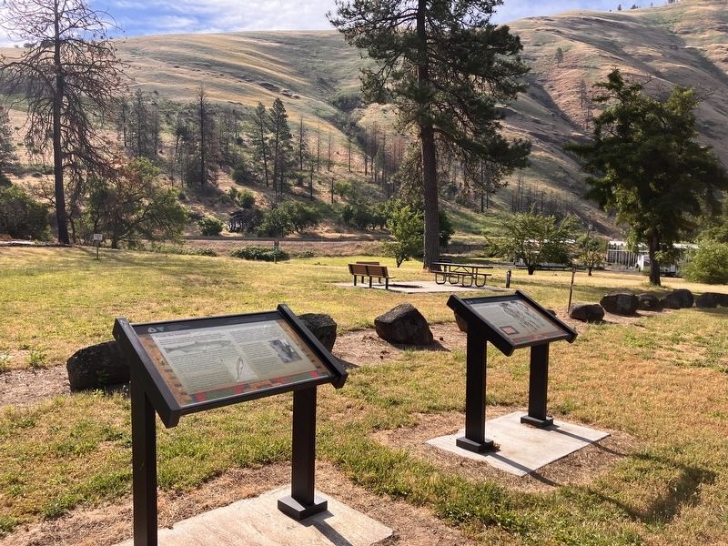
Location. 46° 29.857′ N, 116° 43.623′ W. Marker is in Myrtle, Idaho, in Nez Perce County. It is on U.S. 12 near Hazel Street, on the left when traveling north. Touch for map. Marker is in this post office area: Lapwai ID 83540, United States of America. Touch for directions.

Regionally,
Photographed by Barry Swackhamer, June 16, 2026
2. From the Journals Marker
Other nearby markers. At least 8 other markers are within 6 miles of this marker, measured as the crow flies: A Gastric Catastrophe (here, next to this marker); Site of the Lapwai Mission (approx. 5.3 miles away); Indian Agency Cabin (approx. 5.3 miles away); Spalding Home Site (approx. 5.3 miles away); Spalding Mission (approx. 5.3 miles away); Clearwater River (approx. 5.3 miles away); Rev. Henry Harmon Spalding (approx. 5.3 miles away); Lapwai Mission Cemetery (approx. 5.3 miles away).
Credits. This page was last revised on October 26, 2026. It was originally submitted on October 25, 2026, by Barry Swackhamer of Brentwood, California. This page has been viewed 15 times since then. Photos: 1, 2. submitted on October 25, 2026, by Barry Swackhamer of Brentwood, California.
