Koblenz-Ehrenbreitstein , Rhineland-Palatinate, Germany — Central Europe
Ein Garten der Römerzeit
Photographed by James Hulse, October 3, 2026
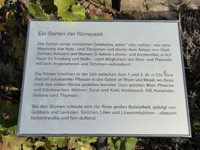
1. Ein Garten der Römerzeit Marker

Der Garten eines römischen Gutshofes, einer "villa rustica", war eine Mischung aus Nutz- und Ziergarten und diente dem Anbau von Obst, Gemüse, Kräutern und Blumen. Er lieferte Lebens- und Arzneimittel, er bot Raum für Erholung und Muße - nach Möglichkeit das Sinn- und Planvolle mit dem Angenehmen und Schönen verbindend.
Die Römer brachten in der Zeit zwischen dem 1. und 3. Jh. n. Chr. eine Vielzahl unbekannter Pflanzen in das Gebiet an Rhein und Mosel, wo diese dank des milden Klimas gedeihen konnten. Dazu gehören Wein, Pfirsiche und Edelkirschen, Möhren, Salat und Kohl, Knoblauch, Dill, Koriander, Sellerie und Thymian.
Bei den Blumen erfreute sich die Rose großer Beliebtheit, gefolgt von Goldlack und Levkojen, Veilchen, Lilien und Löwenmäulchen - allesamt farbenfreudig und fein duftend.
A Roman-Era Garden
The garden of a Roman country estate, a “villa rustica,” combined productive and ornamental gardening and was used to grow fruit, vegetables, herbs and flowers. It supplied food and medicines while providing space for relaxation and leisure, combining
this page online
Between the 1st and 3rd centuries AD, the Romans introduced many previously unfamiliar plants to the Rhine and Moselle region, where the mild climate allowed them to thrive. These included grapevines, peaches and cultivated cherries, carrots, lettuce and cabbage, garlic, dill, coriander, celery and thyme.
Among flowers, roses were particularly popular, followed by wallflowers and stocks, violets, lilies and snapdragons—all colorful and delicately fragrant.
Topics. This historical marker is listed in these topic lists: Agriculture • Forts and Castles.
Location. 50° 21.882′ N, 7° 36.972′ E. Marker is in Koblenz, Rheinland-Pfalz (Rhineland-Palatinate). It is in Koblenz-Ehrenbreitstein. It is on Greiffenklaustraße 2 kilometers west of Friesenstraße. The marker is located on the grounds of the Ehrenbreitstein Fortress. Touch for map. Marker is in this post office area: Koblenz RP 56077, Germany. Touch for directions.

Regionally, this marker is in the German Rhineland, in the Upper Middle Rhine Valley, and specifically
Photographed by James Hulse, October 3, 2026
2. Ein Garten der Römerzeit Marker
Other nearby markers. At least 8 other markers are within walking distance of this marker: Historische Zeitgärten / Historical Period Gardens (a few steps from this marker); Der Mensch wird sesshaft / People Adopt a Settled Way of Life (a few steps from this marker); Ein mittelalterlicher Bauerngarten / A Medieval Cottage Garden (within shouting distance of this marker); Ein 50er Jahre Garten / A 1950s Garden (within shouting distance of this marker); Brunnendenkmal / Fountain Monument (about 210 meters away, measured in a direct line); Preußische Festung Coblenz und Ehrenbreitstein / Prussian Fortress of Coblenz and Ehrenbreitstein (about 210 meters away); Demokratischer Widerstand Junger Menschen zu Allen Zeiten (approx. 0.8 kilometers away); Gegen das Vergessen des Unrechts der Sed-Diktatur (approx. 0.8 kilometers away). Touch for a list and map of all markers in Koblenz.
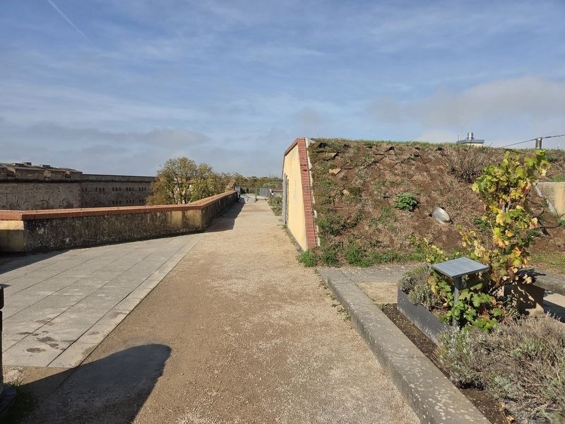
More about this marker. The marker stands atop the Ehrenbreitstein Fortress. Admission is required to enter the fortress and visit the marker.
Credits. This page was last revised on October 26, 2026. It was originally submitted on October 25, 2026, by James Hulse of Medina, Texas. This page has been viewed 6 times since then. Photos: 1, 2. submitted on October 26, 2026, by James Hulse of Medina, Texas.
