Kooskia in Idaho County, Idaho — The American West (Mountains)
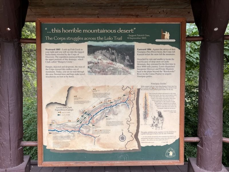
..."this horrible mountainous desert"
Sargent Patrick Gass, 19 September, 1805
| — | The Corps struggles across the Lolo Trail | — |
Photographed by Barry Swackhamer, June 16, 2026
1. ..."this horrible mountainous desert" Marker
Hungry, dejected and desperate, the men of the Corps crossed this endless sea of mountains. Today, you see no trail through this area. Downed trees and bogs make travel treacherous on foot or by horse.
Eastward 1806 - Against the advice of their Nimiipuu (Nez Perce) hosts, the Corps left Kamiah before the snow had left the mountains.
Drenched by rain and unable to locate the trail because of deep snow at Cache Mountain, they retreated for the first time in their 8000-mile journey. Lewis dispatched Interpreter Drewyer and Private Shannon back to the plains beyond the "Kooskooske" River (to the Camas Prairie) to acquire Nimiipuu guides.
While camped with the Corps along Hungery Creek, the Nez Perce guides performed a fire ceremony. They told the Corps the ceremony would provide good weather for the trip.
"Last evening the indians entertained us with seting the fir trees on fire. they have a great number of dry lims near their bodies which when set on fire creates a very sudden and immence blaze from both to top of thos tall trees. they are a beatifull object in this situation at night. this exhibition, reminded me of a display of fireworks, the natives told us that their object in setting those trees on fire was to bring fair wether for our journey."
this page online
25 June 1806
The guides skillfully led the expedition over the mountains to a gentler landscape in what is now the state of Montana.
"...we were entirely surrounded by those mountains from which to one unacquainted with them it would have seemed impossible ever to have escaped; ... these fellows are most admireable pilots."
Captain Meriwether Lewis
27 June 1806
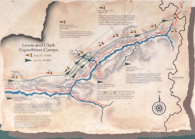
[Yellow arrows and line: Sept. 13-22, 1805
Green arrows and line: June 14-28, 1806
Numbers: Camp dates ]
Sept. 18, 1805
"Signs of deer and nothing else, much falling timber made 32 miles and Encamped on a bold running Creek passing to the left which I call Hungery Creek as at that place we had nothing to eate. The want of provisions together with the dificuely of passing those emence mountians dampened the Spirits of the party..."
Portable Soup Camp
Captain Meriwether Lewis
Sept. 19, 1805
"We encamped on the start. side of it in a little raviene, having 18 miles over a very bad road. we took a small quantity of potable soup, and retired to rest much fatiegued"
Cache Mountain
Captain Meriwether Lewis
June 17, 1806
"...having come to this resolution, we ordered the party to make a deposit for all the baggage which we had not immediate use for , and also all the roots and bread of cows (cous)... we left our instruments papers, &c believe them safer here than to wrisk them on horseback over the roads and creeks which we had passed.
... we returned by the rout we had come to hungry creek which we ascended about 2 miles and encamped. we had here more grass for our horses than the preceeding evening yet it was but scant. the party were a good deel dejected tho'not so as I had apprehended they would have been. this is the first time since we have been on this long tour that we have ever been compelled to retreat or make a retrograde march."
Jerusalem Artichoke Camp
Captain Meriwether Lewis
June 25, 1806
"I met with a plant the root of which the shoshones eat. it is a small knob root a good deal in flavor an consistency like the Jerusalem Artichoke. It has two small oval smooth leaves placed opposite on either side of the peduncle just above4 the root the scape is only about: 4 inches long is round and smooth..."
Cache Mountain
Captain Meriwether Lewis
June 26, 1806
"This morning we collected our horses and set out after an early breakfast or at 6 A.M. we passed by the same route we had travelled on the 17th inst. to our deposit on the top of the snowy mountain to the N.E. of hungary creek. here we necessarily halted about 2 hours to arrange our baggage and prepared our loads..."
Erected by Lewis
Photographed by Barry Swackhamer, June 16, 2026
2. ..."this horrible mountainous desert" Marker (detail)
Green arrows and line: June 14-28, 1806
Numbers: Camp dates ]
Topics and series. This historical marker is listed in these topic lists: Entertainment • Natural Features. In addition, it is included in the Lewis & Clark Expedition series list.
Location. 46° 20.087′ N, 115° 20.662′ W. Marker is in Kooskia, Idaho, in Idaho County. It is on U.S. 12 at milepost 122 near Forest Road 462, on the right when traveling east. This marker is about a mile west of the Lochsa Historical Ranger Station on US Highway 12. Touch for map. Marker is in this post office area: Kooskia ID 83539, United States of America. Touch for directions.

Regionally, this marker is in North Idaho — Idaho’s Panhandle. It is also in the American Mountain West, specifically in the Pacific Northwest, and in the Lewis & Clark Corridor. Globally, it is in North America, the Rocky Mountains, the Western Hemisphere, the Western World, and the Anglosphere.
Other nearby markers. At least 8 other markers are within 14 miles of this marker, measured as the crow flies: "Harlies" Ride the River (a few steps from this
Photographed by Barry Swackhamer, June 16, 2026
3. ..."this horrible mountainous desert" Marker
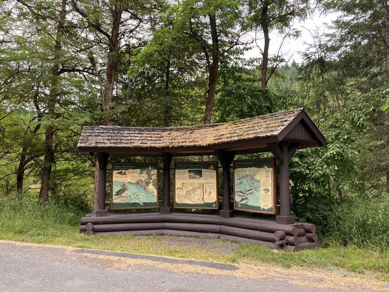
Marker at the center
Also see . . . Lewis and Clark on the Lolo Trai -- Nez Perce - Clearwater National Forests. "From Traveller’s Rest they traveled westerly, crossing the Bitterroot Divide and climbing to follow ridge tops, descending to traverse saddles. Clark and six hunters broke out of the mountains September 20 and found themselves at the edge of a prairie near what is now the small town of Weippe, Idaho." (Submitted on October 26, 2026, by Barry Swackhamer of Brentwood, California.)
Credits. This page was last revised on October 26, 2026. It was originally submitted on October 26, 2026, by Barry Swackhamer of Brentwood, California. This page has been viewed 23 times since then. Photos: 1, 2, 3. submitted on October 26, 2026, by Barry Swackhamer of Brentwood, California.
