Rockingham in Richmond County, North Carolina — The American South (South Atlantic)
Sherman's March
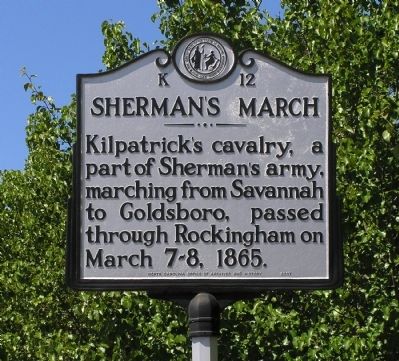
Photographed by Paul Crumlish, May 9, 2010
1. Sherman's March Marker
Erected 1940 by North Carolina Office of Archives and History. (Marker Number K-12.)
Topics. This historical marker is listed in this topic list: War, US Civil. A significant historical date for this entry is March 7, 1865.
Location. 34° 56.712′ N, 79° 45.371′ W. Marker is in Rockingham, North Carolina, in Richmond County. It is at the intersection of Fayetteville Road (U.S. 1) and Richmond Road (North Carolina Highway 1423), on the left when traveling east on Fayetteville Road. Touch for map. Marker is in this post office area: Rockingham NC 28379, United States of America. Touch for directions.

Regionally, this marker is in the Piedmont. It is also in the American South and specifically in the Upper South. Globally, it is in North America, the Western Hemisphere, the Western World, and the Anglosphere. Historically, it finds itself in what was once the territory of the Mississippian Culture, one of the original Thirteen Colonies, one of the Confederate States of America, and the Antebellum
this page online
Other nearby markers. At least 8 other markers are within 2 miles of this marker, measured as the crow flies: Henry William Harrington (approx. 1.1 miles away); Confederate Soldiers Memorial (approx. 1.1 miles away); Alfred Dockery (approx. 1.1 miles away); Cameron Morrison (approx. 1.1 miles away); Harrington Square (approx. 1.1 miles away); Lest We Forget (approx. 1.1 miles away); 1890 Bell (approx. 1.1 miles away); N.C. Farmers' Alliance (approx. 1.3 miles away). Touch for a list and map of all markers in Rockingham.
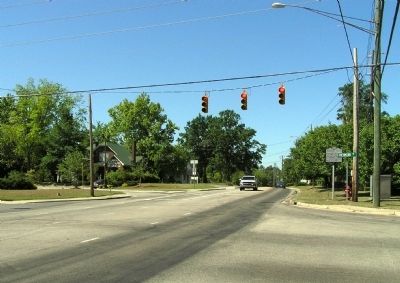
Photographed by Paul Crumlish, May 9, 2010
2. Wide view of the Sherman's March Marker
Credits. This page was last revised on November 8, 2024. It was originally submitted on June 4, 2010, by PaulwC3 of Northern, Virginia. This page has been viewed 2,018 times since then and 67 times this year. Photos: 1, 2. submitted on June 4, 2010, by PaulwC3 of Northern, Virginia.
