Columbia Heights in Northwest Washington in Washington, District of Columbia — The American Northeast (Mid-Atlantic)
Creating the "City Beautiful"
Rock Creek Park
| — | National Park Service, U.S. Department of the Interior | — |
Photographed by Devry Becker Jones, October 26, 2026
1. Creating the "City Beautiful" Marker
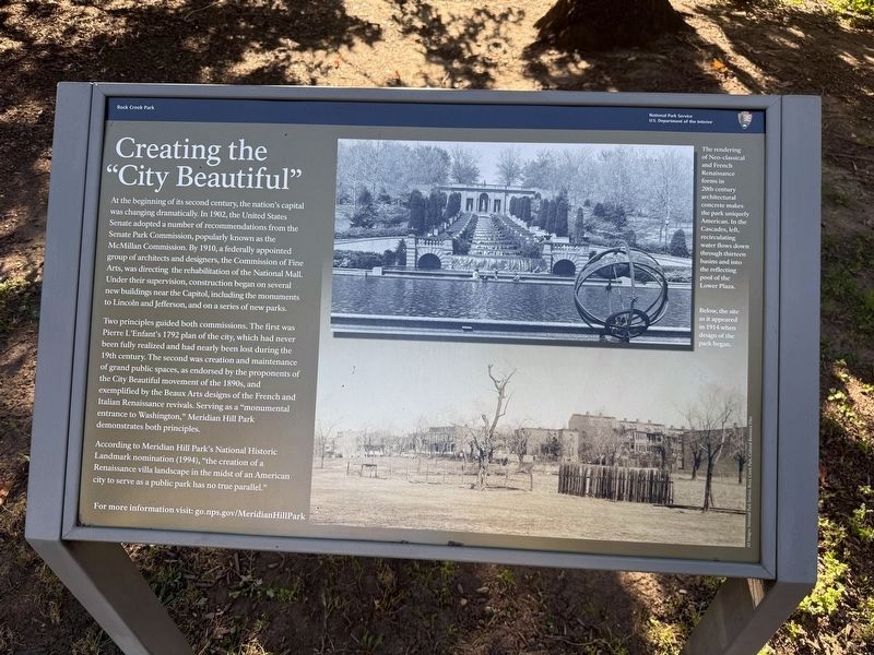
At the beginning of its second century, the nation's capital was changing dramatically. In 1902, the United States Senate adopted a number of recommendations from the Senate Park Commission, popularly known as the McMillan Commission. By 1910, a federally appointed group of architects and designers, the Commission of Fine Arts, was directing the rehabilitation of the National Mall. Under their supervision, construction began on several new buildings near the Capitol, including the monuments to Lincoln and Jefferson, and on a series of new parks.
Two principles guided both commissions. The first was Pierre L'Enfant's 1792 plan of the city, which had never been fully realized and had nearly been lost during the 19th century. The second was creation and maintenance of grand public spaces, as endorsed by the proponents of the City Beautiful movement of the 1890s, and exemplified by the Beaux Arts designs of the French and Italian Renaissance revivals. Serving as a "monumental entrance to Washington," Meridian Hill Park demonstrates both principles.
According to Meridian Hill Park's National Historic Landmark nomination
this page online
For more information visit: go.nps.gov/MeridianHillPark
[Captions:]
The rendering of Neo-classical and French Renaissance forms in 20th century architectural concrete makes the park uniquely American. In the Cascades, left, recirculating water flows down through thirteen basins and into the reflecting pool of the Lower Plaza.
Below, the site as it appeared in 1914 when design of the park began.
Erected 2026 by National Park Service, U.S. Department of the Interior.
Topics and series. This historical marker is listed in these topic lists: Architecture • Landmarks • Parks & Recreational Areas. In addition, it is included in the National Historic Landmarks series list. A significant historical year for this entry is 1902.
Location. 38° 55.333′ N, 77° 2.129′ W. Marker is in Northwest Washington in Washington, District of Columbia. It is in Columbia Heights. It can be reached from 15th Street Northwest north of Chapin Street Northwest, on the left when traveling north. Touch for map.
Photographed by Devry Becker Jones (CC0), October 26, 2026
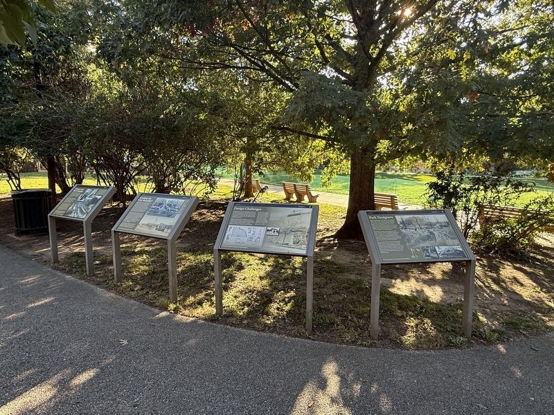
2. Four markers on display in Meridian Hill/Malcolm X Park

Regionally, this marker is in the Washington Metropolitan Area. It is also in the American Northeast, in the Upper South, in the Mid-Atlantic, in the Tidewater, and in the Chesapeake Bay Region. Globally, it is in North America, the Western Hemisphere, the Western World, and the Anglosphere.
Other nearby markers. At least 8 other markers are within walking distance of this marker: Design Challenges (here, next to this marker); a different marker also named Visionary and Park Champion (here, next to this marker); a different marker also named Park Designers (here, next to this marker); Mansions, Parks, and People (within shouting distance of this marker); An American Meridian (within shouting distance of this marker); Serenity (within shouting distance of this marker); College Hill (about 300 feet away, measured in a direct line); Campus to Army Camps and Back Again (about 300 feet away). Touch for a list and map of all markers in Northwest Washington.
Other markers no longer nearby. Visionary and Park Champion (was here, next to this marker but has been replaced with another marker now near it); a different marker also named Creating the "City Beautiful" (has been replaced with this marker); a different marker also named Design Challenges (was here, next to this marker but has been replaced with another marker now near it); Park Designers (was here, next to this marker but has been replaced with another marker now near it); a different marker also named An American Meridian (was within shouting distance of this marker but has been replaced with another marker now near it).
Additional keywords. landscape architecture
Credits. This page was last revised on October 26, 2026. It was originally submitted on October 26, 2026, by Devry Becker Jones of Washington, District of Columbia. This page has been viewed 3 times since then. Photos: 1, 2. submitted on October 26, 2026, by Devry Becker Jones of Washington, District of Columbia.
Editor’s want-list for this marker. A link to the nomination form, citing the park's historical significance. • Can you help?
